Langzhong elevation
Langzhong (Sichuan), China elevation is 362 meters and Langzhong elevation in feet is 1188 ft above sea level [src 1]. Langzhong is a seat of a third-order administrative division (feature code) with elevation that is 196 meters (643 ft) smaller than average city elevation in China.
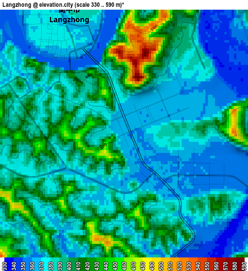
Below is the Elevation map of Langzhong, which displays elevation range with different colors. Scale of the first map is from 330 to 590 m (1083 to 1936 ft) with average elevation of 388 meters (=1273 ft) [note 1]
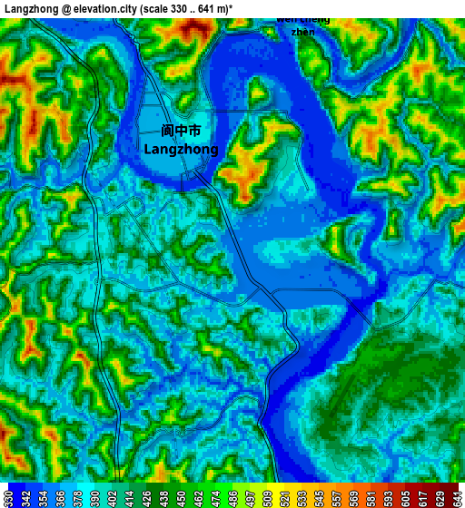
These maps also provides idea of topography and contour of this city, they are displayed at different zoom levels. More info about maps, scale and edge coordinates you can find below images.
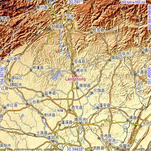
| \ | Map #1 | Map #2 | Topo.Map |
| Scale [m] | 330..590 m | 330..641 m | × |
| Scale [ft] | 1083..1936 ft | 1083..2103 ft | × |
| Average | 388 m = 1273 ft | 408.7 m = 1341 ft | × |
| Width | 8.33 km = 5.2 mi | 16.66 km = 10.4 mi | 266.5 km = 165.6 mi |
| Height | 8.33 km = 5.2 mi | 16.66 km = 10.4 mi | 266.5 km = 165.6 mi |
| ↑Max Latitude | 31.587812° | 31.625239° | 32.741° |
| Latitude at center | 31.55037° | 31.55037° | 31.55037° |
| ↓Min Latitude | 31.512913° | 31.475441° | 30.34435° |
| ← Min Longitude | 105.949865° | 105.905919° | 104.58756° |
| Longitude center | 105.99381° | 105.99381° | 105.99381° |
| →Max Longitude | 106.037755° | 106.081701° | 107.40006° |
Nearby cities:
Cities around Langzhong sort by population:
• Nanlong elevation 352 m
22.9 km,  163°
163°
• Dongxi 461 m
62.2 km,  22°
22°
• Donghe 483 m
81.3 km, 20°
• Bazhou 366 m
81.1 km,  65°
65°
• Wenchang 484 m
80 km,  276°
276°
• Bazhong 455 m
79.4 km,  63°
63°
• Langchi 335 m
75.4 km,  133°
133°
• Zhoukou 320 m
69.2 km,  145°
145°
• Yunxi 386 m
68 km,  238°
238°
• Jincheng 332 m
62.4 km,  189°
189°
• Xinzheng 333 m
41.4 km,  137°
137°
• Lingjiang 389 m
21.3 km,  343°
343°
Multilingual:
 En español:
Langzhong elevación 362 m.
 En France:
Langzhong élévation 362 m.
 Auf Deutsch:
Langzhong höhe über dem Meeresspiegel ist 362 m.

Sources and notes:
- [note 1] Map square and city borders are not equal. Map elevation data is calculated only from area inside that square.
- [src 1] Elevation data from geonames database provided with same terms of usage.
- [src 2] The elevation map of Langzhong is generated using elevation data from NASA's 3 arcsec (90m) resolution SRTM data.
- [src 3] Base (background) map © OpenStreetMap contributors tiles are generated by Geofabrik and OpenTopoMap.
Copyright & License:
This Langzhong Elevation Map is licensed under CC BY-SA. You may reuse any part from this page, if you give a proper credit by linking to this URL:
 More info on terms of use page.