Changzhi elevation
Changzhi (Shanxi), China elevation is 381 meters and Changzhi elevation in feet is 1250 ft above sea level [src 1]. Changzhi is a populated place (feature code) with elevation that is 177 meters (581 ft) smaller than average city elevation in China.
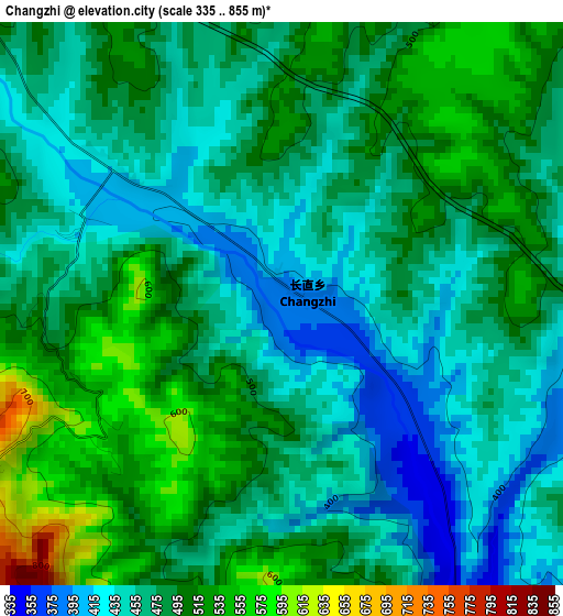
Below is the Elevation map of Changzhi, which displays elevation range with different colors. Scale of the first map is from 335 to 855 m (1099 to 2805 ft) with average elevation of 478.2 meters (=1569 ft) [note 1]
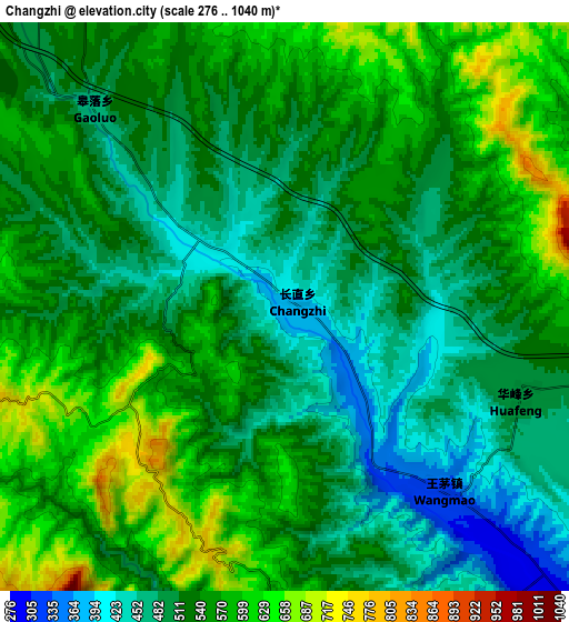
These maps also provides idea of topography and contour of this city, they are displayed at different zoom levels. More info about maps, scale and edge coordinates you can find below images.
| \ | Map #1 | Map #2 | Topo.Map |
| Scale [m] | 335..855 m | 276..1040 m | × |
| Scale [ft] | 1099..2805 ft | 906..3412 ft | × |
| Average | 478.2 m = 1569 ft | 533.6 m = 1751 ft | × |
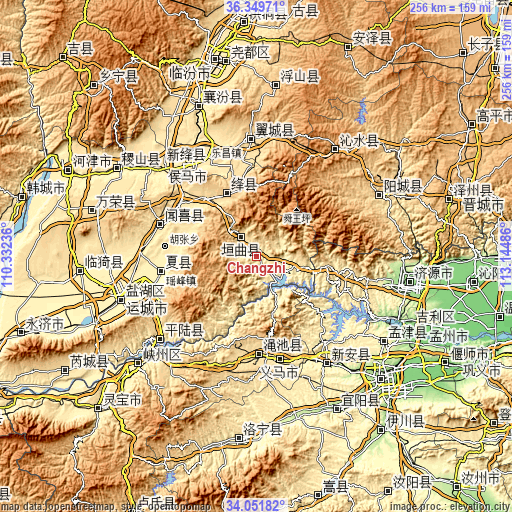
| Width | 7.98 km = 5 mi | 15.97 km = 9.9 mi | 255.5 km = 158.8 mi |
| Height | 7.98 km = 5 mi | 15.97 km = 9.9 mi | 255.5 km = 158.8 mi |
| ↑Max Latitude | 35.244788° | 35.28067° | 36.34971° |
| Latitude at center | 35.20889° | 35.20889° | 35.20889° |
| ↓Min Latitude | 35.172976° | 35.137047° | 34.05182° |
| ← Min Longitude | 111.694665° | 111.650719° | 110.33236° |
| Longitude center | 111.73861° | 111.73861° | 111.73861° |
| →Max Longitude | 111.782555° | 111.826501° | 113.14486° |
Nearby cities:
Cities around Changzhi sort by population:
• Yima elevation 484 m
54 km,  165°
165°
• Longxing 401 m
65.1 km,  313°
313°
• Shengrenjian 387 m
64.2 km,  230°
230°
• Tangxing 603 m
59.7 km,  356°
356°
• Xintian 423 m
56.8 km,  322°
322°
• Lechang 460 m
54.1 km,  332°
332°
• Qianqiu 482 m
53.3 km, 166°
• Mianchi Chengguanzhen 483 m
50.6 km,  177°
177°
• Tongcheng 470 m
50.1 km,  288°
288°
• Yaofeng 410 m
48.5 km,  260°
260°
• Gujiang 734 m
35.9 km, 332°
• Xincheng 555 m
12.2 km, 326°
Multilingual:
 En español:
Changzhi elevación 381 m.
 En France:
Changzhi élévation 381 m.
 Auf Deutsch:
Changzhi höhe über dem Meeresspiegel ist 381 m.

Sources and notes:
- [note 1] Map square and city borders are not equal. Map elevation data is calculated only from area inside that square.
- [src 1] Elevation data from geonames database provided with same terms of usage.
- [src 2] The elevation map of Changzhi is generated using elevation data from NASA's 3 arcsec (90m) resolution SRTM data.
- [src 3] Base (background) map © OpenStreetMap contributors tiles are generated by Geofabrik and OpenTopoMap.
Copyright & License:
This Changzhi Elevation Map is licensed under CC BY-SA. You may reuse any part from this page, if you give a proper credit by linking to this URL:
 More info on terms of use page.