Huaidian elevation
Huaidian (Henan), China elevation is 40 meters and Huaidian elevation in feet is 131 ft above sea level [src 1]. Huaidian is a populated place (feature code) with elevation that is 518 meters (1699 ft) smaller than average city elevation in China.
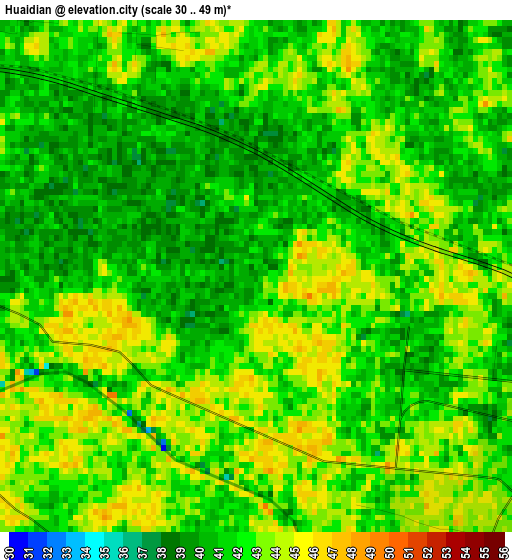
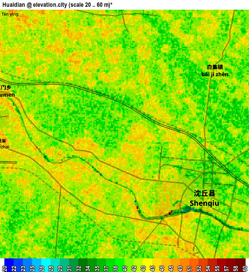
Below is the Elevation map of Huaidian, which displays elevation range with different colors. Scale of the first map is from 30 to 49 m (98 to 161 ft) with average elevation of 41.9 meters (=137 ft) [note 1]
These maps also provides idea of topography and contour of this city, they are displayed at different zoom levels. More info about maps, scale and edge coordinates you can find below images.
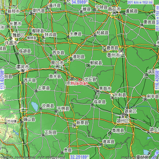
| \ | Map #1 | Map #2 | Topo.Map |
| Scale [m] | 30..49 m | 20..60 m | × |
| Scale [ft] | 98..161 ft | 66..197 ft | × |
| Average | 41.9 m = 137 ft | 41.7 m = 137 ft | × |
| Width | 8.16 km = 5.1 mi | 16.31 km = 10.1 mi | 261 km = 162.2 mi |
| Height | 8.16 km = 5.1 mi | 16.31 km = 10.1 mi | 261 km = 162.2 mi |
| ↑Max Latitude | 33.469996° | 33.506646° | 34.5989° |
| Latitude at center | 33.43333° | 33.43333° | 33.43333° |
| ↓Min Latitude | 33.396649° | 33.359952° | 32.25189° |
| ← Min Longitude | 114.989385° | 114.945439° | 113.62708° |
| Longitude center | 115.03333° | 115.03333° | 115.03333° |
| →Max Longitude | 115.077275° | 115.121221° | 116.43958° |
Nearby cities:
Cities around Huaidian sort by population:
• Zhoukou elevation 54 m
43.2 km,  300°
300°
• Jieshou 42 m
35.8 km,  121°
121°
• Jishui 41 m
47.6 km,  45°
45°
• Wacheng 56 m
61.7 km,  309°
309°
• Xincheng 43 m
26.2 km,  32°
32°
• Taihe Chengguanzhen 35 m
64.5 km, 117°
• Xiguan 44 m
62.7 km,  39°
39°
• Linquan Chengguanzhen 34 m
45.5 km,  148°
148°
• Xincheng 49 m
42.1 km,  286°
286°
• Huaiyang Chengguanzhen 53 m
36.1 km,  337°
337°
• Huayuan 43 m
15.4 km,  284°
284°
• Dongcheng 40 m
5 km, 117°
Multilingual:
 En español:
Huaidian elevación 40 m.
 En France:
Huaidian élévation 40 m.


Sources and notes:
- [note 1] Map square and city borders are not equal. Map elevation data is calculated only from area inside that square.
- [src 1] Elevation data from geonames database provided with same terms of usage.
- [src 2] The elevation map of Huaidian is generated using elevation data from NASA's 3 arcsec (90m) resolution SRTM data.
- [src 3] Base (background) map © OpenStreetMap contributors tiles are generated by Geofabrik and OpenTopoMap.
Copyright & License:
This Huaidian Elevation Map is licensed under CC BY-SA. You may reuse any part from this page, if you give a proper credit by linking to this URL:
 More info on terms of use page.