Wacheng elevation
Wacheng (Henan), China elevation is 56 meters and Wacheng elevation in feet is 184 ft above sea level [src 1]. Wacheng is a seat of a third-order administrative division (feature code) with elevation that is 502 meters (1647 ft) smaller than average city elevation in China.
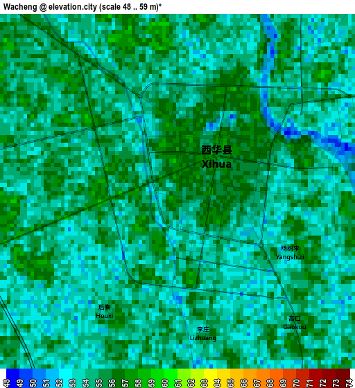
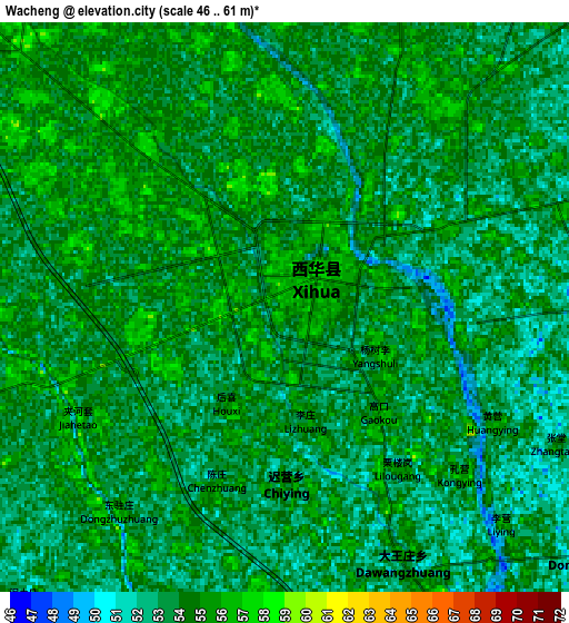
Below is the Elevation map of Wacheng, which displays elevation range with different colors. Scale of the first map is from 48 to 59 m (157 to 194 ft) with average elevation of 54.1 meters (=177 ft) [note 1]
These maps also provides idea of topography and contour of this city, they are displayed at different zoom levels. More info about maps, scale and edge coordinates you can find below images.
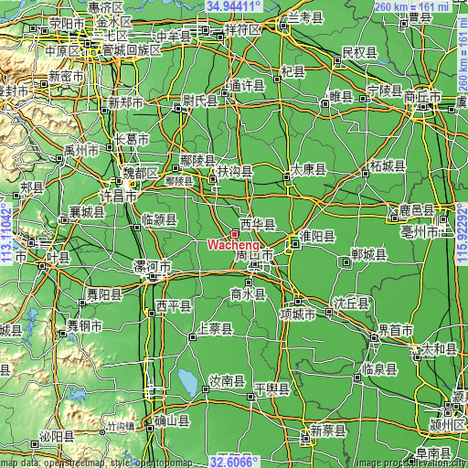
| \ | Map #1 | Map #2 | Topo.Map |
| Scale [m] | 48..59 m | 46..61 m | × |
| Scale [ft] | 157..194 ft | 151..200 ft | × |
| Average | 54.1 m = 177 ft | 53.7 m = 176 ft | × |
| Width | 8.12 km = 5 mi | 16.24 km = 10.1 mi | 259.9 km = 161.5 mi |
| Height | 8.12 km = 5 mi | 16.24 km = 10.1 mi | 259.9 km = 161.5 mi |
| ↑Max Latitude | 33.819847° | 33.856349° | 34.94411° |
| Latitude at center | 33.78333° | 33.78333° | 33.78333° |
| ↓Min Latitude | 33.746797° | 33.710249° | 32.6066° |
| ← Min Longitude | 114.472725° | 114.428779° | 113.11042° |
| Longitude center | 114.51667° | 114.51667° | 114.51667° |
| →Max Longitude | 114.560615° | 114.604561° | 115.92292° |
Nearby cities:
Cities around Wacheng sort by population:
• Luohe elevation 62 m
50.2 km,  240°
240°
• Zhoukou 54 m
19.9 km,  147°
147°
• Huaidian 40 m
61.7 km,  129°
129°
• Yancheng Chengguanzhen 69 m
53.8 km,  245°
245°
• Ganhechen 64 m
52.3 km, 241°
• Anling 62 m
48.3 km,  318°
318°
• Huayuan 43 m
48.1 km,  136°
136°
• Dizhuang 63 m
48 km, 239°
• Taikang Chengguanzhen 52 m
45.1 km,  45°
45°
• Huaiyang Chengguanzhen 53 m
34.3 km,  99°
99°
• Fugou Chengguanzhen 59 m
33.8 km,  338°
338°
• Xincheng 49 m
27.9 km,  164°
164°
Multilingual:
 En español:
Wacheng elevación 56 m.
 En France:
Wacheng élévation 56 m.


Sources and notes:
- [note 1] Map square and city borders are not equal. Map elevation data is calculated only from area inside that square.
- [src 1] Elevation data from geonames database provided with same terms of usage.
- [src 2] The elevation map of Wacheng is generated using elevation data from NASA's 3 arcsec (90m) resolution SRTM data.
- [src 3] Base (background) map © OpenStreetMap contributors tiles are generated by Geofabrik and OpenTopoMap.
Copyright & License:
This Wacheng Elevation Map is licensed under CC BY-SA. You may reuse any part from this page, if you give a proper credit by linking to this URL:
 More info on terms of use page.