Juye elevation
Juye (Shandong), China elevation is 44 meters and Juye elevation in feet is 144 ft above sea level [src 1]. Juye is a seat of a third-order administrative division (feature code) with elevation that is 514 meters (1686 ft) smaller than average city elevation in China.
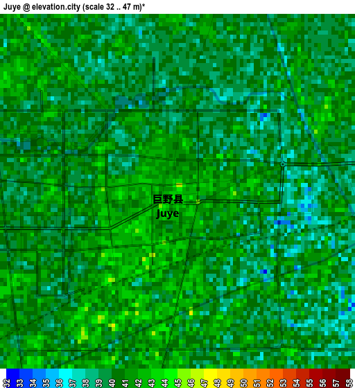
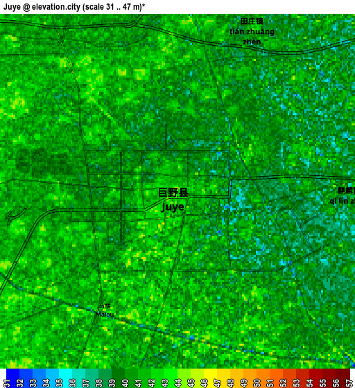
Below is the Elevation map of Juye, which displays elevation range with different colors. Scale of the first map is from 32 to 47 m (105 to 154 ft) with average elevation of 40.1 meters (=132 ft) [note 1]
These maps also provides idea of topography and contour of this city, they are displayed at different zoom levels. More info about maps, scale and edge coordinates you can find below images.
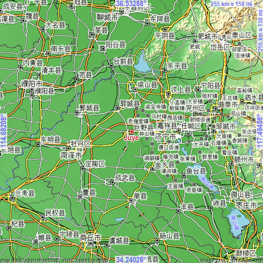
| \ | Map #1 | Map #2 | Topo.Map |
| Scale [m] | 32..47 m | 31..47 m | × |
| Scale [ft] | 105..154 ft | 102..154 ft | × |
| Average | 40.1 m = 132 ft | 40.2 m = 132 ft | × |
| Width | 7.97 km = 5 mi | 15.93 km = 9.9 mi | 254.9 km = 158.4 mi |
| Height | 7.97 km = 5 mi | 15.93 km = 9.9 mi | 254.9 km = 158.4 mi |
| ↑Max Latitude | 35.430535° | 35.466335° | 36.53288° |
| Latitude at center | 35.39472° | 35.39472° | 35.39472° |
| ↓Min Latitude | 35.358889° | 35.323041° | 34.24026° |
| ← Min Longitude | 116.044385° | 116.000439° | 114.68208° |
| Longitude center | 116.08833° | 116.08833° | 116.08833° |
| →Max Longitude | 116.132275° | 116.176221° | 117.49458° |
Nearby cities:
Cities around Juye sort by population:
• Jining elevation 43 m
44.7 km,  88°
88°
• Heze 53 m
58.4 km,  252°
252°
• Zhoucheng 41 m
61 km,  19°
19°
• Yucheng 37 m
62.1 km,  146°
146°
• Wenshang 44 m
52.2 km,  44°
44°
• Dingtao 53 m
59.3 km,  233°
233°
• Xicheng 55 m
61.7 km, 254°
• Juancheng 52 m
56.3 km,  289°
289°
• Chengwu 47 m
52.4 km,  200°
200°
• Yangying 41 m
48.7 km,  344°
344°
• Yuncheng 47 m
26.6 km,  328°
328°
• Jiaxiang 41 m
23.5 km, 89°
Multilingual:
 En español:
Juye elevación 44 m.
 En France:
Juye élévation 44 m.


Sources and notes:
- [note 1] Map square and city borders are not equal. Map elevation data is calculated only from area inside that square.
- [src 1] Elevation data from geonames database provided with same terms of usage.
- [src 2] The elevation map of Juye is generated using elevation data from NASA's 3 arcsec (90m) resolution SRTM data.
- [src 3] Base (background) map © OpenStreetMap contributors tiles are generated by Geofabrik and OpenTopoMap.
Copyright & License:
This Juye Elevation Map is licensed under CC BY-SA. You may reuse any part from this page, if you give a proper credit by linking to this URL:
 More info on terms of use page.