Linqu elevation
Linqu (Shandong), China elevation is 97 meters and Linqu elevation in feet is 318 ft above sea level [src 1]. Linqu is a populated place (feature code) with elevation that is 461 meters (1512 ft) smaller than average city elevation in China.
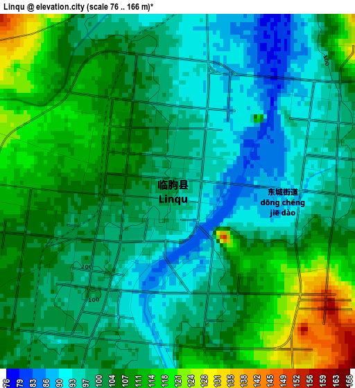
Below is the Elevation map of Linqu, which displays elevation range with different colors. Scale of the first map is from 76 to 166 m (249 to 545 ft) with average elevation of 103.3 meters (=339 ft) [note 1]
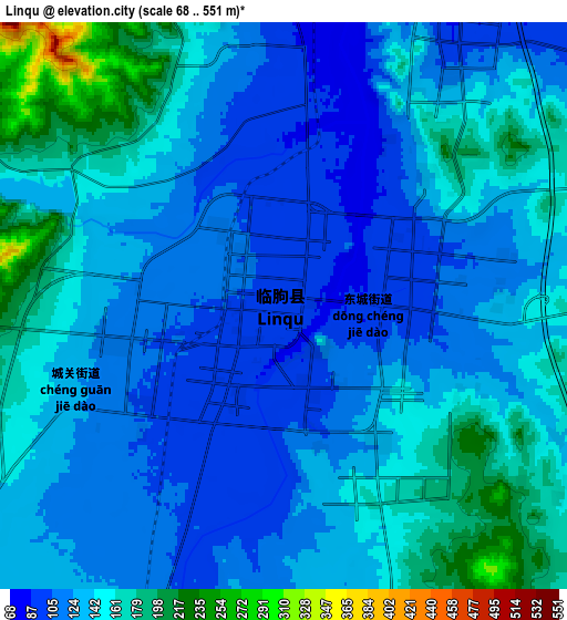
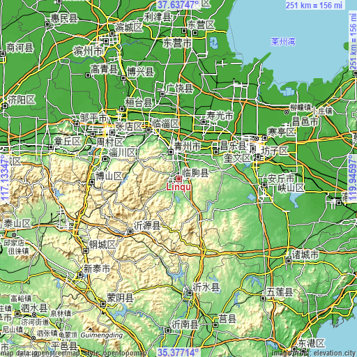
These maps also provides idea of topography and contour of this city, they are displayed at different zoom levels. More info about maps, scale and edge coordinates you can find below images.
| \ | Map #1 | Map #2 | Topo.Map |
| Scale [m] | 76..166 m | 68..551 m | × |
| Scale [ft] | 249..545 ft | 223..1808 ft | × |
| Average | 103.3 m = 339 ft | 138 m = 453 ft | × |
| Width | 7.85 km = 4.9 mi | 15.71 km = 9.8 mi | 251.3 km = 156.2 mi |
| Height | 7.85 km = 4.9 mi | 15.71 km = 9.8 mi | 251.3 km = 156.2 mi |
| ↑Max Latitude | 36.550871° | 36.586165° | 37.63747° |
| Latitude at center | 36.51556° | 36.51556° | 36.51556° |
| ↓Min Latitude | 36.480233° | 36.44489° | 35.37714° |
| ← Min Longitude | 118.495775° | 118.451829° | 117.13347° |
| Longitude center | 118.53972° | 118.53972° | 118.53972° |
| →Max Longitude | 118.583665° | 118.627611° | 119.94597° |
Nearby cities:
Cities around Linqu sort by population:
• Zibo elevation 51 m
52.4 km,  305°
305°
• Weifang 30 m
54.6 km,  66°
66°
• Boshan 368 m
63.2 km,  266°
266°
• Qingzhou 98 m
20.8 km,  345°
345°
• Anqiu 58 m
59.1 km,  98°
98°
• Nanding 64 m
50.3 km,  300°
300°
• Xindian 73 m
38.2 km,  325°
325°
• Shouguang 26 m
44.2 km,  23°
23°
• Nanma 283 m
50.4 km,  223°
223°
• Suozhen 20 m
62.3 km,  321°
321°
• Guangrao 16 m
61 km, 348°
• Dongping 398 m
48.6 km, 267°
Multilingual:
 En español:
Linqu elevación 97 m.
 En France:
Linqu élévation 97 m.


Sources and notes:
- [note 1] Map square and city borders are not equal. Map elevation data is calculated only from area inside that square.
- [src 1] Elevation data from geonames database provided with same terms of usage.
- [src 2] The elevation map of Linqu is generated using elevation data from NASA's 3 arcsec (90m) resolution SRTM data.
- [src 3] Base (background) map © OpenStreetMap contributors tiles are generated by Geofabrik and OpenTopoMap.
Copyright & License:
This Linqu Elevation Map is licensed under CC BY-SA. You may reuse any part from this page, if you give a proper credit by linking to this URL:
 More info on terms of use page.