Longquan elevation
Longquan (Yunnan), China elevation is 1591 meters and Longquan elevation in feet is 5220 ft above sea level [src 1]. Longquan is a seat of a third-order administrative division (feature code) with elevation that is 1033 meters (3389 ft) bigger than average city elevation in China.
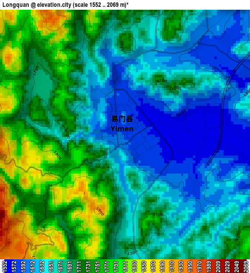
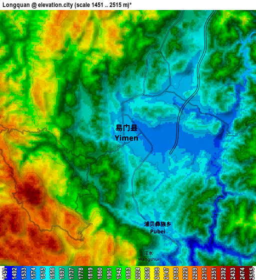
Below is the Elevation map of Longquan, which displays elevation range with different colors. Scale of the first map is from 1552 to 2069 m (5092 to 6788 ft) with average elevation of 1691.1 meters (=5548 ft) [note 1]
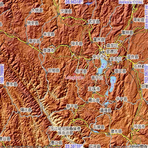
These maps also provides idea of topography and contour of this city, they are displayed at different zoom levels. More info about maps, scale and edge coordinates you can find below images.
| \ | Map #1 | Map #2 | Topo.Map |
| Scale [m] | 1552..2069 m | 1451..2515 m | × |
| Scale [ft] | 5092..6788 ft | 4760..8251 ft | × |
| Average | 1691.1 m = 5548 ft | 1849.9 m = 6069 ft | × |
| Width | 8.88 km = 5.5 mi | 17.76 km = 11 mi | 284.2 km = 176.6 mi |
| Height | 8.88 km = 5.5 mi | 17.76 km = 11 mi | 284.2 km = 176.6 mi |
| ↑Max Latitude | 24.711857° | 24.751772° | 25.94318° |
| Latitude at center | 24.67193° | 24.67193° | 24.67193° |
| ↓Min Latitude | 24.63199° | 24.592037° | 23.38759° |
| ← Min Longitude | 102.117355° | 102.073409° | 100.75505° |
| Longitude center | 102.1613° | 102.1613° | 102.1613° |
| →Max Longitude | 102.205245° | 102.249191° | 103.56755° |
Nearby cities:
Cities around Longquan sort by population:
• Kunming elevation 1895 m
69.4 km,  54°
54°
• Majie 1894 m
62.6 km, 50°
• Haikou 1909 m
43.5 km,  73°
73°
• Lianran 1836 m
43 km, 49°
• Yuxi 1638 m
52.2 km,  132°
132°
• Guishan 1875 m
71 km,  193°
193°
• Longcheng 1945 m
69.2 km, 68°
• Yongding 1840 m
65.9 km,  27°
27°
• Shuangjiang 1544 m
60.6 km,  156°
156°
• Tuodian 1855 m
53.4 km,  269°
269°
• Jinshan 1649 m
49.7 km,  352°
352°
• Kunyang 1896 m
43.5 km,  90°
90°
Multilingual:
 En español:
Longquan elevación 1591 m.
 En France:
Longquan élévation 1591 m.
 Auf Deutsch:
Longquan höhe über dem Meeresspiegel ist 1591 m.

Sources and notes:
- [note 1] Map square and city borders are not equal. Map elevation data is calculated only from area inside that square.
- [src 1] Elevation data from geonames database provided with same terms of usage.
- [src 2] The elevation map of Longquan is generated using elevation data from NASA's 3 arcsec (90m) resolution SRTM data.
- [src 3] Base (background) map © OpenStreetMap contributors tiles are generated by Geofabrik and OpenTopoMap.
Copyright & License:
This Longquan Elevation Map is licensed under CC BY-SA. You may reuse any part from this page, if you give a proper credit by linking to this URL:
 More info on terms of use page.