Luorong elevation
Luorong (Guangxi), China elevation is 76 meters and Luorong elevation in feet is 249 ft above sea level [src 1]. Luorong is a populated place (feature code) with elevation that is 482 meters (1581 ft) smaller than average city elevation in China.
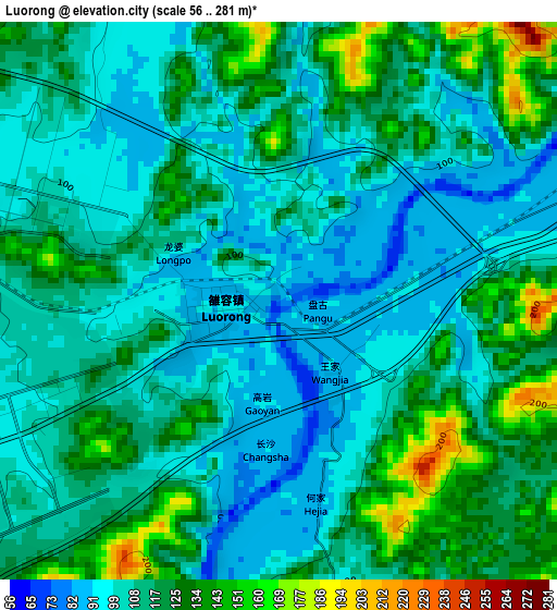
Below is the Elevation map of Luorong, which displays elevation range with different colors. Scale of the first map is from 56 to 281 m (184 to 922 ft) with average elevation of 112.3 meters (=368 ft) [note 1]
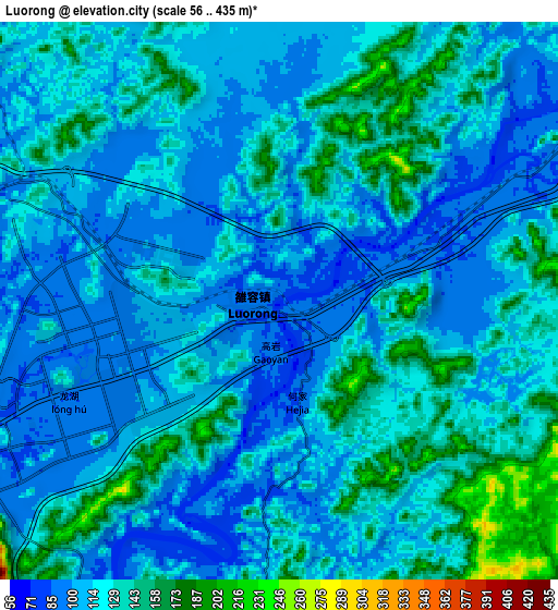
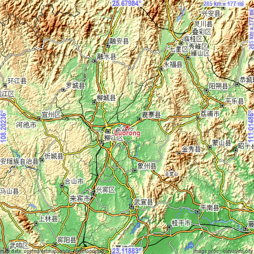
These maps also provides idea of topography and contour of this city, they are displayed at different zoom levels. More info about maps, scale and edge coordinates you can find below images.
| \ | Map #1 | Map #2 | Topo.Map |
| Scale [m] | 56..281 m | 56..435 m | × |
| Scale [ft] | 184..922 ft | 184..1427 ft | × |
| Average | 112.3 m = 368 ft | 120.3 m = 395 ft | × |
| Width | 8.9 km = 5.5 mi | 17.8 km = 11.1 mi | 284.8 km = 177 mi |
| Height | 8.9 km = 5.5 mi | 17.8 km = 11.1 mi | 284.8 km = 177 mi |
| ↑Max Latitude | 24.445842° | 24.485841° | 25.67984° |
| Latitude at center | 24.40583° | 24.40583° | 24.40583° |
| ↓Min Latitude | 24.365805° | 24.325768° | 23.11883° |
| ← Min Longitude | 109.564665° | 109.520719° | 108.20236° |
| Longitude center | 109.60861° | 109.60861° | 109.60861° |
| →Max Longitude | 109.652555° | 109.696501° | 111.01486° |
Nearby cities:
Cities around Luorong sort by population:
• Laibin elevation 83 m
85.8 km,  203°
203°
• Wuxuan 68 m
87 km,  177°
177°
• Dongmen 348 m
83.5 km,  300°
300°
• Rongshui 114 m
81.9 km,  333°
333°
• Licheng 170 m
79.8 km,  81°
81°
• Yongfu 205 m
76.5 km,  29°
29°
• Jinxiu 908 m
65.2 km,  117°
117°
• Xiangzhou 77 m
48.5 km,  173°
173°
• Dabu 100 m
47.6 km,  307°
307°
• Labu 109 m
32.2 km,  239°
239°
• Liuzhou 94 m
24.5 km, 244°
• Luzhai 94 m
16.2 km,  51°
51°
Multilingual:
 En español:
Luorong elevación 76 m.
 En France:
Luorong élévation 76 m.


Sources and notes:
- [note 1] Map square and city borders are not equal. Map elevation data is calculated only from area inside that square.
- [src 1] Elevation data from geonames database provided with same terms of usage.
- [src 2] The elevation map of Luorong is generated using elevation data from NASA's 3 arcsec (90m) resolution SRTM data.
- [src 3] Base (background) map © OpenStreetMap contributors tiles are generated by Geofabrik and OpenTopoMap.
Copyright & License:
This Luorong Elevation Map is licensed under CC BY-SA. You may reuse any part from this page, if you give a proper credit by linking to this URL:
 More info on terms of use page.