Neijiang elevation
Neijiang (Sichuan, Neijiang Shi), China elevation is 349 meters and Neijiang elevation in feet is 1145 ft above sea level [src 1]. Neijiang is a seat of a third-order administrative division (feature code) with elevation that is 209 meters (686 ft) smaller than average city elevation in China.
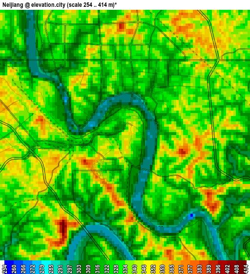
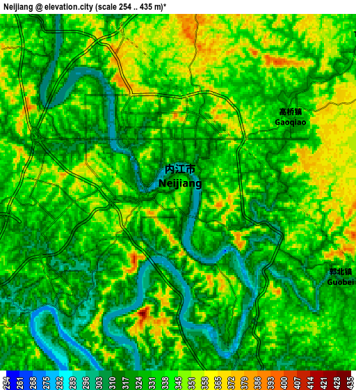
Below is the Elevation map of Neijiang, which displays elevation range with different colors. Scale of the first map is from 254 to 414 m (833 to 1358 ft) with average elevation of 328.8 meters (=1079 ft) [note 1]
These maps also provides idea of topography and contour of this city, they are displayed at different zoom levels. More info about maps, scale and edge coordinates you can find below images.
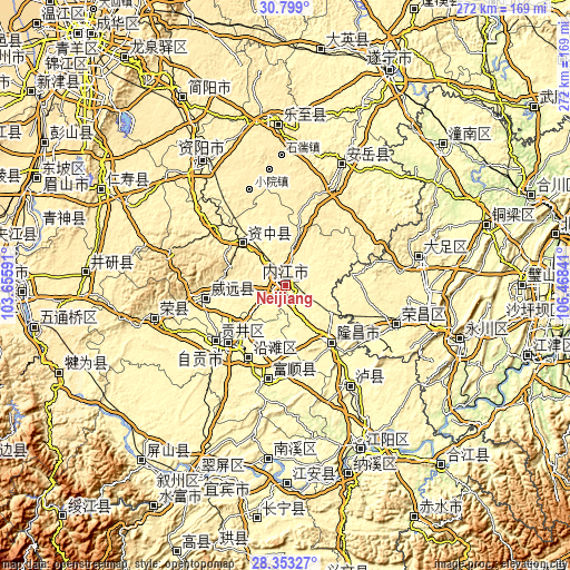
| \ | Map #1 | Map #2 | Topo.Map |
| Scale [m] | 254..414 m | 254..435 m | × |
| Scale [ft] | 833..1358 ft | 833..1427 ft | × |
| Average | 328.8 m = 1079 ft | 332.6 m = 1091 ft | × |
| Width | 8.5 km = 5.3 mi | 17 km = 10.6 mi | 271.9 km = 169 mi |
| Height | 8.5 km = 5.3 mi | 17 km = 10.6 mi | 271.9 km = 169 mi |
| ↑Max Latitude | 29.621749° | 29.659944° | 30.799° |
| Latitude at center | 29.58354° | 29.58354° | 29.58354° |
| ↓Min Latitude | 29.545316° | 29.507078° | 28.35327° |
| ← Min Longitude | 105.018215° | 104.974269° | 103.65591° |
| Longitude center | 105.06216° | 105.06216° | 105.06216° |
| →Max Longitude | 105.106105° | 105.150051° | 106.46841° |
Nearby cities:
Cities around Neijiang sort by population:
• Zigong elevation 306 m
38.6 km,  225°
225°
• Chonglong 361 m
29.9 km,  317°
317°
• Shuanglu 389 m
68.7 km,  99°
99°
• Tangxiang 378 m
65.3 km,  78°
78°
• Xuyang 363 m
63.7 km,  257°
257°
• Fuji 291 m
57.1 km,  148°
148°
• Changyuan 319 m
54.7 km,  111°
111°
• Fushi 294 m
44.8 km,  187°
187°
• Gongjing 317 m
42.9 km, 232°
• Yanling 318 m
39.2 km, 261°
• Yantan 299 m
39 km,  207°
207°
• Jin’e 374 m
34.3 km,  141°
141°
Multilingual:
 En español:
Neijiang elevación 349 m.
 En France:
Neijiang élévation 349 m.
 Auf Deutsch:
Neijiang höhe über dem Meeresspiegel ist 349 m.

Sources and notes:
- [note 1] Map square and city borders are not equal. Map elevation data is calculated only from area inside that square.
- [src 1] Elevation data from geonames database provided with same terms of usage.
- [src 2] The elevation map of Neijiang is generated using elevation data from NASA's 3 arcsec (90m) resolution SRTM data.
- [src 3] Base (background) map © OpenStreetMap contributors tiles are generated by Geofabrik and OpenTopoMap.
Copyright & License:
This Neijiang Elevation Map is licensed under CC BY-SA. You may reuse any part from this page, if you give a proper credit by linking to this URL:
 More info on terms of use page.