Wenxing elevation
Wenxing (Hunan), China elevation is 51 meters and Wenxing elevation in feet is 167 ft above sea level [src 1]. Wenxing is a seat of a third-order administrative division (feature code) with elevation that is 507 meters (1663 ft) smaller than average city elevation in China.
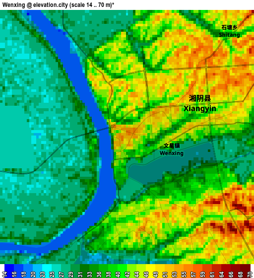
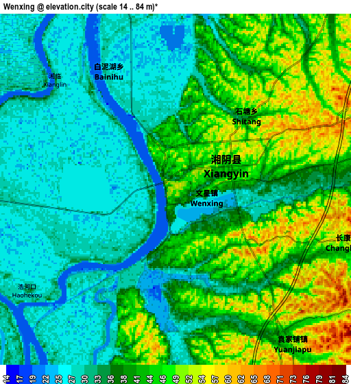
Below is the Elevation map of Wenxing, which displays elevation range with different colors. Scale of the first map is from 14 to 70 m (46 to 230 ft) with average elevation of 36 meters (=118 ft) [note 1]
These maps also provides idea of topography and contour of this city, they are displayed at different zoom levels. More info about maps, scale and edge coordinates you can find below images.
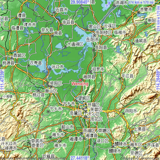
| \ | Map #1 | Map #2 | Topo.Map |
| Scale [m] | 14..70 m | 14..84 m | × |
| Scale [ft] | 46..230 ft | 46..276 ft | × |
| Average | 36 m = 118 ft | 37.6 m = 123 ft | × |
| Width | 8.57 km = 5.3 mi | 17.15 km = 10.7 mi | 274.3 km = 170.4 mi |
| Height | 8.57 km = 5.3 mi | 17.15 km = 10.7 mi | 274.3 km = 170.4 mi |
| ↑Max Latitude | 28.720626° | 28.759158° | 29.90845° |
| Latitude at center | 28.68208° | 28.68208° | 28.68208° |
| ↓Min Latitude | 28.64352° | 28.604946° | 27.44118° |
| ← Min Longitude | 112.834695° | 112.790749° | 111.47239° |
| Longitude center | 112.87864° | 112.87864° | 112.87864° |
| →Max Longitude | 112.922585° | 112.966531° | 114.28489° |
Nearby cities:
Cities around Wenxing sort by population:
• Changsha elevation 67 m
54.5 km,  170°
170°
• Yiyang 25 m
54.7 km,  259°
259°
• Qionghu 31 m
52.3 km,  289°
289°
• Yutan 53 m
56.5 km,  213°
213°
• Rongjiawan 48 m
56.4 km,  22°
22°
• Damatou 34 m
53.3 km, 262°
• Xingsha 69 m
53.3 km,  157°
157°
• Heshan 59 m
52.7 km, 257°
• Furong Beilu 39 m
50.5 km, 168°
• Wangyue 70 m
49.8 km,  175°
175°
• Gaotangling 28 m
35.6 km,  189°
189°
• Miluo Chengguanzhen 46 m
23.2 km,  51°
51°
Multilingual:
 En español:
Wenxing elevación 51 m.
 En France:
Wenxing élévation 51 m.


Sources and notes:
- [note 1] Map square and city borders are not equal. Map elevation data is calculated only from area inside that square.
- [src 1] Elevation data from geonames database provided with same terms of usage.
- [src 2] The elevation map of Wenxing is generated using elevation data from NASA's 3 arcsec (90m) resolution SRTM data.
- [src 3] Base (background) map © OpenStreetMap contributors tiles are generated by Geofabrik and OpenTopoMap.
Copyright & License:
This Wenxing Elevation Map is licensed under CC BY-SA. You may reuse any part from this page, if you give a proper credit by linking to this URL:
 More info on terms of use page.