Zaoyang elevation
Zaoyang (Hubei), China elevation is 113 meters and Zaoyang elevation in feet is 371 ft above sea level [src 1]. Zaoyang is a populated place (feature code) with elevation that is 445 meters (1460 ft) smaller than average city elevation in China.
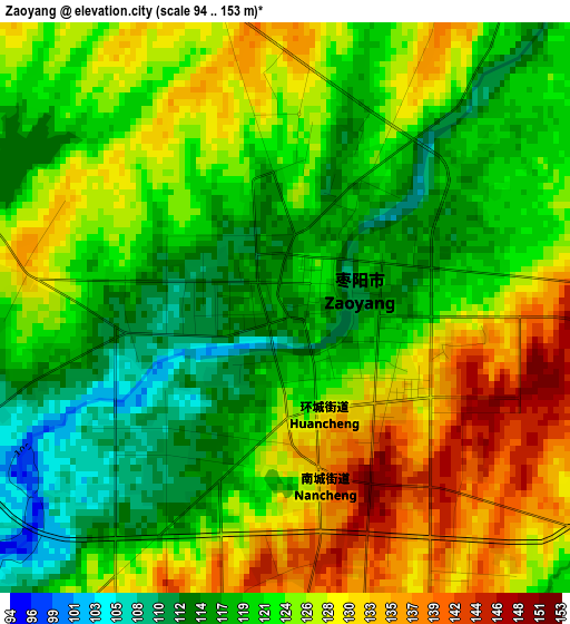
Below is the Elevation map of Zaoyang, which displays elevation range with different colors. Scale of the first map is from 94 to 153 m (308 to 502 ft) with average elevation of 123.3 meters (=405 ft) [note 1]
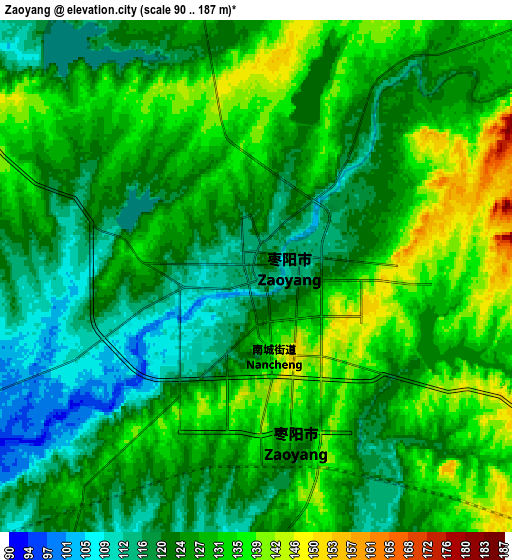
These maps also provides idea of topography and contour of this city, they are displayed at different zoom levels. More info about maps, scale and edge coordinates you can find below images.
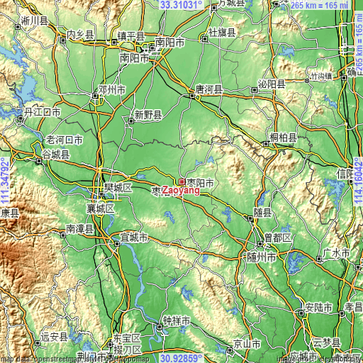
| \ | Map #1 | Map #2 | Topo.Map |
| Scale [m] | 94..153 m | 90..187 m | × |
| Scale [ft] | 308..502 ft | 295..614 ft | × |
| Average | 123.3 m = 405 ft | 126.5 m = 415 ft | × |
| Width | 8.28 km = 5.1 mi | 16.55 km = 10.3 mi | 264.8 km = 164.5 mi |
| Height | 8.28 km = 5.1 mi | 16.55 km = 10.3 mi | 264.8 km = 164.5 mi |
| ↑Max Latitude | 32.164428° | 32.201622° | 33.31031° |
| Latitude at center | 32.12722° | 32.12722° | 32.12722° |
| ↓Min Latitude | 32.089996° | 32.052758° | 30.92859° |
| ← Min Longitude | 112.710225° | 112.666279° | 111.34792° |
| Longitude center | 112.75417° | 112.75417° | 112.75417° |
| →Max Longitude | 112.798115° | 112.842061° | 114.16042° |
Nearby cities:
Cities around Zaoyang sort by population:
• Xiangyang elevation 71 m
58.2 km,  260°
260°
• Suizhou 67 m
73.8 km,  128°
128°
• Xihe 64 m
83.2 km, 126°
• Binhe 109 m
62.8 km,  6°
6°
• Hancheng 94 m
57.6 km,  319°
319°
• Yicheng 63 m
66.5 km,  225°
225°
• Huazhou 119 m
88.3 km,  314°
314°
• Bishui 142 m
84 km,  38°
38°
• Xiangcheng 221 m
81.6 km,  254°
254°
• Tongbai Chengguanzhen 148 m
65.9 km,  66°
66°
• Lishan 85 m
59.2 km,  120°
120°
• Zhangwan 70 m
55.5 km, 264°
Multilingual:
 En español:
Zaoyang elevación 113 m.
 En France:
Zaoyang élévation 113 m.


Sources and notes:
- [note 1] Map square and city borders are not equal. Map elevation data is calculated only from area inside that square.
- [src 1] Elevation data from geonames database provided with same terms of usage.
- [src 2] The elevation map of Zaoyang is generated using elevation data from NASA's 3 arcsec (90m) resolution SRTM data.
- [src 3] Base (background) map © OpenStreetMap contributors tiles are generated by Geofabrik and OpenTopoMap.
Copyright & License:
This Zaoyang Elevation Map is licensed under CC BY-SA. You may reuse any part from this page, if you give a proper credit by linking to this URL:
 More info on terms of use page.