Graneros elevation
Graneros (O'Higgins Region, Provincia de Cachapoal), Chile elevation is 483 meters and Graneros elevation in feet is 1585 ft above sea level [src 1]. Graneros is a populated place (feature code) with elevation that is 208 meters (682 ft) bigger than average city elevation in Chile.
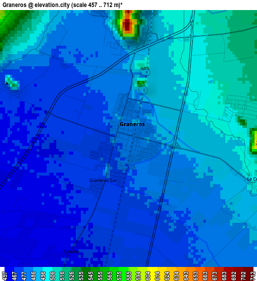
Below is the Elevation map of Graneros, which displays elevation range with different colors. Scale of the first map is from 457 to 712 m (1499 to 2336 ft) with average elevation of 484.5 meters (=1590 ft) [note 1]
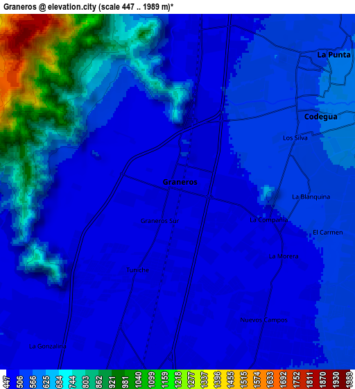
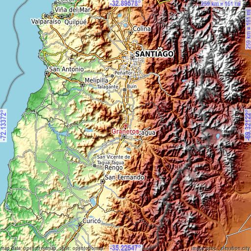
These maps also provides idea of topography and contour of this city, they are displayed at different zoom levels. More info about maps, scale and edge coordinates you can find below images.
| \ | Map #1 | Map #2 | Topo.Map |
| Scale [m] | 457..712 m | 447..1989 m | × |
| Scale [ft] | 1499..2336 ft | 1467..6526 ft | × |
| Average | 484.5 m = 1590 ft | 580.3 m = 1904 ft | × |
| Width | 8.1 km = 5 mi | 16.19 km = 10.1 mi | 259 km = 160.9 mi |
| Height | 8.1 km = 5 mi | 16.19 km = 10.1 mi | 259 km = 160.9 mi |
| ↑Max Latitude | -34.032219° | -33.995793° | -32.89578° |
| Latitude at center | -34.06863° | -34.06863° | -34.06863° |
| ↓Min Latitude | -34.105025° | -34.141404° | -35.22547° |
| ← Min Longitude | -70.771415° | -70.815361° | -72.13372° |
| Longitude center | -70.72747° | -70.72747° | -70.72747° |
| →Max Longitude | -70.683525° | -70.639579° | -69.32122° |
Nearby cities:
Cities around Graneros sort by population:
• Puente Alto elevation 700 m
52.7 km,  15°
15°
• San Bernardo 571 m
53 km,  2°
2°
• Rancagua 506 m
11.5 km,  187°
187°
• Peñaflor 395 m
53.2 km,  345°
345°
• Buin 483 m
37.4 km,  357°
357°
• Talagante 344 m
48.6 km,  337°
337°
• Rengo 326 m
39.4 km,  197°
197°
• Paine 407 m
29 km, 357°
• San Vicente de Tagua Tagua 214 m
52.2 km,  218°
218°
• Machalí 568 m
14.4 km,  150°
150°
• El Monte 300 m
49.3 km,  331°
331°
• San Vicente 210 m
52.1 km, 218°
Multilingual:
 En español:
Graneros elevación 483 m.
 En France:
Graneros élévation 483 m.
 Auf Deutsch:
Graneros höhe über dem Meeresspiegel ist 483 m.

Sources and notes:
- [note 1] Map square and city borders are not equal. Map elevation data is calculated only from area inside that square.
- [src 1] Elevation data from geonames database provided with same terms of usage.
- [src 2] The elevation map of Graneros is generated using elevation data from NASA's 3 arcsec (90m) resolution SRTM data.
- [src 3] Base (background) map © OpenStreetMap contributors tiles are generated by Geofabrik and OpenTopoMap.
Copyright & License:
This Graneros Elevation Map is licensed under CC BY-SA. You may reuse any part from this page, if you give a proper credit by linking to this URL:
 More info on terms of use page.