Ependes elevation
Ependes (Fribourg, Sarine District), Switzerland elevation is 751 meters and Ependes elevation in feet is 2464 ft above sea level [src 1]. Ependes is a populated place (feature code) with elevation that is 203 meters (666 ft) bigger than average city elevation in Switzerland.
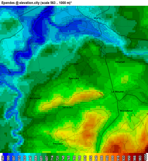
Below is the Elevation map of Ependes, which displays elevation range with different colors. Scale of the first map is from 563 to 1000 m (1847 to 3281 ft) with average elevation of 712.1 meters (=2336 ft) [note 1]
These maps also provides idea of topography and contour of this city, they are displayed at different zoom levels. More info about maps, scale and edge coordinates you can find below images.
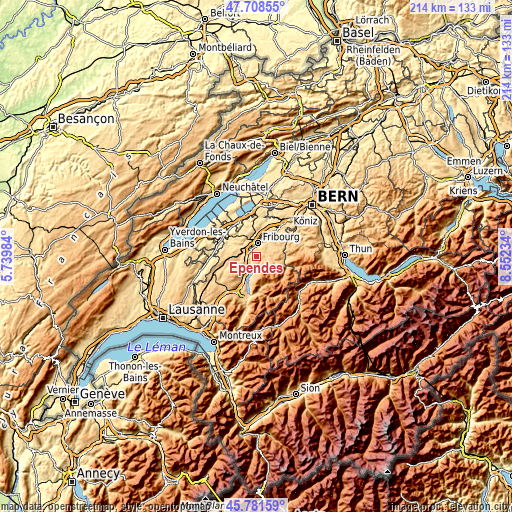
| \ | Map #1 | Topo.Map |
| Scale [m] | 563..1000 m | × |
| Scale [ft] | 1847..3281 ft | × |
| Average | 712.1 m = 2336 ft | × |
| Width | 6.7 km = 4.2 mi | 214.3 km = 133.2 mi |
| Height | 6.7 km = 4.2 mi | 214.2 km = 133.1 mi |
| ↑Max Latitude | 46.78378° | 47.70855° |
| Latitude at center | 46.75368° | 46.75368° |
| ↓Min Latitude | 46.723563° | 45.78159° |
| ← Min Longitude | 7.102145° | 5.73984° |
| Longitude center | 7.14609° | 7.14609° |
| →Max Longitude | 7.190035° | 8.55234° |
Nearby cities:
Cities around Ependes sort by population:
• Fribourg elevation 627 m
5.4 km,  4°
4°
• Villars-sur-Glâne 656 m
4.7 km,  331°
331°
• Marly 636 m
2.9 km,  29°
29°
• Givisiez 645 m
6.7 km,  346°
346°
• Corminboeuf 646 m
7 km, 333°
• Giffers 756 m
4.8 km,  78°
78°
• La Roche 750 m
6.4 km,  186°
186°
• Treyvaux 783 m
2.9 km, 192°
• Avry-sur-Matran 697 m
7.1 km,  302°
302°
• Praroman 779 m
2.4 km,  95°
95°
• Pont-la-Ville 788 m
6.8 km,  203°
203°
• Matran 597 m
5.1 km,  314°
314°
Multilingual:
 En español:
Ependes elevación 751 m.
 En France:
Épendes élévation 751 m.
 Auf Deutsch:
Ependes FR höhe über dem Meeresspiegel ist 751 m.

Sources and notes:
- [note 1] Map square and city borders are not equal. Map elevation data is calculated only from area inside that square.
- [src 1] Elevation data from geonames database provided with same terms of usage.
- [src 2] The elevation map of Ependes is generated using elevation data from NASA's 3 arcsec (90m) resolution SRTM data.
- [src 3] Base (background) map © OpenStreetMap contributors tiles are generated by Geofabrik and OpenTopoMap.
Copyright & License:
This Ependes Elevation Map is licensed under CC BY-SA. You may reuse any part from this page, if you give a proper credit by linking to this URL:
 More info on terms of use page.