Frenkendorf elevation
Frenkendorf (Basel-Landschaft, Bezirk Liestal), Switzerland elevation is 330 meters and Frenkendorf elevation in feet is 1083 ft above sea level [src 1]. Frenkendorf is a populated place (feature code) with elevation that is 218 meters (715 ft) smaller than average city elevation in Switzerland.
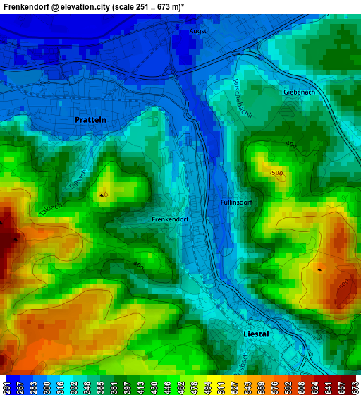
Below is the Elevation map of Frenkendorf, which displays elevation range with different colors. Scale of the first map is from 251 to 673 m (823 to 2208 ft) with average elevation of 385.8 meters (=1266 ft) [note 1]
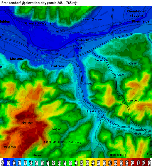
These maps also provides idea of topography and contour of this city, they are displayed at different zoom levels. More info about maps, scale and edge coordinates you can find below images.
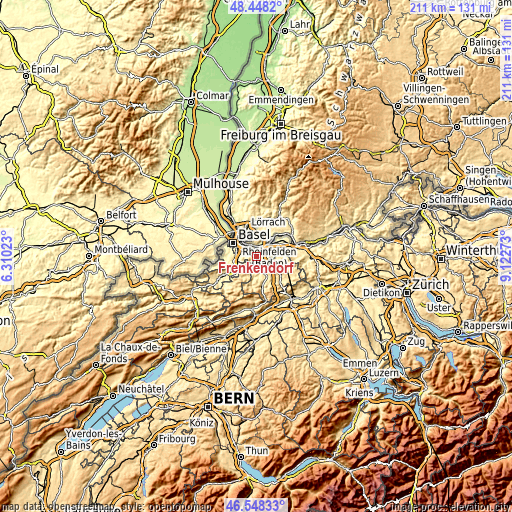
| \ | Map #1 | Map #2 | Topo.Map |
| Scale [m] | 251..673 m | 248..765 m | × |
| Scale [ft] | 823..2208 ft | 814..2510 ft | × |
| Average | 385.8 m = 1266 ft | 414.2 m = 1359 ft | × |
| Width | 6.6 km = 4.1 mi | 13.2 km = 8.2 mi | 211.2 km = 131.2 mi |
| Height | 6.6 km = 4.1 mi | 13.2 km = 8.2 mi | 211.2 km = 131.2 mi |
| ↑Max Latitude | 47.536537° | 47.566197° | 48.4482° |
| Latitude at center | 47.50686° | 47.50686° | 47.50686° |
| ↓Min Latitude | 47.477166° | 47.447456° | 46.54833° |
| ← Min Longitude | 7.672535° | 7.628589° | 6.31023° |
| Longitude center | 7.71648° | 7.71648° | 7.71648° |
| →Max Longitude | 7.760425° | 7.804371° | 9.12273° |
Nearby cities:
Cities around Frenkendorf sort by population:
• Muttenz elevation 293 m
5.6 km,  288°
288°
• Pratteln 291 m
2.3 km,  311°
311°
• Liestal 327 m
2.8 km,  151°
151°
• Arlesheim 332 m
7.4 km,  258°
258°
• Lausen 336 m
5.1 km,  140°
140°
• Bubendorf 376 m
7 km,  166°
166°
• Füllinsdorf 348 m
1.1 km,  89°
89°
• Kaiseraugst 268 m
3.7 km,  11°
11°
• Magden 324 m
7.5 km,  71°
71°
• Itingen 366 m
6.8 km,  131°
131°
• Arisdorf 349 m
3.7 km,  79°
79°
• Seltisberg 496 m
4.9 km,  176°
176°
Multilingual:
 En español:
Frenkendorf elevación 330 m.
 En France:
Frenkendorf élévation 330 m.
 Auf Deutsch:
Frenkendorf höhe über dem Meeresspiegel ist 330 m.

Sources and notes:
- [note 1] Map square and city borders are not equal. Map elevation data is calculated only from area inside that square.
- [src 1] Elevation data from geonames database provided with same terms of usage.
- [src 2] The elevation map of Frenkendorf is generated using elevation data from NASA's 3 arcsec (90m) resolution SRTM data.
- [src 3] Base (background) map © OpenStreetMap contributors tiles are generated by Geofabrik and OpenTopoMap.
Copyright & License:
This Frenkendorf Elevation Map is licensed under CC BY-SA. You may reuse any part from this page, if you give a proper credit by linking to this URL:
 More info on terms of use page.