Liestal elevation
Liestal (Basel-Landschaft, Bezirk Liestal), Switzerland elevation is 327 meters and Liestal elevation in feet is 1073 ft above sea level [src 1]. Liestal is a seat of a first-order administrative division (feature code) with elevation that is 221 meters (725 ft) smaller than average city elevation in Switzerland.
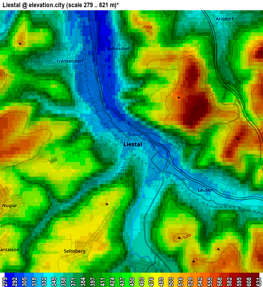
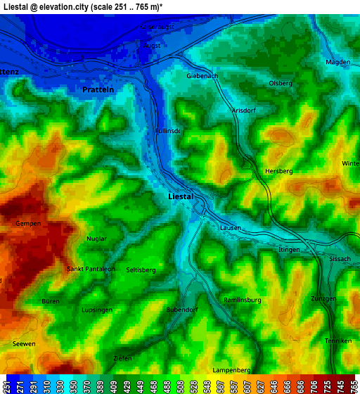
Below is the Elevation map of Liestal, which displays elevation range with different colors. Scale of the first map is from 279 to 621 m (915 to 2037 ft) with average elevation of 420.4 meters (=1379 ft) [note 1]
These maps also provides idea of topography and contour of this city, they are displayed at different zoom levels. More info about maps, scale and edge coordinates you can find below images.
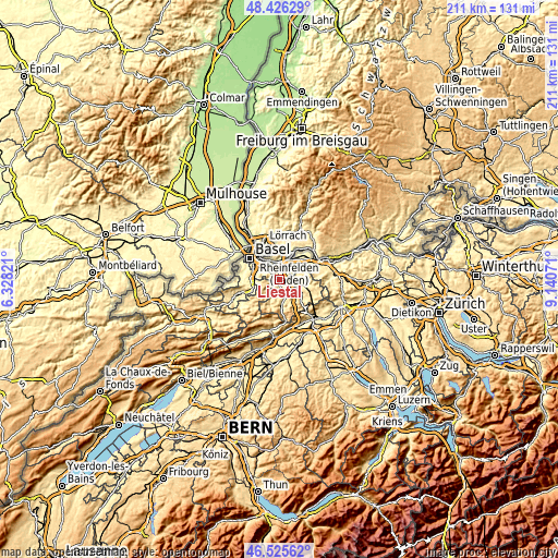
| \ | Map #1 | Map #2 | Topo.Map |
| Scale [m] | 279..621 m | 251..765 m | × |
| Scale [ft] | 915..2037 ft | 823..2510 ft | × |
| Average | 420.4 m = 1379 ft | 450.2 m = 1477 ft | × |
| Width | 6.6 km = 4.1 mi | 13.21 km = 8.2 mi | 211.3 km = 131.3 mi |
| Height | 6.6 km = 4.1 mi | 13.21 km = 8.2 mi | 211.3 km = 131.3 mi |
| ↑Max Latitude | 47.514239° | 47.543912° | 48.42629° |
| Latitude at center | 47.48455° | 47.48455° | 47.48455° |
| ↓Min Latitude | 47.454844° | 47.425121° | 46.52562° |
| ← Min Longitude | 7.690515° | 7.646569° | 6.32821° |
| Longitude center | 7.73446° | 7.73446° | 7.73446° |
| →Max Longitude | 7.778405° | 7.822351° | 9.14071° |
Nearby cities:
Cities around Liestal sort by population:
• Pratteln elevation 291 m
5.1 km,  322°
322°
• Frenkendorf 330 m
2.8 km,  331°
331°
• Sissach 374 m
6 km,  112°
112°
• Lausen 336 m
2.4 km,  126°
126°
• Bubendorf 376 m
4.3 km,  176°
176°
• Füllinsdorf 348 m
2.5 km,  354°
354°
• Kaiseraugst 268 m
6.2 km, 354°
• Zunzgen 399 m
6.8 km, 125°
• Hölstein 430 m
7.4 km,  158°
158°
• Itingen 366 m
4.3 km,  117°
117°
• Arisdorf 349 m
3.9 km,  35°
35°
• Seltisberg 496 m
2.7 km,  203°
203°
Multilingual:
 En español:
Liestal elevación 327 m.
 En France:
Liestal élévation 327 m.


Sources and notes:
- [note 1] Map square and city borders are not equal. Map elevation data is calculated only from area inside that square.
- [src 1] Elevation data from geonames database provided with same terms of usage.
- [src 2] The elevation map of Liestal is generated using elevation data from NASA's 3 arcsec (90m) resolution SRTM data.
- [src 3] Base (background) map © OpenStreetMap contributors tiles are generated by Geofabrik and OpenTopoMap.
Copyright & License:
This Liestal Elevation Map is licensed under CC BY-SA. You may reuse any part from this page, if you give a proper credit by linking to this URL:
 More info on terms of use page.