Muttenz elevation
Muttenz (Basel-Landschaft, Bezirk Arlesheim), Switzerland elevation is 293 meters and Muttenz elevation in feet is 961 ft above sea level [src 1]. Muttenz is a populated place (feature code) with elevation that is 255 meters (837 ft) smaller than average city elevation in Switzerland.
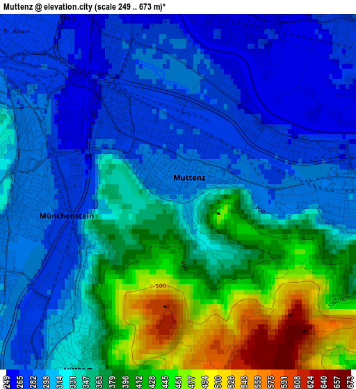
Below is the Elevation map of Muttenz, which displays elevation range with different colors. Scale of the first map is from 249 to 673 m (817 to 2208 ft) with average elevation of 341.2 meters (=1119 ft) [note 1]
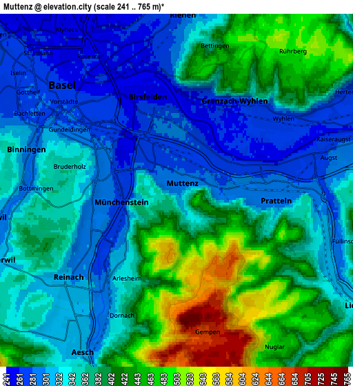
These maps also provides idea of topography and contour of this city, they are displayed at different zoom levels. More info about maps, scale and edge coordinates you can find below images.
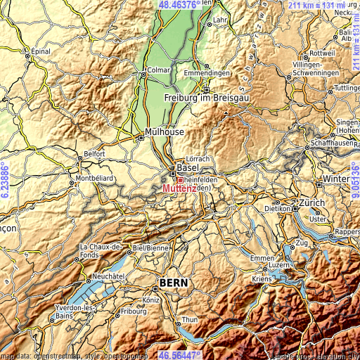
| \ | Map #1 | Map #2 | Topo.Map |
| Scale [m] | 249..673 m | 241..765 m | × |
| Scale [ft] | 817..2208 ft | 791..2510 ft | × |
| Average | 341.2 m = 1119 ft | 365.5 m = 1199 ft | × |
| Width | 6.6 km = 4.1 mi | 13.2 km = 8.2 mi | 211.2 km = 131.2 mi |
| Height | 6.6 km = 4.1 mi | 13.2 km = 8.2 mi | 211.2 km = 131.2 mi |
| ↑Max Latitude | 47.552378° | 47.582029° | 48.46376° |
| Latitude at center | 47.52271° | 47.52271° | 47.52271° |
| ↓Min Latitude | 47.493025° | 47.463324° | 46.56447° |
| ← Min Longitude | 7.601165° | 7.557219° | 6.23886° |
| Longitude center | 7.64511° | 7.64511° | 7.64511° |
| →Max Longitude | 7.689055° | 7.733001° | 9.05136° |
Nearby cities:
Cities around Muttenz sort by population:
• Riehen elevation 280 m
6.2 km,  1°
1°
• Pratteln 291 m
3.6 km,  93°
93°
• Binningen 316 m
6 km,  288°
288°
• Münchenstein 287 m
2.7 km,  259°
259°
• Birsfelden 259 m
3.7 km,  333°
333°
• Oberwil 299 m
6.6 km, 261°
• Arlesheim 332 m
3.7 km,  210°
210°
• Dornach 337 m
5.2 km,  204°
204°
• Frenkendorf 330 m
5.6 km,  108°
108°
• Bottmingen 295 m
5.5 km,  270°
270°
• Kaiseraugst 268 m
6.4 km,  72°
72°
• Bettingen 383 m
5.5 km,  15°
15°
Multilingual:
 En español:
Muttenz elevación 293 m.
 En France:
Muttenz élévation 293 m.


Sources and notes:
- [note 1] Map square and city borders are not equal. Map elevation data is calculated only from area inside that square.
- [src 1] Elevation data from geonames database provided with same terms of usage.
- [src 2] The elevation map of Muttenz is generated using elevation data from NASA's 3 arcsec (90m) resolution SRTM data.
- [src 3] Base (background) map © OpenStreetMap contributors tiles are generated by Geofabrik and OpenTopoMap.
Copyright & License:
This Muttenz Elevation Map is licensed under CC BY-SA. You may reuse any part from this page, if you give a proper credit by linking to this URL:
 More info on terms of use page.