Horw elevation
Horw (Lucerne, Lucerne-Land District), Switzerland elevation is 441 meters and Horw elevation in feet is 1447 ft above sea level [src 1]. Horw is a seat of a third-order administrative division (feature code) with elevation that is 107 meters (351 ft) smaller than average city elevation in Switzerland.
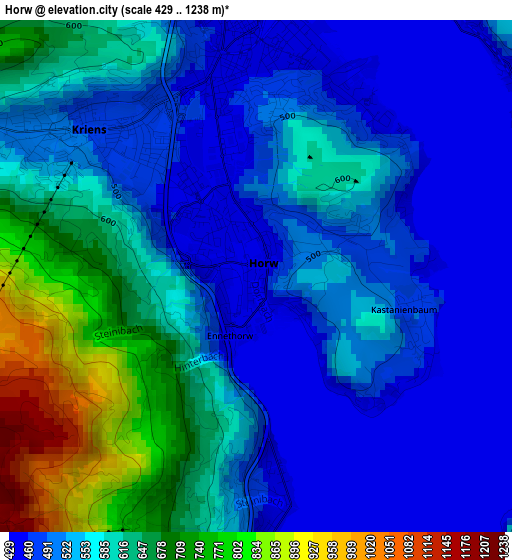
Below is the Elevation map of Horw, which displays elevation range with different colors. Scale of the first map is from 429 to 1238 m (1407 to 4062 ft) with average elevation of 564.4 meters (=1852 ft) [note 1]
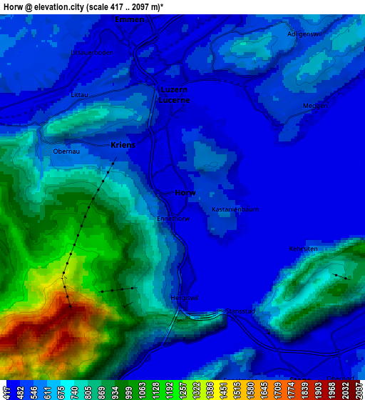
These maps also provides idea of topography and contour of this city, they are displayed at different zoom levels. More info about maps, scale and edge coordinates you can find below images.
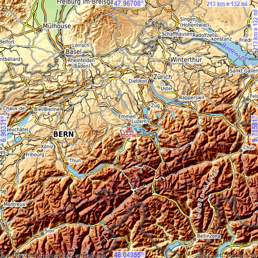
| \ | Map #1 | Map #2 | Topo.Map |
| Scale [m] | 429..1238 m | 417..2097 m | × |
| Scale [ft] | 1407..4062 ft | 1368..6880 ft | × |
| Average | 564.4 m = 1852 ft | 662 m = 2172 ft | × |
| Width | 6.66 km = 4.1 mi | 13.33 km = 8.3 mi | 213.2 km = 132.5 mi |
| Height | 6.66 km = 4.1 mi | 13.33 km = 8.3 mi | 213.2 km = 132.5 mi |
| ↑Max Latitude | 47.046873° | 47.076809° | 47.96708° |
| Latitude at center | 47.01692° | 47.01692° | 47.01692° |
| ↓Min Latitude | 46.98695° | 46.956964° | 46.04955° |
| ← Min Longitude | 8.265615° | 8.221669° | 6.90331° |
| Longitude center | 8.30956° | 8.30956° | 8.30956° |
| →Max Longitude | 8.353505° | 8.397451° | 9.71581° |
Nearby cities:
Cities around Horw sort by population:
• Luzern elevation 437 m
3.7 km,  356°
356°
• Emmen 464 m
7.3 km,  338°
338°
• Kriens 476 m
2.4 km,  310°
310°
• Littau 509 m
5.1 km,  316°
316°
• Ebikon 437 m
7.3 km,  18°
18°
• Stans 453 m
7.8 km,  146°
146°
• Meggen 476 m
6 km,  55°
55°
• Adligenswil 547 m
6.6 km,  36°
36°
• Hergiswil 452 m
3.6 km,  180°
180°
• Alpnach 463 m
8.8 km,  199°
199°
• Stansstad 435 m
4.9 km,  156°
156°
• Ennetbürgen 436 m
8.4 km,  115°
115°
Multilingual:
 En español:
Horw elevación 441 m.
 En France:
Horw élévation 441 m.


Sources and notes:
- [note 1] Map square and city borders are not equal. Map elevation data is calculated only from area inside that square.
- [src 1] Elevation data from geonames database provided with same terms of usage.
- [src 2] The elevation map of Horw is generated using elevation data from NASA's 3 arcsec (90m) resolution SRTM data.
- [src 3] Base (background) map © OpenStreetMap contributors tiles are generated by Geofabrik and OpenTopoMap.
Copyright & License:
This Horw Elevation Map is licensed under CC BY-SA. You may reuse any part from this page, if you give a proper credit by linking to this URL:
 More info on terms of use page.