Emmen elevation
Emmen (Lucerne, Hochdorf District), Switzerland elevation is 464 meters and Emmen elevation in feet is 1522 ft above sea level [src 1]. Emmen is a populated place (feature code) with elevation that is 84 meters (276 ft) smaller than average city elevation in Switzerland.
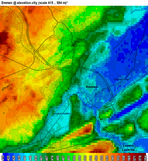
Below is the Elevation map of Emmen, which displays elevation range with different colors. Scale of the first map is from 415 to 584 m (1362 to 1916 ft) with average elevation of 484.3 meters (=1589 ft) [note 1]
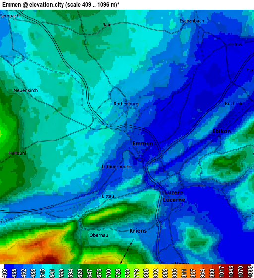
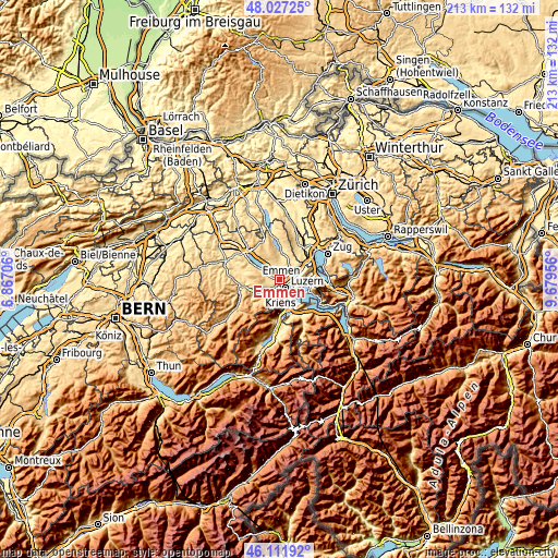
These maps also provides idea of topography and contour of this city, they are displayed at different zoom levels. More info about maps, scale and edge coordinates you can find below images.
| \ | Map #1 | Map #2 | Topo.Map |
| Scale [m] | 415..584 m | 409..1096 m | × |
| Scale [ft] | 1362..1916 ft | 1342..3596 ft | × |
| Average | 484.3 m = 1589 ft | 526.7 m = 1728 ft | × |
| Width | 6.66 km = 4.1 mi | 13.31 km = 8.3 mi | 213 km = 132.4 mi |
| Height | 6.66 km = 4.1 mi | 13.31 km = 8.3 mi | 213 km = 132.4 mi |
| ↑Max Latitude | 47.108108° | 47.13801° | 48.02725° |
| Latitude at center | 47.07819° | 47.07819° | 47.07819° |
| ↓Min Latitude | 47.048255° | 47.018303° | 46.11192° |
| ← Min Longitude | 8.229365° | 8.185419° | 6.86706° |
| Longitude center | 8.27331° | 8.27331° | 8.27331° |
| →Max Longitude | 8.317255° | 8.361201° | 9.67956° |
Nearby cities:
Cities around Emmen sort by population:
• Luzern elevation 437 m
4 km,  140°
140°
• Kriens 476 m
5.3 km,  170°
170°
• Littau 509 m
3.2 km,  194°
194°
• Horw 441 m
7.3 km,  158°
158°
• Ebikon 437 m
5.1 km,  88°
88°
• Meggen 476 m
8.4 km,  114°
114°
• Malters 504 m
8.3 km,  236°
236°
• Neuenkirch 550 m
5.8 km,  294°
294°
• Adligenswil 547 m
6.8 km,  102°
102°
• Buchrain 458 m
5.9 km,  70°
70°
• Inwil 427 m
7.8 km,  47°
47°
• Hildisrieden 681 m
8.8 km,  335°
335°
Multilingual:
 En español:
Emmen elevación 464 m.
 En France:
Emmen élévation 464 m.


Sources and notes:
- [note 1] Map square and city borders are not equal. Map elevation data is calculated only from area inside that square.
- [src 1] Elevation data from geonames database provided with same terms of usage.
- [src 2] The elevation map of Emmen is generated using elevation data from NASA's 3 arcsec (90m) resolution SRTM data.
- [src 3] Base (background) map © OpenStreetMap contributors tiles are generated by Geofabrik and OpenTopoMap.
Copyright & License:
This Emmen Elevation Map is licensed under CC BY-SA. You may reuse any part from this page, if you give a proper credit by linking to this URL:
 More info on terms of use page.