Hergiswil elevation
Hergiswil (Nidwalden), Switzerland elevation is 452 meters and Hergiswil elevation in feet is 1483 ft above sea level [src 1]. Hergiswil is a populated place (feature code) with elevation that is 96 meters (315 ft) smaller than average city elevation in Switzerland.
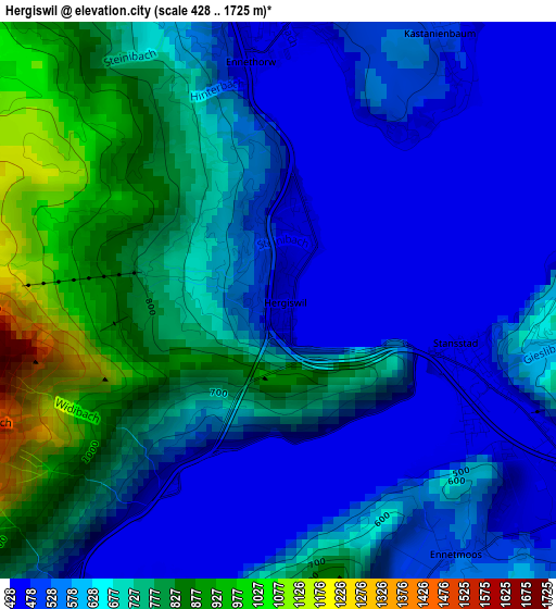
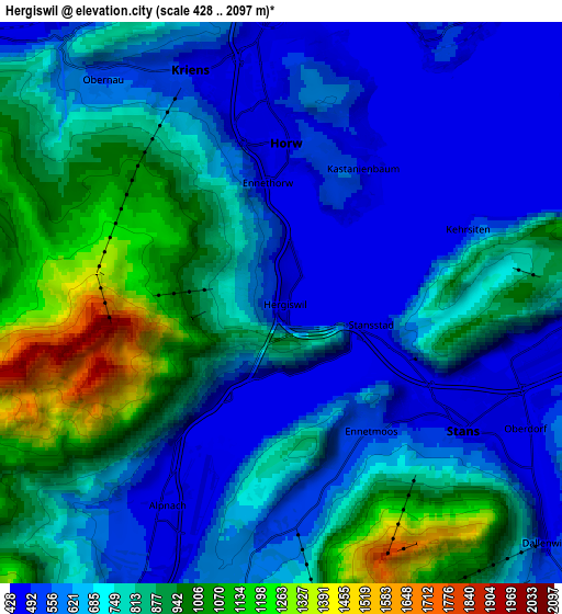
Below is the Elevation map of Hergiswil, which displays elevation range with different colors. Scale of the first map is from 428 to 1725 m (1404 to 5659 ft) with average elevation of 637 meters (=2090 ft) [note 1]
These maps also provides idea of topography and contour of this city, they are displayed at different zoom levels. More info about maps, scale and edge coordinates you can find below images.
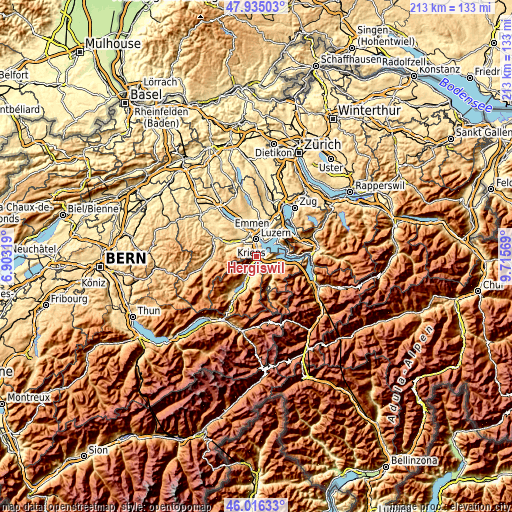
| \ | Map #1 | Map #2 | Topo.Map |
| Scale [m] | 428..1725 m | 428..2097 m | × |
| Scale [ft] | 1404..5659 ft | 1404..6880 ft | × |
| Average | 637 m = 2090 ft | 730.3 m = 2396 ft | × |
| Width | 6.67 km = 4.1 mi | 13.33 km = 8.3 mi | 213.3 km = 132.5 mi |
| Height | 6.67 km = 4.1 mi | 13.33 km = 8.3 mi | 213.3 km = 132.5 mi |
| ↑Max Latitude | 47.014261° | 47.044215° | 47.93503° |
| Latitude at center | 46.98429° | 46.98429° | 46.98429° |
| ↓Min Latitude | 46.954302° | 46.924297° | 46.01633° |
| ← Min Longitude | 8.265495° | 8.221549° | 6.90319° |
| Longitude center | 8.30944° | 8.30944° | 8.30944° |
| →Max Longitude | 8.353385° | 8.397331° | 9.71569° |
Nearby cities:
Cities around Hergiswil sort by population:
• Luzern elevation 437 m
7.4 km,  358°
358°
• Kriens 476 m
5.5 km,  340°
340°
• Littau 509 m
8.1 km,  334°
334°
• Horw 441 m
3.6 km,  0°
0°
• Stans 453 m
5.2 km,  124°
124°
• Meggen 476 m
8.5 km,  35°
35°
• Buochs 441 m
8.7 km,  97°
97°
• Alpnach 463 m
5.5 km,  211°
211°
• Kerns 564 m
9.6 km,  195°
195°
• Stansstad 435 m
2.1 km,  112°
112°
• Ennetbürgen 436 m
7.6 km,  90°
90°
• Dallenwil 565 m
8.9 km,  138°
138°
Multilingual:
 En español:
Hergiswil elevación 452 m.
 En France:
Hergiswil élévation 452 m.
 Auf Deutsch:
Hergiswil NW höhe über dem Meeresspiegel ist 452 m.

Sources and notes:
- [note 1] Map square and city borders are not equal. Map elevation data is calculated only from area inside that square.
- [src 1] Elevation data from geonames database provided with same terms of usage.
- [src 2] The elevation map of Hergiswil is generated using elevation data from NASA's 3 arcsec (90m) resolution SRTM data.
- [src 3] Base (background) map © OpenStreetMap contributors tiles are generated by Geofabrik and OpenTopoMap.
Copyright & License:
This Hergiswil Elevation Map is licensed under CC BY-SA. You may reuse any part from this page, if you give a proper credit by linking to this URL:
 More info on terms of use page.