Hünenberg elevation
Hünenberg (Zug), Switzerland elevation is 449 meters and Hünenberg elevation in feet is 1473 ft above sea level [src 1]. Hünenberg is a populated place (feature code) with elevation that is 99 meters (325 ft) smaller than average city elevation in Switzerland.
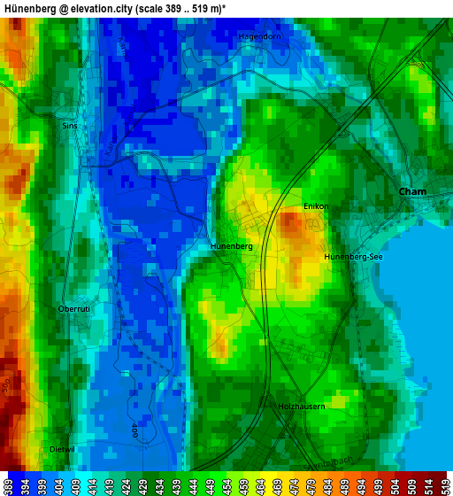
Below is the Elevation map of Hünenberg, which displays elevation range with different colors. Scale of the first map is from 389 to 519 m (1276 to 1703 ft) with average elevation of 427.1 meters (=1401 ft) [note 1]
These maps also provides idea of topography and contour of this city, they are displayed at different zoom levels. More info about maps, scale and edge coordinates you can find below images.
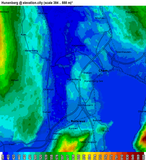
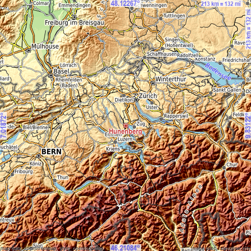
| \ | Map #1 | Map #2 | Topo.Map |
| Scale [m] | 389..519 m | 384..888 m | × |
| Scale [ft] | 1276..1703 ft | 1260..2913 ft | × |
| Average | 427.1 m = 1401 ft | 460.6 m = 1511 ft | × |
| Width | 6.64 km = 4.1 mi | 13.29 km = 8.3 mi | 212.6 km = 132.1 mi |
| Height | 6.64 km = 4.1 mi | 13.29 km = 8.3 mi | 212.6 km = 132.1 mi |
| ↑Max Latitude | 47.205224° | 47.235071° | 48.12267° |
| Latitude at center | 47.17536° | 47.17536° | 47.17536° |
| ↓Min Latitude | 47.145479° | 47.115582° | 46.21084° |
| ← Min Longitude | 8.381025° | 8.337079° | 7.01872° |
| Longitude center | 8.42497° | 8.42497° | 8.42497° |
| →Max Longitude | 8.468915° | 8.512861° | 9.83122° |
Nearby cities:
Cities around Hünenberg sort by population:
• Zug elevation 424 m
7 km,  92°
92°
• Cham 424 m
3 km,  75°
75°
• Rotkreuz 427 m
3.6 km,  172°
172°
• Steinhausen 425 m
5.1 km,  64°
64°
• Root 426 m
7.3 km,  201°
201°
• Sins 425 m
3.1 km,  309°
309°
• Ballwil 502 m
8.1 km,  252°
252°
• Inwil 427 m
8 km,  225°
225°
• Auw 485 m
6 km, 311°
• Oberrüti 415 m
2.5 km, 247°
• Meierskappel 503 m
5.8 km, 166°
• Knonau 431 m
6 km,  27°
27°
Multilingual:
 En español:
Hünenberg elevación 449 m.
 En France:
Hünenberg élévation 449 m.
 Auf Deutsch:
Hünenberg ZG höhe über dem Meeresspiegel ist 449 m.

Sources and notes:
- [note 1] Map square and city borders are not equal. Map elevation data is calculated only from area inside that square.
- [src 1] Elevation data from geonames database provided with same terms of usage.
- [src 2] The elevation map of Hünenberg is generated using elevation data from NASA's 3 arcsec (90m) resolution SRTM data.
- [src 3] Base (background) map © OpenStreetMap contributors tiles are generated by Geofabrik and OpenTopoMap.
Copyright & License:
This Hünenberg Elevation Map is licensed under CC BY-SA. You may reuse any part from this page, if you give a proper credit by linking to this URL:
 More info on terms of use page.