Jona elevation
Jona (Saint Gallen, Wahlkreis See-Gaster), Switzerland elevation is 424 meters and Jona elevation in feet is 1391 ft above sea level [src 1]. Jona is a populated place (feature code) with elevation that is 124 meters (407 ft) smaller than average city elevation in Switzerland.
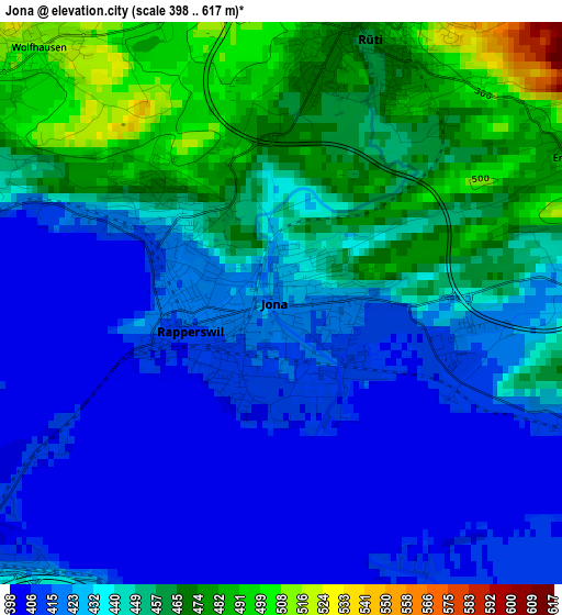
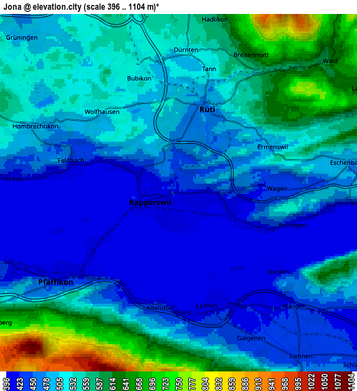
Below is the Elevation map of Jona, which displays elevation range with different colors. Scale of the first map is from 398 to 617 m (1306 to 2024 ft) with average elevation of 438.7 meters (=1439 ft) [note 1]
These maps also provides idea of topography and contour of this city, they are displayed at different zoom levels. More info about maps, scale and edge coordinates you can find below images.
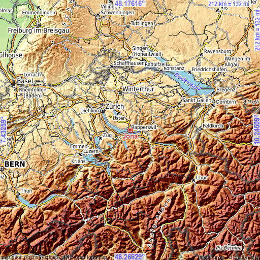
| \ | Map #1 | Map #2 | Topo.Map |
| Scale [m] | 398..617 m | 396..1104 m | × |
| Scale [ft] | 1306..2024 ft | 1299..3622 ft | × |
| Average | 438.7 m = 1439 ft | 510.2 m = 1674 ft | × |
| Width | 6.64 km = 4.1 mi | 13.27 km = 8.2 mi | 212.4 km = 132 mi |
| Height | 6.64 km = 4.1 mi | 13.27 km = 8.2 mi | 212.3 km = 131.9 mi |
| ↑Max Latitude | 47.259663° | 47.289479° | 48.17616° |
| Latitude at center | 47.22983° | 47.22983° | 47.22983° |
| ↓Min Latitude | 47.19998° | 47.170113° | 46.26629° |
| ← Min Longitude | 8.794895° | 8.750949° | 7.43259° |
| Longitude center | 8.83884° | 8.83884° | 8.83884° |
| →Max Longitude | 8.882785° | 8.926731° | 10.24509° |
Nearby cities:
Cities around Jona sort by population:
• Rapperswil elevation 408 m
1.3 km,  249°
249°
• Rüti 470 m
3.2 km,  23°
23°
• Lachen 413 m
4.3 km,  165°
165°
• Altendorf 414 m
4.4 km,  180°
180°
• Rüti / Dorfzentrum, Südl. Teil 469 m
3 km,  26°
26°
• Rüti / Westlicher Dorfteil 475 m
2.9 km,  9°
9°
• Tann 507 m
4.4 km, 11°
• Rüti / Oberdorf 540 m
3.8 km, 31°
• Wolfhausen 505 m
4.2 km,  314°
314°
• Tann / Tann (Dorfkern) 503 m
4 km, 12°
• Bubikon 523 m
4.4 km,  339°
339°
• Dürnten 514 m
5.4 km,  2°
2°
Multilingual:
 En español:
Jona elevación 424 m.
 En France:
Jona élévation 424 m.


Sources and notes:
- [note 1] Map square and city borders are not equal. Map elevation data is calculated only from area inside that square.
- [src 1] Elevation data from geonames database provided with same terms of usage.
- [src 2] The elevation map of Jona is generated using elevation data from NASA's 3 arcsec (90m) resolution SRTM data.
- [src 3] Base (background) map © OpenStreetMap contributors tiles are generated by Geofabrik and OpenTopoMap.
Copyright & License:
This Jona Elevation Map is licensed under CC BY-SA. You may reuse any part from this page, if you give a proper credit by linking to this URL:
 More info on terms of use page.