Muotathal elevation
Muotathal (Schwyz, Bezirk Schwyz), Switzerland elevation is 640 meters and Muotathal elevation in feet is 2100 ft above sea level [src 1]. Muotathal is a populated place (feature code) with elevation that is 92 meters (302 ft) bigger than average city elevation in Switzerland.
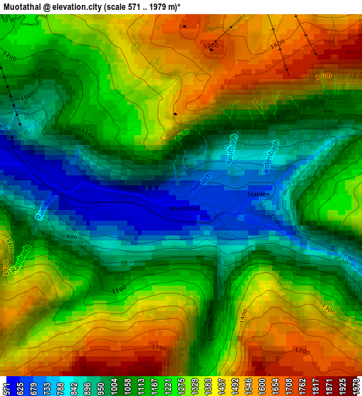
Below is the Elevation map of Muotathal, which displays elevation range with different colors. Scale of the first map is from 571 to 1979 m (1873 to 6493 ft) with average elevation of 1199.3 meters (=3935 ft) [note 1]
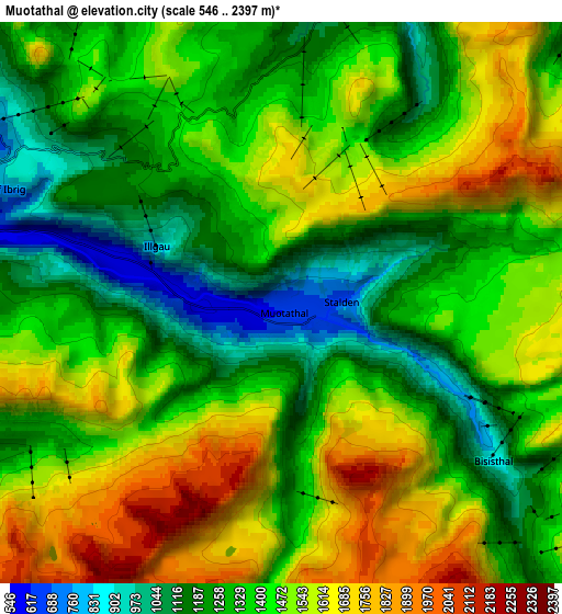
These maps also provides idea of topography and contour of this city, they are displayed at different zoom levels. More info about maps, scale and edge coordinates you can find below images.
| \ | Map #1 | Map #2 | Topo.Map |
| Scale [m] | 571..1979 m | 546..2397 m | × |
| Scale [ft] | 1873..6493 ft | 1791..7864 ft | × |
| Average | 1199.3 m = 3935 ft | 1413.1 m = 4636 ft | × |
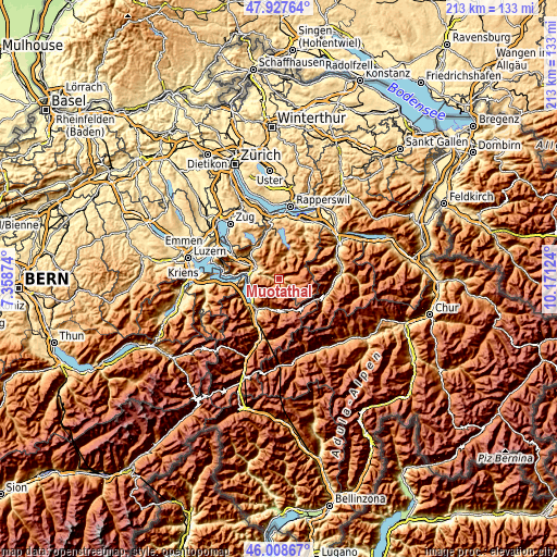
| Width | 6.67 km = 4.1 mi | 13.34 km = 8.3 mi | 213.4 km = 132.6 mi |
| Height | 6.67 km = 4.1 mi | 13.34 km = 8.3 mi | 213.4 km = 132.6 mi |
| ↑Max Latitude | 47.006735° | 47.036694° | 47.92764° |
| Latitude at center | 46.97676° | 46.97676° | 46.97676° |
| ↓Min Latitude | 46.946768° | 46.916759° | 46.00867° |
| ← Min Longitude | 8.721045° | 8.677099° | 7.35874° |
| Longitude center | 8.76499° | 8.76499° | 8.76499° |
| →Max Longitude | 8.808935° | 8.852881° | 10.17124° |
Nearby cities:
Cities around Muotathal sort by population:
• Schwyz elevation 521 m
9.7 km,  300°
300°
• Altdorf 465 m
14.1 km,  220°
220°
• Ingenbohl 438 m
11.6 km,  282°
282°
• Schattdorf 483 m
14.9 km,  214°
214°
• Bürglen 571 m
13.5 km, 213°
• Ibach 454 m
9.8 km,  292°
292°
• Steinen 477 m
14.1 km,  305°
305°
• Unteriberg 922 m
10 km,  17°
17°
• Flüelen 431 m
13.4 km,  233°
233°
• Sattel 811 m
15.3 km,  320°
320°
• Seedorf 446 m
15.5 km, 227°
• Bauen 467 m
14.9 km,  252°
252°
Multilingual:
 En español:
Muotathal elevación 640 m.
 En France:
Muotathal élévation 640 m.
 Auf Deutsch:
Muotathal höhe über dem Meeresspiegel ist 640 m.

Sources and notes:
- [note 1] Map square and city borders are not equal. Map elevation data is calculated only from area inside that square.
- [src 1] Elevation data from geonames database provided with same terms of usage.
- [src 2] The elevation map of Muotathal is generated using elevation data from NASA's 3 arcsec (90m) resolution SRTM data.
- [src 3] Base (background) map © OpenStreetMap contributors tiles are generated by Geofabrik and OpenTopoMap.
Copyright & License:
This Muotathal Elevation Map is licensed under CC BY-SA. You may reuse any part from this page, if you give a proper credit by linking to this URL:
 More info on terms of use page.