Sargans elevation
Sargans (Saint Gallen, Wahlkreis Sarganserland), Switzerland elevation is 487 meters and Sargans elevation in feet is 1598 ft above sea level [src 1]. Sargans is a seat of a second-order administrative division (feature code) with elevation that is 61 meters (200 ft) smaller than average city elevation in Switzerland.
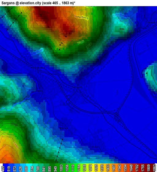
Below is the Elevation map of Sargans, which displays elevation range with different colors. Scale of the first map is from 465 to 1863 m (1526 to 6112 ft) with average elevation of 704.9 meters (=2313 ft) [note 1]
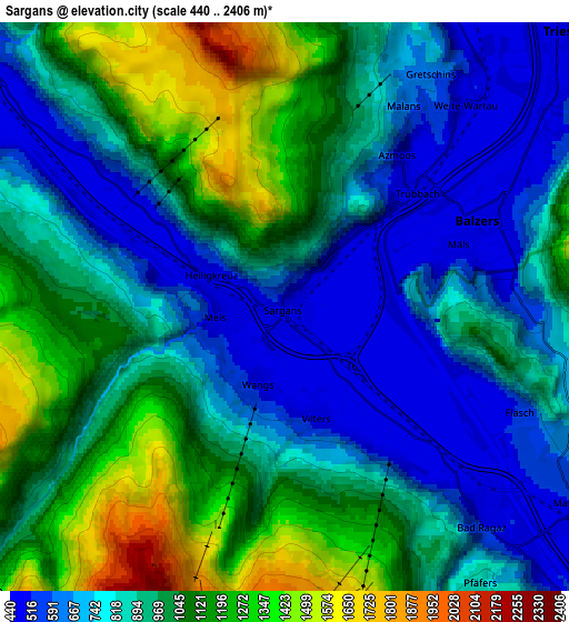
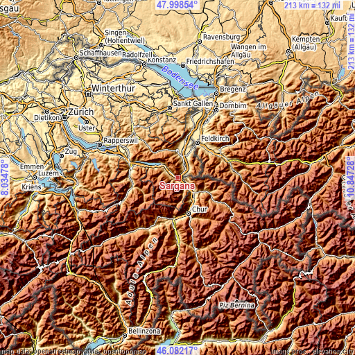
These maps also provides idea of topography and contour of this city, they are displayed at different zoom levels. More info about maps, scale and edge coordinates you can find below images.
| \ | Map #1 | Map #2 | Topo.Map |
| Scale [m] | 465..1863 m | 440..2406 m | × |
| Scale [ft] | 1526..6112 ft | 1444..7894 ft | × |
| Average | 704.9 m = 2313 ft | 926.4 m = 3039 ft | × |
| Width | 6.66 km = 4.1 mi | 13.32 km = 8.3 mi | 213.1 km = 132.4 mi |
| Height | 6.66 km = 4.1 mi | 13.32 km = 8.3 mi | 213.1 km = 132.4 mi |
| ↑Max Latitude | 47.078895° | 47.108813° | 47.99854° |
| Latitude at center | 47.04896° | 47.04896° | 47.04896° |
| ↓Min Latitude | 47.019008° | 46.98904° | 46.08217° |
| ← Min Longitude | 9.397085° | 9.353139° | 8.03478° |
| Longitude center | 9.44103° | 9.44103° | 9.44103° |
| →Max Longitude | 9.484975° | 9.528921° | 10.84728° |
Nearby cities:
Cities around Sargans sort by population:
• Buchs elevation 451 m
13.5 km,  11°
11°
• Igis 567 m
15.2 km,  139°
139°
• Grabs 474 m
14.8 km,  0°
0°
• Bad Ragaz 512 m
6.7 km, 135°
• Walenstadt 426 m
12.9 km,  310°
310°
• Flums 456 m
8.7 km,  301°
301°
• Sevelen 463 m
8.8 km,  22°
22°
• Zizers 563 m
15.7 km, 143°
• Maienfeld 506 m
8.4 km,  125°
125°
• Untervaz 573 m
15.2 km,  152°
152°
• Malans 556 m
12.7 km, 126°
• Landquart 532 m
14.6 km, 139°
Multilingual:
 En español:
Sargans elevación 487 m.
 En France:
Sargans élévation 487 m.


Sources and notes:
- [note 1] Map square and city borders are not equal. Map elevation data is calculated only from area inside that square.
- [src 1] Elevation data from geonames database provided with same terms of usage.
- [src 2] The elevation map of Sargans is generated using elevation data from NASA's 3 arcsec (90m) resolution SRTM data.
- [src 3] Base (background) map © OpenStreetMap contributors tiles are generated by Geofabrik and OpenTopoMap.
Copyright & License:
This Sargans Elevation Map is licensed under CC BY-SA. You may reuse any part from this page, if you give a proper credit by linking to this URL:
 More info on terms of use page.