Sitten elevation
Sitten (Valais, Sion District), Switzerland elevation is 487 meters and Sitten elevation in feet is 1598 ft above sea level [src 1]. Sitten is a seat of a first-order administrative division (feature code) with elevation that is 61 meters (200 ft) smaller than average city elevation in Switzerland.
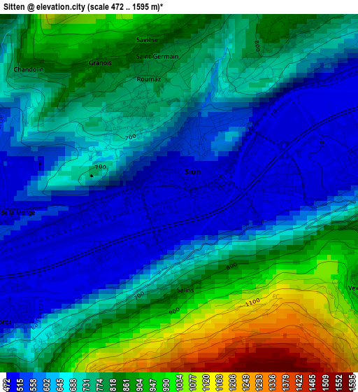
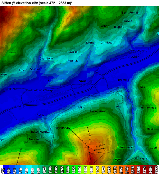
Below is the Elevation map of Sitten, which displays elevation range with different colors. Scale of the first map is from 472 to 1595 m (1549 to 5233 ft) with average elevation of 742.8 meters (=2437 ft) [note 1]
These maps also provides idea of topography and contour of this city, they are displayed at different zoom levels. More info about maps, scale and edge coordinates you can find below images.
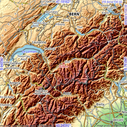
| \ | Map #1 | Map #2 | Topo.Map |
| Scale [m] | 472..1595 m | 472..2533 m | × |
| Scale [ft] | 1549..5233 ft | 1549..8310 ft | × |
| Average | 742.8 m = 2437 ft | 1043 m = 3422 ft | × |
| Width | 6.76 km = 4.2 mi | 13.52 km = 8.4 mi | 216.3 km = 134.4 mi |
| Height | 6.76 km = 4.2 mi | 13.52 km = 8.4 mi | 216.3 km = 134.4 mi |
| ↑Max Latitude | 46.257783° | 46.288159° | 47.19162° |
| Latitude at center | 46.22739° | 46.22739° | 46.22739° |
| ↓Min Latitude | 46.19698° | 46.166554° | 45.24592° |
| ← Min Longitude | 7.311645° | 7.267699° | 5.94934° |
| Longitude center | 7.35559° | 7.35559° | 7.35559° |
| →Max Longitude | 7.399535° | 7.443481° | 8.76184° |
Nearby cities:
Cities around Sitten sort by population:
• Conthey elevation 491 m
4.1 km,  264°
264°
• Savièse 840 m
2.8 km,  343°
343°
• Basse-Nendaz 1004 m
5.3 km,  218°
218°
• Vétroz 482 m
6 km, 263°
• Lens 1177 m
9.5 km,  49°
49°
• Ayent 1057 m
7.4 km,  34°
34°
• Grimisuat 863 m
4.2 km, 31°
• Ardon 487 m
7.6 km,  254°
254°
• Grône 503 m
8.5 km,  70°
70°
• Saint-Léonard 506 m
5.4 km,  60°
60°
• Vex 929 m
3.7 km,  116°
116°
• Hérémence 1225 m
6.5 km,  144°
144°
Multilingual:
 En español:
Sion elevación 487 m.
 En France:
Sion élévation 487 m.


Sources and notes:
- [note 1] Map square and city borders are not equal. Map elevation data is calculated only from area inside that square.
- [src 1] Elevation data from geonames database provided with same terms of usage.
- [src 2] The elevation map of Sitten is generated using elevation data from NASA's 3 arcsec (90m) resolution SRTM data.
- [src 3] Base (background) map © OpenStreetMap contributors tiles are generated by Geofabrik and OpenTopoMap.
Copyright & License:
This Sitten Elevation Map is licensed under CC BY-SA. You may reuse any part from this page, if you give a proper credit by linking to this URL:
 More info on terms of use page.