Spreitenbach elevation
Spreitenbach (Aargau, Bezirk Baden), Switzerland elevation is 403 meters and Spreitenbach elevation in feet is 1322 ft above sea level [src 1]. Spreitenbach is a populated place (feature code) with elevation that is 145 meters (476 ft) smaller than average city elevation in Switzerland.
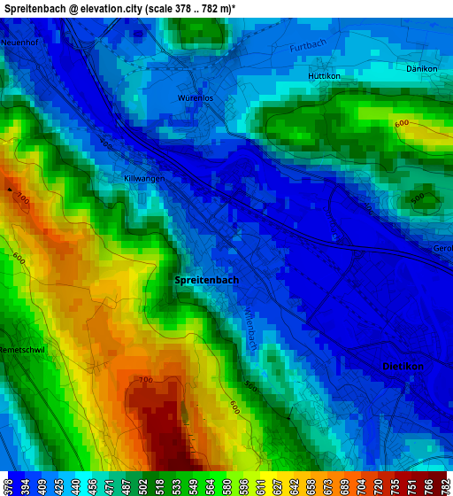
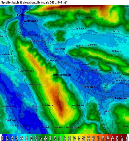
Below is the Elevation map of Spreitenbach, which displays elevation range with different colors. Scale of the first map is from 378 to 782 m (1240 to 2566 ft) with average elevation of 486.8 meters (=1597 ft) [note 1]
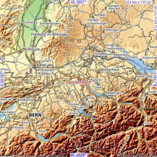
These maps also provides idea of topography and contour of this city, they are displayed at different zoom levels. More info about maps, scale and edge coordinates you can find below images.
| \ | Map #1 | Map #2 | Topo.Map |
| Scale [m] | 378..782 m | 348..846 m | × |
| Scale [ft] | 1240..2566 ft | 1142..2776 ft | × |
| Average | 486.8 m = 1597 ft | 481.9 m = 1581 ft | × |
| Width | 6.61 km = 4.1 mi | 13.22 km = 8.2 mi | 211.6 km = 131.5 mi |
| Height | 6.61 km = 4.1 mi | 13.22 km = 8.2 mi | 211.6 km = 131.5 mi |
| ↑Max Latitude | 47.452574° | 47.482282° | 48.3657° |
| Latitude at center | 47.42285° | 47.42285° | 47.42285° |
| ↓Min Latitude | 47.393109° | 47.363351° | 46.4628° |
| ← Min Longitude | 8.323975° | 8.280029° | 6.96167° |
| Longitude center | 8.36792° | 8.36792° | 8.36792° |
| →Max Longitude | 8.411865° | 8.455811° | 9.77417° |
Nearby cities:
Cities around Spreitenbach sort by population:
• Dietikon elevation 397 m
3.4 km,  134°
134°
• Neuenhof 398 m
4.3 km,  314°
314°
• Würenlos 407 m
2.2 km,  349°
349°
• Dietikon / Oberdorf 408 m
3.2 km,  141°
141°
• Oberrohrdorf 519 m
3.7 km,  262°
262°
• Geroldswil 403 m
3.2 km,  91°
91°
• Dietikon / Vorstadt 387 m
2.7 km, 126°
• Dietikon / Almend 400 m
2.7 km, 138°
• Dietikon / Kreuzacker 407 m
3.6 km, 136°
• Killwangen 411 m
1.6 km, 309°
• Dänikon 430 m
3.9 km,  47°
47°
• Dietikon / Guggenbühl 389 m
3.9 km, 129°
Multilingual:
 En español:
Spreitenbach elevación 403 m.
 En France:
Spreitenbach élévation 403 m.
 Auf Deutsch:
Spreitenbach höhe über dem Meeresspiegel ist 403 m.

Sources and notes:
- [note 1] Map square and city borders are not equal. Map elevation data is calculated only from area inside that square.
- [src 1] Elevation data from geonames database provided with same terms of usage.
- [src 2] The elevation map of Spreitenbach is generated using elevation data from NASA's 3 arcsec (90m) resolution SRTM data.
- [src 3] Base (background) map © OpenStreetMap contributors tiles are generated by Geofabrik and OpenTopoMap.
Copyright & License:
This Spreitenbach Elevation Map is licensed under CC BY-SA. You may reuse any part from this page, if you give a proper credit by linking to this URL:
 More info on terms of use page.