Wohlen elevation
Wohlen (Aargau, Bezirk Bremgarten), Switzerland elevation is 418 meters and Wohlen elevation in feet is 1371 ft above sea level [src 1]. Wohlen is a populated place (feature code) with elevation that is 130 meters (427 ft) smaller than average city elevation in Switzerland.
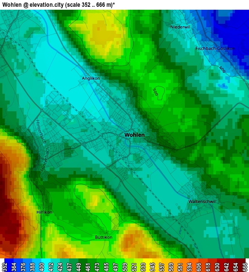
Below is the Elevation map of Wohlen, which displays elevation range with different colors. Scale of the first map is from 352 to 666 m (1155 to 2185 ft) with average elevation of 457 meters (=1499 ft) [note 1]
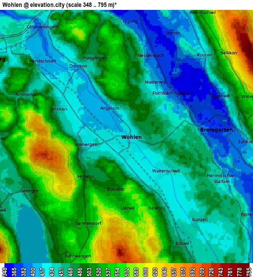
These maps also provides idea of topography and contour of this city, they are displayed at different zoom levels. More info about maps, scale and edge coordinates you can find below images.
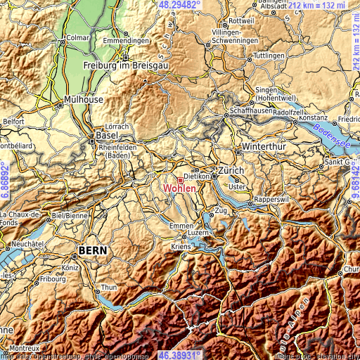
| \ | Map #1 | Map #2 | Topo.Map |
| Scale [m] | 352..666 m | 348..795 m | × |
| Scale [ft] | 1155..2185 ft | 1142..2608 ft | × |
| Average | 457 m = 1499 ft | 482.1 m = 1582 ft | × |
| Width | 6.62 km = 4.1 mi | 13.24 km = 8.2 mi | 211.9 km = 131.7 mi |
| Height | 6.62 km = 4.1 mi | 13.24 km = 8.2 mi | 211.9 km = 131.7 mi |
| ↑Max Latitude | 47.380425° | 47.410173° | 48.29482° |
| Latitude at center | 47.35066° | 47.35066° | 47.35066° |
| ↓Min Latitude | 47.320878° | 47.29108° | 46.38931° |
| ← Min Longitude | 8.231225° | 8.187279° | 6.86892° |
| Longitude center | 8.27517° | 8.27517° | 8.27517° |
| →Max Longitude | 8.319115° | 8.363061° | 9.68142° |
Nearby cities:
Cities around Wohlen sort by population:
• Bremgarten elevation 389 m
5 km,  89°
89°
• Villmergen 422 m
2.1 km,  268°
268°
• Seengen 474 m
5.9 km,  240°
240°
• Dottikon 416 m
4.6 km,  324°
324°
• Meisterschwanden 503 m
7.1 km,  209°
209°
• Sarmenstorf 535 m
4.8 km,  203°
203°
• Waltenschwil 431 m
2.6 km,  138°
138°
• Hägglingen 469 m
4.5 km,  338°
338°
• Künten 427 m
5.9 km,  44°
44°
• Egliswil 453 m
6.8 km, 268°
• Besenbüren 468 m
6.7 km,  127°
127°
• Bünzen 439 m
5.8 km, 141°
Multilingual:
 En español:
Wohlen elevación 418 m.
 En France:
Wohlen élévation 418 m.
 Auf Deutsch:
Wohlen AG höhe über dem Meeresspiegel ist 418 m.

Sources and notes:
- [note 1] Map square and city borders are not equal. Map elevation data is calculated only from area inside that square.
- [src 1] Elevation data from geonames database provided with same terms of usage.
- [src 2] The elevation map of Wohlen is generated using elevation data from NASA's 3 arcsec (90m) resolution SRTM data.
- [src 3] Base (background) map © OpenStreetMap contributors tiles are generated by Geofabrik and OpenTopoMap.
Copyright & License:
This Wohlen Elevation Map is licensed under CC BY-SA. You may reuse any part from this page, if you give a proper credit by linking to this URL:
 More info on terms of use page.