Bremgarten elevation
Bremgarten (Aargau, Bezirk Bremgarten), Switzerland elevation is 389 meters and Bremgarten elevation in feet is 1276 ft above sea level [src 1]. Bremgarten is a seat of a second-order administrative division (feature code) with elevation that is 159 meters (522 ft) smaller than average city elevation in Switzerland.
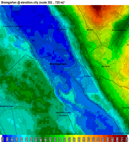
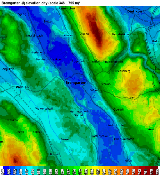
Below is the Elevation map of Bremgarten, which displays elevation range with different colors. Scale of the first map is from 352 to 725 m (1155 to 2379 ft) with average elevation of 450.5 meters (=1478 ft) [note 1]
These maps also provides idea of topography and contour of this city, they are displayed at different zoom levels. More info about maps, scale and edge coordinates you can find below images.
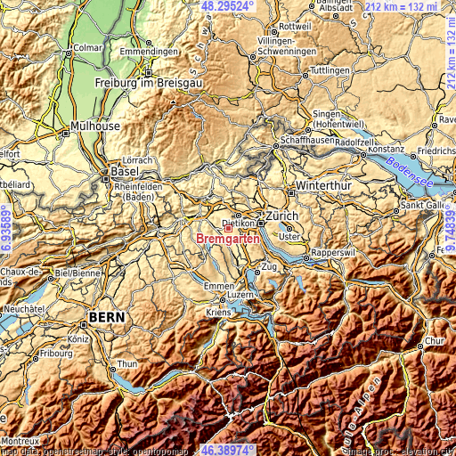
| \ | Map #1 | Map #2 | Topo.Map |
| Scale [m] | 352..725 m | 348..795 m | × |
| Scale [ft] | 1155..2379 ft | 1142..2608 ft | × |
| Average | 450.5 m = 1478 ft | 484.7 m = 1590 ft | × |
| Width | 6.62 km = 4.1 mi | 13.24 km = 8.2 mi | 211.9 km = 131.7 mi |
| Height | 6.62 km = 4.1 mi | 13.24 km = 8.2 mi | 211.9 km = 131.7 mi |
| ↑Max Latitude | 47.380855° | 47.410603° | 48.29524° |
| Latitude at center | 47.35109° | 47.35109° | 47.35109° |
| ↓Min Latitude | 47.321308° | 47.29151° | 46.38974° |
| ← Min Longitude | 8.298195° | 8.254249° | 6.93589° |
| Longitude center | 8.34214° | 8.34214° | 8.34214° |
| →Max Longitude | 8.386085° | 8.430031° | 9.74839° |
Nearby cities:
Cities around Bremgarten sort by population:
• Wohlen elevation 418 m
5 km,  269°
269°
• Berikon 547 m
2.3 km,  88°
88°
• Dietikon / Oberdorf 408 m
6.8 km,  35°
35°
• Rudolfstetten 483 m
3.7 km,  52°
52°
• Waltenschwil 431 m
3.9 km,  239°
239°
• Dietikon / Almend 400 m
7 km,  32°
32°
• Oberlunkhofen 448 m
5.7 km,  138°
138°
• Künten 427 m
4.3 km,  348°
348°
• Unterlunkhofen 395 m
4.4 km, 138°
• Bünzen 439 m
4.8 km,  196°
196°
• Rottenschwil 391 m
4.4 km,  160°
160°
• Besenbüren 468 m
4.1 km,  176°
176°
Multilingual:
 En español:
Bremgarten elevación 389 m.
 En France:
Bremgarten élévation 389 m.
 Auf Deutsch:
Bremgarten höhe über dem Meeresspiegel ist 389 m.

Sources and notes:
- [note 1] Map square and city borders are not equal. Map elevation data is calculated only from area inside that square.
- [src 1] Elevation data from geonames database provided with same terms of usage.
- [src 2] The elevation map of Bremgarten is generated using elevation data from NASA's 3 arcsec (90m) resolution SRTM data.
- [src 3] Base (background) map © OpenStreetMap contributors tiles are generated by Geofabrik and OpenTopoMap.
Copyright & License:
This Bremgarten Elevation Map is licensed under CC BY-SA. You may reuse any part from this page, if you give a proper credit by linking to this URL:
 More info on terms of use page.