Mbandaka elevation
Mbandaka (Équateur, Ville de Mbandaka), Democratic Republic of the Congo elevation is 315 meters and Mbandaka elevation in feet is 1033 ft above sea level [src 1]. Mbandaka is a seat of a first-order administrative division (feature code) with elevation that is 341 meters (1119 ft) smaller than average city elevation in Democratic Republic of the Congo.
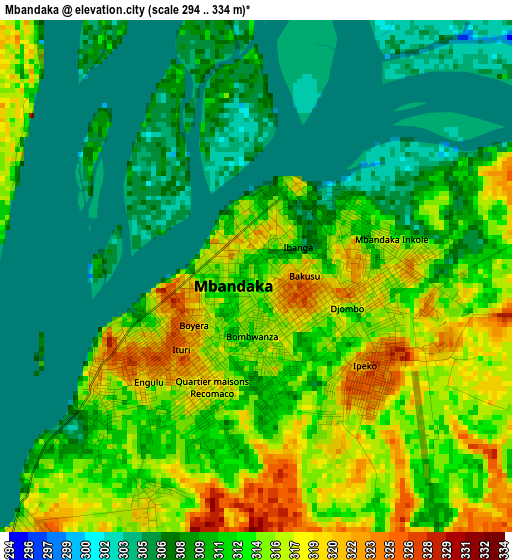
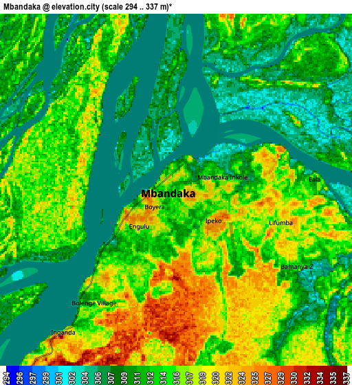
Below is the Elevation map of Mbandaka, which displays elevation range with different colors. Scale of the first map is from 294 to 334 m (965 to 1096 ft) with average elevation of 311 meters (=1020 ft) [note 1]
These maps also provides idea of topography and contour of this city, they are displayed at different zoom levels. More info about maps, scale and edge coordinates you can find below images.
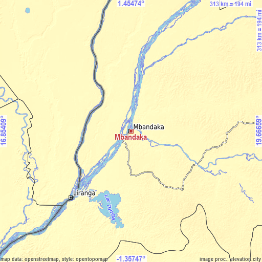
| \ | Map #1 | Map #2 | Topo.Map |
| Scale [m] | 294..334 m | 294..337 m | × |
| Scale [ft] | 965..1096 ft | 965..1106 ft | × |
| Average | 311 m = 1020 ft | 312.2 m = 1024 ft | × |
| Width | 9.77 km = 6.1 mi | 19.55 km = 12.1 mi | 312.7 km = 194.3 mi |
| Height | 9.77 km = 6.1 mi | 19.55 km = 12.1 mi | 312.7 km = 194.3 mi |
| ↑Max Latitude | 0.092595° | 0.136541° | 1.45474° |
| Latitude at center | 0.04865° | 0.04865° | 0.04865° |
| ↓Min Latitude | 0.004705° | -0.039241° | -1.35747° |
| ← Min Longitude | 18.216395° | 18.172449° | 16.85409° |
| Longitude center | 18.26034° | 18.26034° | 18.26034° |
| →Max Longitude | 18.304285° | 18.348231° | 19.66659° |
Nearby cities:
Cities around Mbandaka sort by population:
• Bandundu elevation 322 m
386.8 km,  194°
194°
• Gemena 420 m
394.3 km,  25°
25°
• Lisala 418 m
430.9 km,  57°
57°
• Nioki 326 m
314.3 km, 191°
• Inongo 318 m
219.7 km,  179°
179°
• Mushie 325 m
371.9 km,  203°
203°
• Boende 349 m
293.6 km,  97°
97°
• Bolobo 321 m
333.2 km,  222°
222°
• Libenge 358 m
403 km,  5°
5°
• Lukolela 316 m
172 km, 224°
• Bongandanga 389 m
352.2 km, 62°
Multilingual:
 En español:
Mbandaka elevación 315 m.
 En France:
Mbandaka élévation 315 m.
 Auf Deutsch:
Mbandaka höhe über dem Meeresspiegel ist 315 m.

Sources and notes:
- [note 1] Map square and city borders are not equal. Map elevation data is calculated only from area inside that square.
- [src 1] Elevation data from geonames database provided with same terms of usage.
- [src 2] The elevation map of Mbandaka is generated using elevation data from NASA's 3 arcsec (90m) resolution SRTM data.
- [src 3] Base (background) map © OpenStreetMap contributors tiles are generated by Geofabrik and OpenTopoMap.
Copyright & License:
This Mbandaka Elevation Map is licensed under CC BY-SA. You may reuse any part from this page, if you give a proper credit by linking to this URL:
 More info on terms of use page.