Larkspur elevation
Larkspur (Alberta), Canada elevation is 711 meters and Larkspur elevation in feet is 2333 ft above sea level [src 1]. Larkspur is a section of populated place (feature code) with elevation that is 453 meters (1486 ft) bigger than average city elevation in Canada.
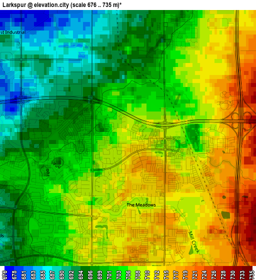
Below is the Elevation map of Larkspur, which displays elevation range with different colors. Scale of the first map is from 676 to 735 m (2218 to 2411 ft) with average elevation of 704.6 meters (=2312 ft) [note 1]
These maps also provides idea of topography and contour of this city, they are displayed at different zoom levels. More info about maps, scale and edge coordinates you can find below images.
| \ | Map #1 | Map #2 | Topo.Map |
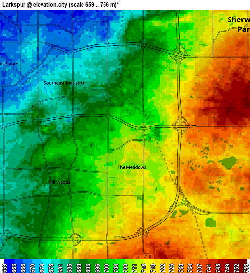
| Scale [m] | 676..735 m | 659..756 m | × |
| Scale [ft] | 2218..2411 ft | 2162..2480 ft | × |
| Average | 704.6 m = 2312 ft | 704.4 m = 2311 ft | × |
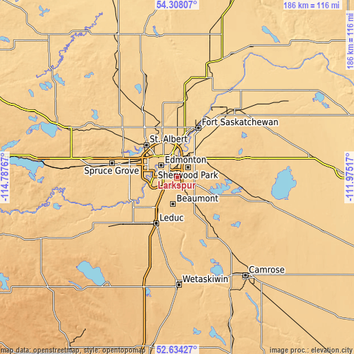
| Width | 5.82 km = 3.6 mi | 11.63 km = 7.2 mi | 186.1 km = 115.6 mi |
| Height | 5.82 km = 3.6 mi | 11.63 km = 7.2 mi | 186.1 km = 115.6 mi |
| ↑Max Latitude | 53.505564° | 53.531692° | 54.30807° |
| Latitude at center | 53.47942° | 53.47942° | 53.47942° |
| ↓Min Latitude | 53.45326° | 53.427083° | 52.63427° |
| ← Min Longitude | -113.425365° | -113.469311° | -114.78767° |
| Longitude center | -113.38142° | -113.38142° | -113.38142° |
| →Max Longitude | -113.337475° | -113.293529° | -111.97517° |
Nearby cities:
Cities around Larkspur sort by population:
• Edmonton elevation 610 m
9.8 km,  323°
323°
• St. Albert 663 m
24 km, 315°
• Sherwood Park 722 m
5.9 km,  44°
44°
• Leduc 728 m
26.2 km,  205°
205°
• Silver Berry 713 m
2.4 km,  180°
180°
• Wild Rose 714 m
1 km, 179°
• Beaumont 716 m
14.6 km,  189°
189°
• Tamarack 710 m
2.1 km,  142°
142°
• Rideau Park 670 m
8.2 km,  269°
269°
• Maple Ridge 703 m
2.8 km,  26°
26°
• Laurel 721 m
3.6 km, 180°
• Mill Woods Town Centre 690 m
4 km,  229°
229°
Multilingual:
 En español:
Larkspur elevación 711 m.
 En France:
Larkspur élévation 711 m.
 Auf Deutsch:
Larkspur höhe über dem Meeresspiegel ist 711 m.

Sources and notes:
- [note 1] Map square and city borders are not equal. Map elevation data is calculated only from area inside that square.
- [src 1] Elevation data from geonames database provided with same terms of usage.
- [src 2] The elevation map of Larkspur is generated using elevation data from NASA's 3 arcsec (90m) resolution SRTM data.
- [src 3] Base (background) map © OpenStreetMap contributors tiles are generated by Geofabrik and OpenTopoMap.
Copyright & License:
This Larkspur Elevation Map is licensed under CC BY-SA. You may reuse any part from this page, if you give a proper credit by linking to this URL:
 More info on terms of use page.