Petawawa elevation
Petawawa (Ontario), Canada elevation is 143 meters and Petawawa elevation in feet is 469 ft above sea level [src 1]. Petawawa is a populated place (feature code) with elevation that is 115 meters (377 ft) smaller than average city elevation in Canada.
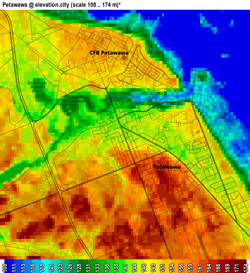
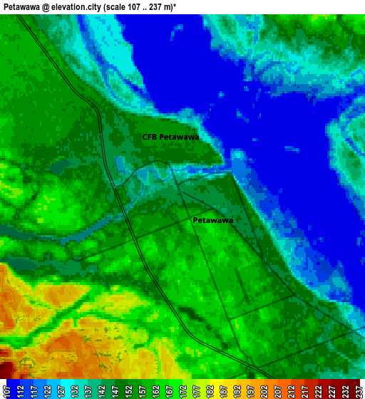
Below is the Elevation map of Petawawa, which displays elevation range with different colors. Scale of the first map is from 108 to 174 m (354 to 571 ft) with average elevation of 143.8 meters (=472 ft) [note 1]
These maps also provides idea of topography and contour of this city, they are displayed at different zoom levels. More info about maps, scale and edge coordinates you can find below images.
| \ | Map #1 | Map #2 | Topo.Map |
| Scale [m] | 108..174 m | 107..237 m | × |
| Scale [ft] | 354..571 ft | 351..778 ft | × |
| Average | 143.8 m = 472 ft | 144.6 m = 474 ft | × |
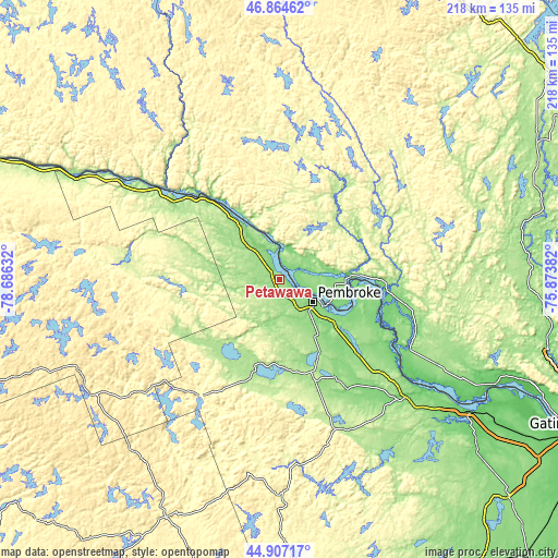
| Width | 6.8 km = 4.2 mi | 13.6 km = 8.5 mi | 217.6 km = 135.2 mi |
| Height | 6.8 km = 4.2 mi | 13.6 km = 8.5 mi | 217.6 km = 135.2 mi |
| ↑Max Latitude | 45.925097° | 45.955657° | 46.86462° |
| Latitude at center | 45.89452° | 45.89452° | 45.89452° |
| ↓Min Latitude | 45.863926° | 45.833316° | 44.90717° |
| ← Min Longitude | -77.324015° | -77.367961° | -78.68632° |
| Longitude center | -77.28007° | -77.28007° | -77.28007° |
| →Max Longitude | -77.236125° | -77.192179° | -75.87382° |
Nearby cities:
Cities around Petawawa sort by population:
• Pembroke elevation 120 m
15.4 km,  124°
124°
• Arnprior 72 m
88.6 km,  125°
125°
• Renfrew 128 m
66.4 km,  135°
135°
• Deep River 146 m
28.5 km,  323°
323°
• Maniwaki 162 m
114.9 km,  61°
61°
• Bancroft 330 m
103.4 km,  205°
205°
• Fort-Coulonge 106 m
42.7 km,  96°
96°
• Mattawa 161 m
119.1 km,  293°
293°
• Constance Bay 61 m
102.8 km, 115°
• Wakefield 305 m
115.1 km, 102°
• Shawville 159 m
70 km, 117°
• Saint-Raphaël 179 m
105.2 km,  67°
67°
Multilingual:
 En español:
Petawawa elevación 143 m.
 En France:
Petawawa élévation 143 m.
 Auf Deutsch:
Petawawa höhe über dem Meeresspiegel ist 143 m.

Sources and notes:
- [note 1] Map square and city borders are not equal. Map elevation data is calculated only from area inside that square.
- [src 1] Elevation data from geonames database provided with same terms of usage.
- [src 2] The elevation map of Petawawa is generated using elevation data from NASA's 3 arcsec (90m) resolution SRTM data.
- [src 3] Base (background) map © OpenStreetMap contributors tiles are generated by Geofabrik and OpenTopoMap.
Copyright & License:
This Petawawa Elevation Map is licensed under CC BY-SA. You may reuse any part from this page, if you give a proper credit by linking to this URL:
 More info on terms of use page.