Houston elevation
Houston (British Columbia, Regional District of Bulkley-Nechako), Canada elevation is 590 meters and Houston elevation in feet is 1936 ft above sea level [src 1]. Houston is a populated place (feature code) with elevation that is 332 meters (1089 ft) bigger than average city elevation in Canada.
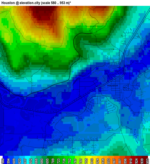
Below is the Elevation map of Houston, which displays elevation range with different colors. Scale of the first map is from 580 to 953 m (1903 to 3127 ft) with average elevation of 663.2 meters (=2176 ft) [note 1]
These maps also provides idea of topography and contour of this city, they are displayed at different zoom levels. More info about maps, scale and edge coordinates you can find below images.
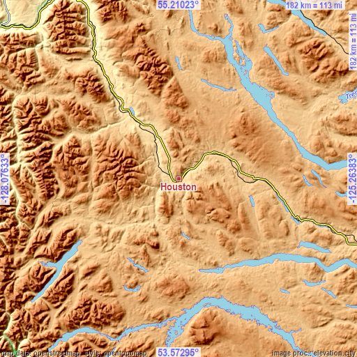
| \ | Map #1 | Topo.Map |
| Scale [m] | 580..953 m | × |
| Scale [ft] | 1903..3127 ft | × |
| Average | 663.2 m = 2176 ft | × |
| Width | 5.69 km = 3.5 mi | 182 km = 113.1 mi |
| Height | 5.69 km = 3.5 mi | 182 km = 113.1 mi |
| ↑Max Latitude | 54.425334° | 55.21023° |
| Latitude at center | 54.39976° | 54.39976° |
| ↓Min Latitude | 54.37417° | 53.57295° |
| ← Min Longitude | -126.714025° | -128.07633° |
| Longitude center | -126.67008° | -126.67008° |
| →Max Longitude | -126.626135° | -125.26383° |
Nearby cities:
Cities around Houston sort by population:
• Prince George elevation 578 m
260.6 km,  101°
101°
• Terrace 70 m
125.6 km,  275°
275°
• Prince Rupert 26 m
236.7 km,  267°
267°
• Kitimat 22 m
134.6 km,  253°
253°
• Smithers 494 m
53.3 km,  322°
322°
• Mackenzie 771 m
251.4 km,  65°
65°
• Burns Lake 724 m
61.9 km,  107°
107°
• Port McNeill 30 m
424.8 km,  183°
183°
• Vanderhoof 635 m
177.5 km, 103°
Multilingual:
 En español:
Houston elevación 590 m.
 En France:
Houston élévation 590 m.


Sources and notes:
- [note 1] Map square and city borders are not equal. Map elevation data is calculated only from area inside that square.
- [src 1] Elevation data from geonames database provided with same terms of usage.
- [src 2] The elevation map of Houston is generated using elevation data from NASA's 3 arcsec (90m) resolution SRTM data.
- [src 3] Base (background) map © OpenStreetMap contributors tiles are generated by Geofabrik and OpenTopoMap.
Copyright & License:
This Houston Elevation Map is licensed under CC BY-SA. You may reuse any part from this page, if you give a proper credit by linking to this URL:
 More info on terms of use page.