Gatineau elevation
Gatineau (Quebec, Outaouais), Canada elevation is 53 meters and Gatineau elevation in feet is 174 ft above sea level [src 1]. Gatineau is a populated place (feature code) with elevation that is 205 meters (673 ft) smaller than average city elevation in Canada.
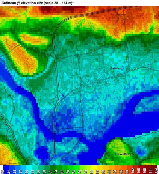
Below is the Elevation map of Gatineau, which displays elevation range with different colors. Scale of the first map is from 38 to 114 m (125 to 374 ft) with average elevation of 59.7 meters (=196 ft) [note 1]
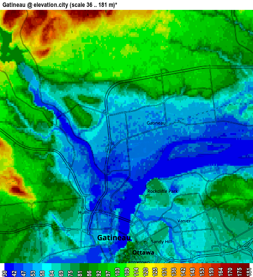
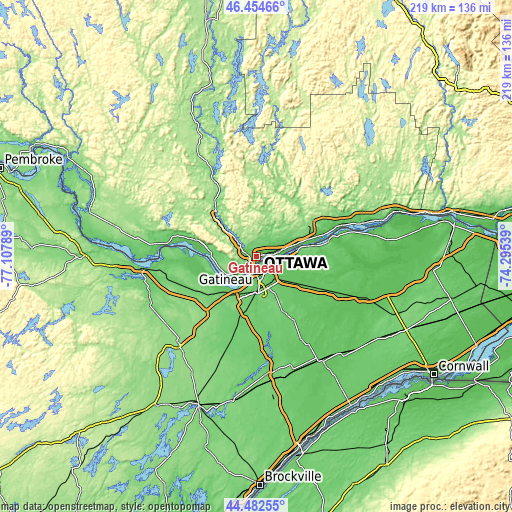
These maps also provides idea of topography and contour of this city, they are displayed at different zoom levels. More info about maps, scale and edge coordinates you can find below images.
| \ | Map #1 | Map #2 | Topo.Map |
| Scale [m] | 38..114 m | 36..181 m | × |
| Scale [ft] | 125..374 ft | 118..594 ft | × |
| Average | 59.7 m = 196 ft | 78.8 m = 259 ft | × |
| Width | 6.85 km = 4.3 mi | 13.7 km = 8.5 mi | 219.3 km = 136.3 mi |
| Height | 6.85 km = 4.3 mi | 13.7 km = 8.5 mi | 219.3 km = 136.3 mi |
| ↑Max Latitude | 45.508036° | 45.538825° | 46.45466° |
| Latitude at center | 45.47723° | 45.47723° | 45.47723° |
| ↓Min Latitude | 45.446407° | 45.415568° | 44.48255° |
| ← Min Longitude | -75.745585° | -75.789531° | -77.10789° |
| Longitude center | -75.70164° | -75.70164° | -75.70164° |
| →Max Longitude | -75.657695° | -75.613749° | -74.29539° |
Nearby cities:
Cities around Gatineau sort by population:
• Ottawa elevation 71 m
7.4 km,  177°
177°
• Nepean 102 m
14.2 km,  192°
192°
• Fallingbrook 78 m
17 km,  90°
90°
• Vanier 57 m
5 km,  145°
145°
• Buckingham 124 m
25 km,  61°
61°
• le Plateau 89 m
7.7 km,  232°
232°
• Queenswood Heights 86 m
15.3 km, 92°
• Cantley 162 m
11.8 km,  327°
327°
• Bells Corners 96 m
20.6 km,  209°
209°
• Val-des-Monts 141 m
19.4 km,  8°
8°
• Wakefield 305 m
23.4 km, 334°
• Saint-Alexandre 74 m
4.5 km,  304°
304°
Multilingual:
 En español:
Gatineau elevación 53 m.
 En France:
Gatineau élévation 53 m.


Sources and notes:
- [note 1] Map square and city borders are not equal. Map elevation data is calculated only from area inside that square.
- [src 1] Elevation data from geonames database provided with same terms of usage.
- [src 2] The elevation map of Gatineau is generated using elevation data from NASA's 3 arcsec (90m) resolution SRTM data.
- [src 3] Base (background) map © OpenStreetMap contributors tiles are generated by Geofabrik and OpenTopoMap.
Copyright & License:
This Gatineau Elevation Map is licensed under CC BY-SA. You may reuse any part from this page, if you give a proper credit by linking to this URL:
 More info on terms of use page.