East Angus elevation
East Angus (Quebec, Estrie), Canada elevation is 191 meters and East Angus elevation in feet is 627 ft above sea level [src 1]. East Angus is a populated place (feature code) with elevation that is 67 meters (220 ft) smaller than average city elevation in Canada.
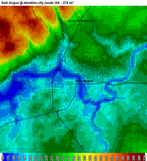
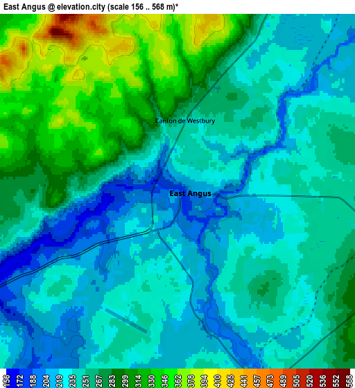
Below is the Elevation map of East Angus, which displays elevation range with different colors. Scale of the first map is from 164 to 374 m (538 to 1227 ft) with average elevation of 230.1 meters (=755 ft) [note 1]
These maps also provides idea of topography and contour of this city, they are displayed at different zoom levels. More info about maps, scale and edge coordinates you can find below images.
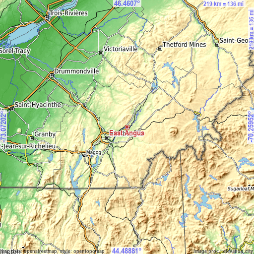
| \ | Map #1 | Map #2 | Topo.Map |
| Scale [m] | 164..374 m | 156..568 m | × |
| Scale [ft] | 538..1227 ft | 512..1864 ft | × |
| Average | 230.1 m = 755 ft | 257.4 m = 844 ft | × |
| Width | 6.85 km = 4.3 mi | 13.7 km = 8.5 mi | 219.3 km = 136.3 mi |
| Height | 6.85 km = 4.3 mi | 13.7 km = 8.5 mi | 219.2 km = 136.2 mi |
| ↑Max Latitude | 45.514182° | 45.544968° | 46.4607° |
| Latitude at center | 45.48338° | 45.48338° | 45.48338° |
| ↓Min Latitude | 45.452561° | 45.421725° | 44.48881° |
| ← Min Longitude | -71.709715° | -71.753661° | -73.07202° |
| Longitude center | -71.66577° | -71.66577° | -71.66577° |
| →Max Longitude | -71.621825° | -71.577879° | -70.25952° |
Nearby cities:
Cities around East Angus sort by population:
• Sherbrooke elevation 175 m
20.4 km,  243°
243°
• Rock Forest 240 m
29.4 km, 241°
• Magog 220 m
44.8 km, 237°
• Asbestos 252 m
37.7 km,  326°
326°
• Coaticook 289 m
40.3 km,  194°
194°
• Windsor 173 m
27.6 km,  289°
289°
• Richmond 126 m
42.8 km,  298°
298°
• Danville 160 m
43 km,  320°
320°
• Cookshire-Eaton 239 m
7.9 km,  160°
160°
• Weedon Centre 272 m
29.7 km,  32°
32°
• Cookshire 237 m
8.1 km, 159°
• Saint-Rémi-de-Tingwick 421 m
44.2 km,  344°
344°
Multilingual:
 En español:
East Angus elevación 191 m.
 En France:
East Angus élévation 191 m.
 Auf Deutsch:
East Angus höhe über dem Meeresspiegel ist 191 m.

Sources and notes:
- [note 1] Map square and city borders are not equal. Map elevation data is calculated only from area inside that square.
- [src 1] Elevation data from geonames database provided with same terms of usage.
- [src 2] The elevation map of East Angus is generated using elevation data from NASA's 3 arcsec (90m) resolution SRTM data.
- [src 3] Base (background) map © OpenStreetMap contributors tiles are generated by Geofabrik and OpenTopoMap.
Copyright & License:
This East Angus Elevation Map is licensed under CC BY-SA. You may reuse any part from this page, if you give a proper credit by linking to this URL:
 More info on terms of use page.