Collingwood elevation
Collingwood (Ontario), Canada elevation is 194 meters and Collingwood elevation in feet is 636 ft above sea level [src 1]. Collingwood is a populated place (feature code) with elevation that is 64 meters (210 ft) smaller than average city elevation in Canada.
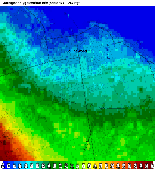
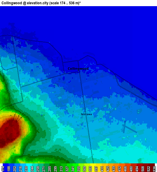
Below is the Elevation map of Collingwood, which displays elevation range with different colors. Scale of the first map is from 174 to 267 m (571 to 876 ft) with average elevation of 199.2 meters (=654 ft) [note 1]
These maps also provides idea of topography and contour of this city, they are displayed at different zoom levels. More info about maps, scale and edge coordinates you can find below images.
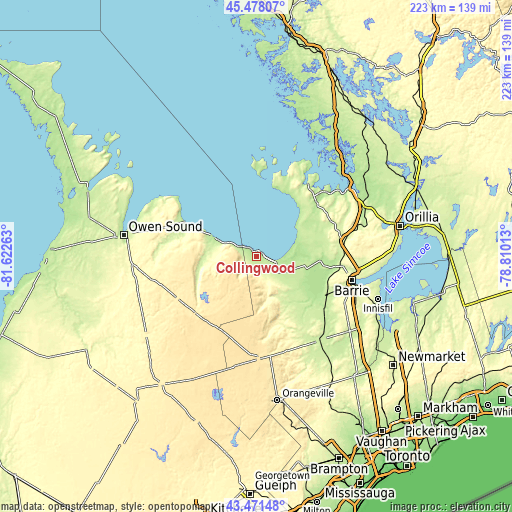
| \ | Map #1 | Map #2 | Topo.Map |
| Scale [m] | 174..267 m | 174..536 m | × |
| Scale [ft] | 571..876 ft | 571..1759 ft | × |
| Average | 199.2 m = 654 ft | 218.5 m = 717 ft | × |
| Width | 6.97 km = 4.3 mi | 13.94 km = 8.7 mi | 223.1 km = 138.6 mi |
| Height | 6.97 km = 4.3 mi | 13.94 km = 8.7 mi | 223.1 km = 138.6 mi |
| ↑Max Latitude | 44.514745° | 44.546072° | 45.47807° |
| Latitude at center | 44.4834° | 44.4834° | 44.4834° |
| ↓Min Latitude | 44.452039° | 44.42066° | 43.47148° |
| ← Min Longitude | -80.260325° | -80.304271° | -81.62263° |
| Longitude center | -80.21638° | -80.21638° | -80.21638° |
| →Max Longitude | -80.172435° | -80.128489° | -78.81013° |
Nearby cities:
Cities around Collingwood sort by population:
• Barrie elevation 269 m
44.6 km,  101°
101°
• Midland 195 m
39.7 km,  41°
41°
• Owen Sound 180 m
58.4 km,  279°
279°
• Alliston 223 m
46.4 km,  143°
143°
• Angus 193 m
32.3 km,  124°
124°
• Shelburne 497 m
45 km,  178°
178°
• Wasaga Beach 188 m
16.3 km,  76°
76°
• Innisfil 266 m
49.4 km,  114°
114°
• Meaford 202 m
34.2 km,  293°
293°
• Elmvale 220 m
29.9 km,  68°
68°
• Markdale 424 m
39.1 km,  241°
241°
• Cookstown 237 m
52.9 km,  129°
129°
Multilingual:
 En español:
Collingwood elevación 194 m.
 En France:
Collingwood élévation 194 m.
 Auf Deutsch:
Collingwood höhe über dem Meeresspiegel ist 194 m.

Sources and notes:
- [note 1] Map square and city borders are not equal. Map elevation data is calculated only from area inside that square.
- [src 1] Elevation data from geonames database provided with same terms of usage.
- [src 2] The elevation map of Collingwood is generated using elevation data from NASA's 3 arcsec (90m) resolution SRTM data.
- [src 3] Base (background) map © OpenStreetMap contributors tiles are generated by Geofabrik and OpenTopoMap.
Copyright & License:
This Collingwood Elevation Map is licensed under CC BY-SA. You may reuse any part from this page, if you give a proper credit by linking to this URL:
 More info on terms of use page.