Altona elevation
Altona (Manitoba), Canada elevation is 246 meters and Altona elevation in feet is 807 ft above sea level [src 1]. Altona is a populated place (feature code) with elevation that is 12 meters (39 ft) smaller than average city elevation in Canada.
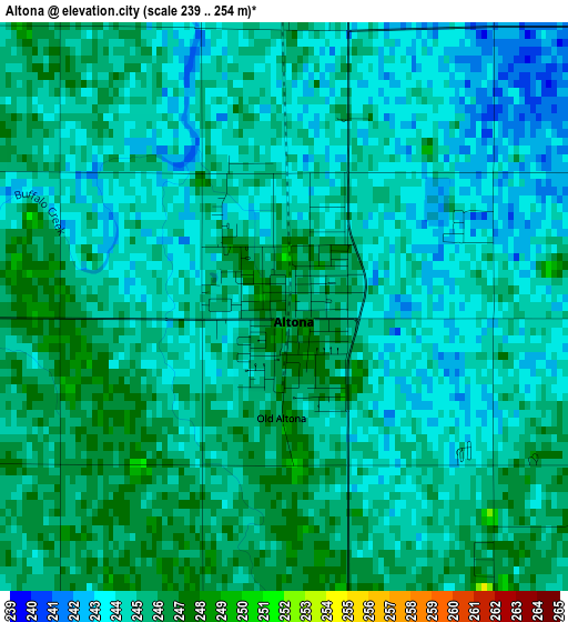
Below is the Elevation map of Altona, which displays elevation range with different colors. Scale of the first map is from 239 to 254 m (784 to 833 ft) with average elevation of 244.4 meters (=802 ft) [note 1]
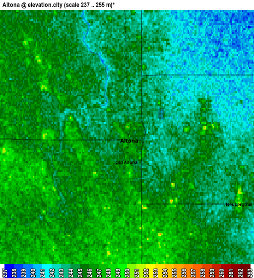
These maps also provides idea of topography and contour of this city, they are displayed at different zoom levels. More info about maps, scale and edge coordinates you can find below images.
| \ | Map #1 | Map #2 | Topo.Map |
| Scale [m] | 239..254 m | 237..255 m | × |
| Scale [ft] | 784..833 ft | 778..837 ft | × |
| Average | 244.4 m = 802 ft | 244.5 m = 802 ft | × |
| Width | 6.4 km = 4 mi | 12.8 km = 8 mi | 204.7 km = 127.2 mi |
| Height | 6.4 km = 4 mi | 12.8 km = 8 mi | 204.7 km = 127.2 mi |
| ↑Max Latitude | 49.133452° | 49.162197° | 50.01681° |
| Latitude at center | 49.10469° | 49.10469° | 49.10469° |
| ↓Min Latitude | 49.075912° | 49.047116° | 48.1755° |
| ← Min Longitude | -97.603555° | -97.647501° | -98.96586° |
| Longitude center | -97.55961° | -97.55961° | -97.55961° |
| →Max Longitude | -97.515665° | -97.471719° | -96.15336° |
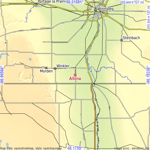
Nearby cities:
Cities around Altona sort by population:
• Steinbach elevation 263 m
78.8 km,  53°
53°
• Winkler 271 m
29 km,  287°
287°
• Morden 306 m
40.6 km,  283°
283°
• Headingley 239 m
86.4 km,  7°
7°
• Lorette 239 m
86.3 km,  35°
35°
• Carman 264 m
54.3 km,  323°
323°
• Niverville 235 m
67.1 km,  33°
33°
• Morris 236 m
31.2 km, 26°
• Grunthal 266 m
60.9 km,  56°
56°
• Ile des Chênes 236 m
79 km, 31°
• St. Adolphe 234 m
71.2 km, 27°
• Landmark 242 m
82.6 km, 40°
Multilingual:
 En español:
Altona elevación 246 m.
 En France:
Altona élévation 246 m.


Sources and notes:
- [note 1] Map square and city borders are not equal. Map elevation data is calculated only from area inside that square.
- [src 1] Elevation data from geonames database provided with same terms of usage.
- [src 2] The elevation map of Altona is generated using elevation data from NASA's 3 arcsec (90m) resolution SRTM data.
- [src 3] Base (background) map © OpenStreetMap contributors tiles are generated by Geofabrik and OpenTopoMap.
Copyright & License:
This Altona Elevation Map is licensed under CC BY-SA. You may reuse any part from this page, if you give a proper credit by linking to this URL:
 More info on terms of use page.