Mahalapye elevation
Mahalapye (Central), Botswana elevation is 1025 meters and Mahalapye elevation in feet is 3363 ft above sea level [src 1]. Mahalapye is a populated place (feature code) with elevation that is 13 meters (43 ft) bigger than average city elevation in Botswana.
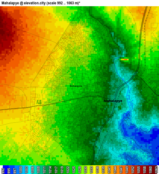
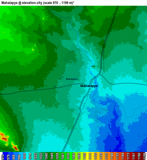
Below is the Elevation map of Mahalapye, which displays elevation range with different colors. Scale of the first map is from 992 to 1063 m (3255 to 3488 ft) with average elevation of 1026.2 meters (=3367 ft) [note 1]
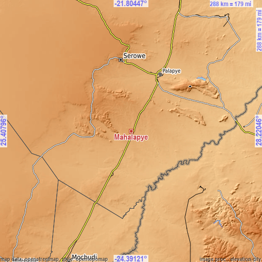
These maps also provides idea of topography and contour of this city, they are displayed at different zoom levels. More info about maps, scale and edge coordinates you can find below images.
| \ | Map #1 | Map #2 | Topo.Map |
| Scale [m] | 992..1063 m | 970..1199 m | × |
| Scale [ft] | 3255..3488 ft | 3182..3934 ft | × |
| Average | 1026.2 m = 3367 ft | 1030 m = 3379 ft | × |
| Width | 8.99 km = 5.6 mi | 17.98 km = 11.2 mi | 287.6 km = 178.7 mi |
| Height | 8.99 km = 5.6 mi | 17.98 km = 11.2 mi | 287.6 km = 178.7 mi |
| ↑Max Latitude | -23.063643° | -23.023204° | -21.80447° |
| Latitude at center | -23.10407° | -23.10407° | -23.10407° |
| ↓Min Latitude | -23.144485° | -23.184887° | -24.39121° |
| ← Min Longitude | 26.770265° | 26.726319° | 25.40796° |
| Longitude center | 26.81421° | 26.81421° | 26.81421° |
| →Max Longitude | 26.858155° | 26.902101° | 28.22046° |
Nearby cities:
Cities around Mahalapye sort by population:
• Ramokgonami elevation 915 m
67.9 km,  66°
66°
• Letsheng 977 m
64.5 km,  40°
40°
• Mookane 957 m
66.8 km,  193°
193°
• Kalamare 1182 m
31.3 km,  307°
307°
• Machaneng 844 m
69.5 km,  97°
97°
• Makwata 888 m
53.5 km,  111°
111°
• Kurametsi 879 m
41.8 km,  141°
141°
• Pilikwe 981 m
51.6 km,  48°
48°
• Maapi 938 m
67 km, 54°
• Magothla 860 m
54.8 km,  159°
159°
• Mathakola 959 m
66.3 km, 50°
• Makoba 848 m
52.3 km, 143°
Multilingual:
 En español:
Mahalapye elevación 1025 m.
 En France:
Mahalapye élévation 1025 m.
 Auf Deutsch:
Mahalapye höhe über dem Meeresspiegel ist 1025 m.

Sources and notes:
- [note 1] Map square and city borders are not equal. Map elevation data is calculated only from area inside that square.
- [src 1] Elevation data from geonames database provided with same terms of usage.
- [src 2] The elevation map of Mahalapye is generated using elevation data from NASA's 3 arcsec (90m) resolution SRTM data.
- [src 3] Base (background) map © OpenStreetMap contributors tiles are generated by Geofabrik and OpenTopoMap.
Copyright & License:
This Mahalapye Elevation Map is licensed under CC BY-SA. You may reuse any part from this page, if you give a proper credit by linking to this URL:
 More info on terms of use page.