Ramokgonami elevation
Ramokgonami (Central), Botswana elevation is 915 meters and Ramokgonami elevation in feet is 3002 ft above sea level [src 1]. Ramokgonami is a populated place (feature code) with elevation that is 97 meters (318 ft) smaller than average city elevation in Botswana.
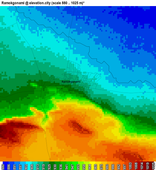
Below is the Elevation map of Ramokgonami, which displays elevation range with different colors. Scale of the first map is from 880 to 1025 m (2887 to 3363 ft) with average elevation of 931 meters (=3054 ft) [note 1]
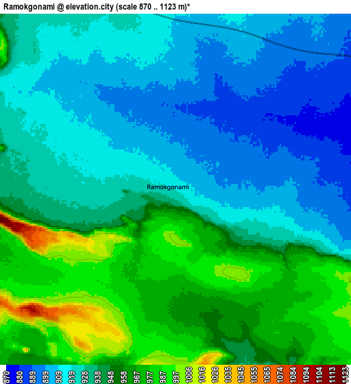
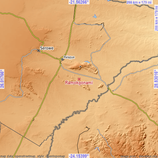
These maps also provides idea of topography and contour of this city, they are displayed at different zoom levels. More info about maps, scale and edge coordinates you can find below images.
| \ | Map #1 | Map #2 | Topo.Map |
| Scale [m] | 880..1025 m | 870..1123 m | × |
| Scale [ft] | 2887..3363 ft | 2854..3684 ft | × |
| Average | 931 m = 3054 ft | 937.3 m = 3075 ft | × |
| Width | 9 km = 5.6 mi | 18.01 km = 11.2 mi | 288.1 km = 179 mi |
| Height | 9 km = 5.6 mi | 18.01 km = 11.2 mi | 288.1 km = 179 mi |
| ↑Max Latitude | -22.824002° | -22.783491° | -21.56266° |
| Latitude at center | -22.8645° | -22.8645° | -22.8645° |
| ↓Min Latitude | -22.904986° | -22.945461° | -24.15399° |
| ← Min Longitude | 27.379965° | 27.336019° | 26.01766° |
| Longitude center | 27.42391° | 27.42391° | 27.42391° |
| →Max Longitude | 27.467855° | 27.511801° | 28.83016° |
Nearby cities:
Cities around Ramokgonami sort by population:
• Palapye elevation 926 m
46.8 km,  319°
319°
• Maunatlala 856 m
36.5 km,  35°
35°
• Letsheng 977 m
30.3 km, 317°
• Ratholo 924 m
21.7 km, 44°
• Machaneng 844 m
36.4 km,  169°
169°
• Makobeng 841 m
28.9 km,  120°
120°
• Makwata 888 m
48.3 km,  195°
195°
• Mogapinyana 915 m
58.2 km,  18°
18°
• Pilikwe 981 m
24.7 km,  287°
287°
• Maapi 938 m
14.1 km,  327°
327°
• Mathakola 959 m
19.7 km, 323°
• Tamasane 946 m
49.7 km,  357°
357°
Multilingual:
 En español:
Ramokgonami elevación 915 m.
 En France:
Ramokgonami élévation 915 m.
 Auf Deutsch:
Ramokgonami höhe über dem Meeresspiegel ist 915 m.

Sources and notes:
- [note 1] Map square and city borders are not equal. Map elevation data is calculated only from area inside that square.
- [src 1] Elevation data from geonames database provided with same terms of usage.
- [src 2] The elevation map of Ramokgonami is generated using elevation data from NASA's 3 arcsec (90m) resolution SRTM data.
- [src 3] Base (background) map © OpenStreetMap contributors tiles are generated by Geofabrik and OpenTopoMap.
Copyright & License:
This Ramokgonami Elevation Map is licensed under CC BY-SA. You may reuse any part from this page, if you give a proper credit by linking to this URL:
 More info on terms of use page.