Sarpang elevation
Sarpang (Geylegphug), Bhutan elevation is 344 meters and Sarpang elevation in feet is 1129 ft above sea level [src 1]. Sarpang is a seat of a first-order administrative division (feature code) with elevation that is 1168 meters (3832 ft) smaller than average city elevation in Bhutan.
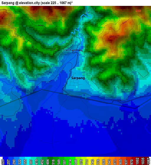
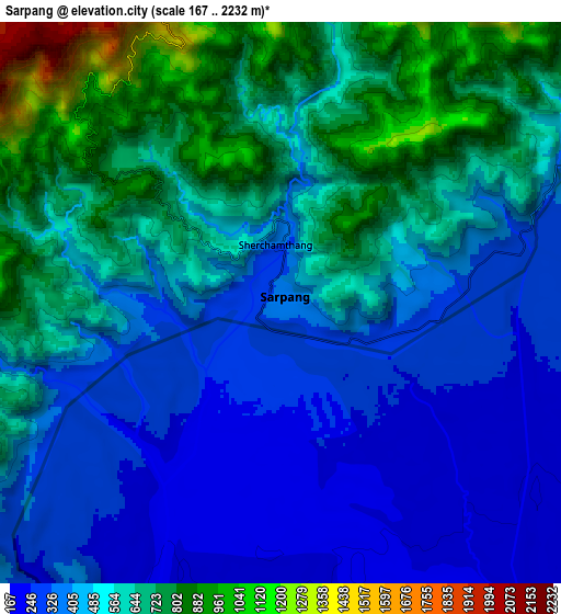
Below is the Elevation map of Sarpang, which displays elevation range with different colors. Scale of the first map is from 225 to 1067 m (738 to 3501 ft) with average elevation of 412.9 meters (=1355 ft) [note 1]
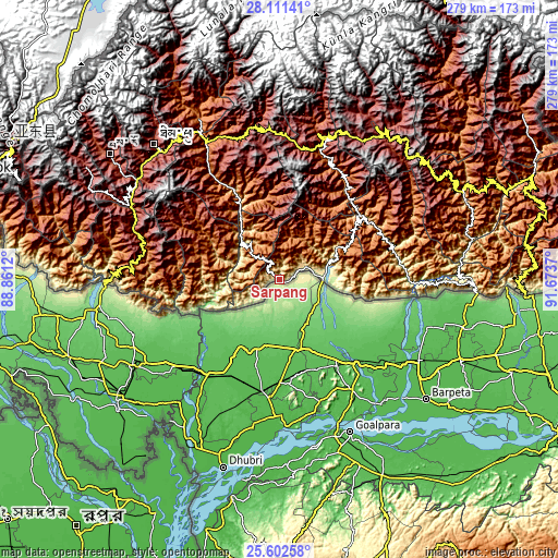
These maps also provides idea of topography and contour of this city, they are displayed at different zoom levels. More info about maps, scale and edge coordinates you can find below images.
| \ | Map #1 | Map #2 | Topo.Map |
| Scale [m] | 225..1067 m | 167..2232 m | × |
| Scale [ft] | 738..3501 ft | 548..7323 ft | × |
| Average | 412.9 m = 1355 ft | 517.6 m = 1698 ft | × |
| Width | 8.72 km = 5.4 mi | 17.44 km = 10.8 mi | 279 km = 173.4 mi |
| Height | 8.72 km = 5.4 mi | 17.44 km = 10.8 mi | 279 km = 173.4 mi |
| ↑Max Latitude | 26.903146° | 26.942328° | 28.11141° |
| Latitude at center | 26.86395° | 26.86395° | 26.86395° |
| ↓Min Latitude | 26.82474° | 26.785517° | 25.60258° |
| ← Min Longitude | 90.223505° | 90.179559° | 88.8612° |
| Longitude center | 90.26745° | 90.26745° | 90.26745° |
| →Max Longitude | 90.311395° | 90.355341° | 91.6737° |
Nearby cities:
Cities around Sarpang sort by population:
• Punākha elevation 1293 m
89.6 km,  334°
334°
• Tsirang 1410 m
22.7 km,  320°
320°
• Phuntsholing 330 m
87.2 km,  269°
269°
• Wangdue Phodrang 1273 m
78.2 km, 332°
• Jakar 2587 m
90 km,  32°
32°
• Pajo 1438 m
83.6 km, 332°
• Tsimasham 2245 m
77 km,  289°
289°
• Trongsa 2108 m
74.9 km,  18°
18°
• Daga 1558 m
45.3 km,  301°
301°
• Daphu 914 m
88.4 km,  277°
277°
• Panbang 214 m
71 km,  89°
89°
• Shemgang 1900 m
55.1 km,  44°
44°
Multilingual:
 En español:
Sarpang elevación 344 m.
 En France:
Sarpang élévation 344 m.


Sources and notes:
- [note 1] Map square and city borders are not equal. Map elevation data is calculated only from area inside that square.
- [src 1] Elevation data from geonames database provided with same terms of usage.
- [src 2] The elevation map of Sarpang is generated using elevation data from NASA's 3 arcsec (90m) resolution SRTM data.
- [src 3] Base (background) map © OpenStreetMap contributors tiles are generated by Geofabrik and OpenTopoMap.
Copyright & License:
This Sarpang Elevation Map is licensed under CC BY-SA. You may reuse any part from this page, if you give a proper credit by linking to this URL:
 More info on terms of use page.