Aguaí elevation
Aguaí (São Paulo), Brazil elevation is 665 meters and Aguaí elevation in feet is 2182 ft above sea level [src 1]. Aguaí is a populated place (feature code) with elevation that is 283 meters (928 ft) bigger than average city elevation in Brazil.
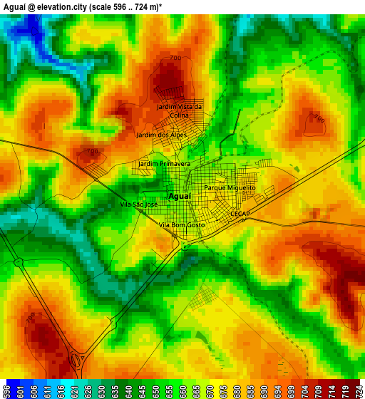
Below is the Elevation map of Aguaí, which displays elevation range with different colors. Scale of the first map is from 596 to 724 m (1955 to 2375 ft) with average elevation of 668.4 meters (=2193 ft) [note 1]
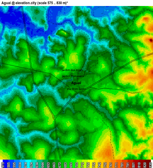
These maps also provides idea of topography and contour of this city, they are displayed at different zoom levels. More info about maps, scale and edge coordinates you can find below images.
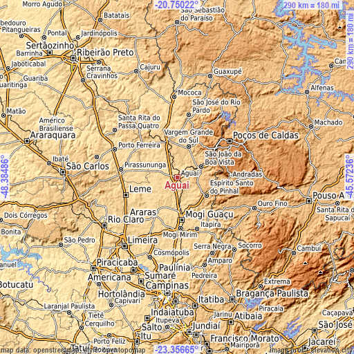
| \ | Map #1 | Map #2 | Topo.Map |
| Scale [m] | 596..724 m | 575..830 m | × |
| Scale [ft] | 1955..2375 ft | 1886..2723 ft | × |
| Average | 668.4 m = 2193 ft | 667.1 m = 2189 ft | × |
| Width | 9.06 km = 5.6 mi | 18.11 km = 11.3 mi | 289.8 km = 180.1 mi |
| Height | 9.06 km = 5.6 mi | 18.11 km = 11.3 mi | 289.8 km = 180.1 mi |
| ↑Max Latitude | -22.018706° | -21.97796° | -20.75022° |
| Latitude at center | -22.05944° | -22.05944° | -22.05944° |
| ↓Min Latitude | -22.100162° | -22.140873° | -23.35665° |
| ← Min Longitude | -47.022555° | -47.066501° | -48.38486° |
| Longitude center | -46.97861° | -46.97861° | -46.97861° |
| →Max Longitude | -46.934665° | -46.890719° | -45.57236° |
Nearby cities:
Cities around Aguaí sort by population:
• Mogi Guaçu elevation 612 m
34.4 km,  174°
174°
• Leme 630 m
44.7 km,  251°
251°
• Mogi Mirim 631 m
41.5 km,  177°
177°
• São João da Boa Vista 774 m
21.1 km,  61°
61°
• Itapira 649 m
44.9 km,  158°
158°
• Espírito Santo do Pinhal 849 m
31.1 km,  101°
101°
• Vargem Grande do Sul 725 m
26.7 km,  19°
19°
• Andradas 905 m
42.2 km,  91°
91°
• Santa Cruz das Palmeiras 655 m
38 km,  312°
312°
• Casa Branca 692 m
33.6 km,  340°
340°
• Conchal 594 m
36.1 km,  213°
213°
• Jacutinga 842 m
45.3 km,  123°
123°
Multilingual:
 En español:
Aguaí elevación 665 m.
 En France:
Aguaí élévation 665 m.


Sources and notes:
- [note 1] Map square and city borders are not equal. Map elevation data is calculated only from area inside that square.
- [src 1] Elevation data from geonames database provided with same terms of usage.
- [src 2] The elevation map of Aguaí is generated using elevation data from NASA's 3 arcsec (90m) resolution SRTM data.
- [src 3] Base (background) map © OpenStreetMap contributors tiles are generated by Geofabrik and OpenTopoMap.
Copyright & License:
This Aguaí Elevation Map is licensed under CC BY-SA. You may reuse any part from this page, if you give a proper credit by linking to this URL:
 More info on terms of use page.