Caxias do Sul elevation
Caxias do Sul (Rio Grande do Sul), Brazil elevation is 787 meters and Caxias do Sul elevation in feet is 2582 ft above sea level [src 1]. Caxias do Sul is a populated place (feature code) with elevation that is 405 meters (1329 ft) bigger than average city elevation in Brazil.
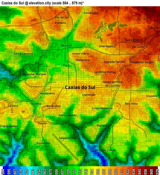
Below is the Elevation map of Caxias do Sul, which displays elevation range with different colors. Scale of the first map is from 584 to 879 m (1916 to 2884 ft) with average elevation of 753.4 meters (=2472 ft) [note 1]
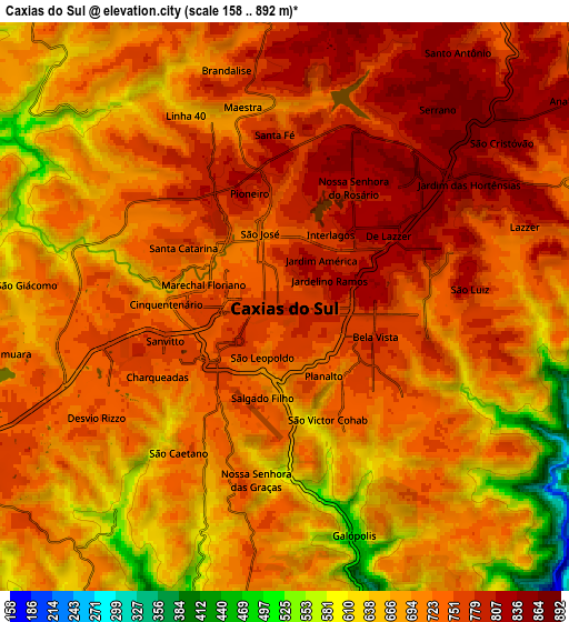
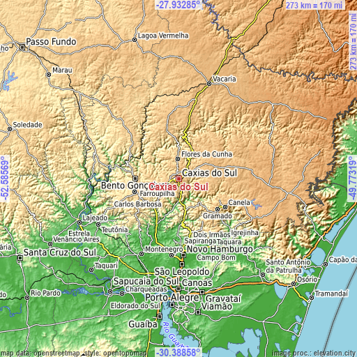
These maps also provides idea of topography and contour of this city, they are displayed at different zoom levels. More info about maps, scale and edge coordinates you can find below images.
| \ | Map #1 | Map #2 | Topo.Map |
| Scale [m] | 584..879 m | 158..892 m | × |
| Scale [ft] | 1916..2884 ft | 518..2927 ft | × |
| Average | 753.4 m = 2472 ft | 713.1 m = 2340 ft | × |
| Width | 8.53 km = 5.3 mi | 17.07 km = 10.6 mi | 273.1 km = 169.7 mi |
| Height | 8.53 km = 5.3 mi | 17.07 km = 10.6 mi | 273.1 km = 169.7 mi |
| ↑Max Latitude | -29.12968° | -29.091286° | -27.93285° |
| Latitude at center | -29.16806° | -29.16806° | -29.16806° |
| ↓Min Latitude | -29.206426° | -29.244777° | -30.38858° |
| ← Min Longitude | -51.223385° | -51.267331° | -52.58569° |
| Longitude center | -51.17944° | -51.17944° | -51.17944° |
| →Max Longitude | -51.135495° | -51.091549° | -49.77319° |
Nearby cities:
Cities around Caxias do Sul sort by population:
• Bento Gonçalves elevation 673 m
33 km,  269°
269°
• Farroupilha 773 m
17.5 km,  248°
248°
• Estância Velha 43 m
53.4 km,  179°
179°
• Canela 826 m
41.2 km,  120°
120°
• Garibaldi 607 m
35.7 km, 254°
• Flores da Cunha 748 m
15.5 km,  359°
359°
• Veranópolis 669 m
44.3 km,  305°
305°
• Carlos Barbosa 680 m
34.6 km, 245°
• São Sebastião do Caí 16 m
50.3 km,  202°
202°
• São Marcos 741 m
24.4 km,  26°
26°
• Ivoti 125 m
47.1 km, 177°
• Nova Petrópolis 589 m
24 km,  164°
164°
Multilingual:
 En español:
Caxias do Sul elevación 787 m.
 En France:
Caxias do Sul élévation 787 m.
 Auf Deutsch:
Caxias do Sul höhe über dem Meeresspiegel ist 787 m.

Sources and notes:
- [note 1] Map square and city borders are not equal. Map elevation data is calculated only from area inside that square.
- [src 1] Elevation data from geonames database provided with same terms of usage.
- [src 2] The elevation map of Caxias do Sul is generated using elevation data from NASA's 3 arcsec (90m) resolution SRTM data.
- [src 3] Base (background) map © OpenStreetMap contributors tiles are generated by Geofabrik and OpenTopoMap.
Copyright & License:
This Caxias do Sul Elevation Map is licensed under CC BY-SA. You may reuse any part from this page, if you give a proper credit by linking to this URL:
 More info on terms of use page.