Guaraniaçu elevation
Guaraniaçu (Paraná), Brazil elevation is 819 meters and Guaraniaçu elevation in feet is 2687 ft above sea level [src 1]. Guaraniaçu is a populated place (feature code) with elevation that is 437 meters (1434 ft) bigger than average city elevation in Brazil.
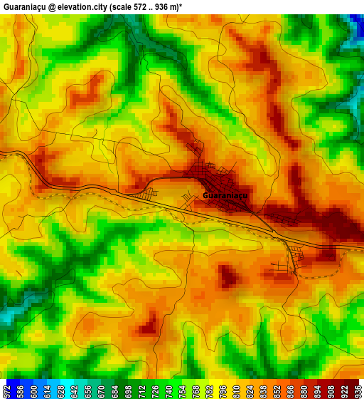
Below is the Elevation map of Guaraniaçu, which displays elevation range with different colors. Scale of the first map is from 572 to 936 m (1877 to 3071 ft) with average elevation of 795.3 meters (=2609 ft) [note 1]
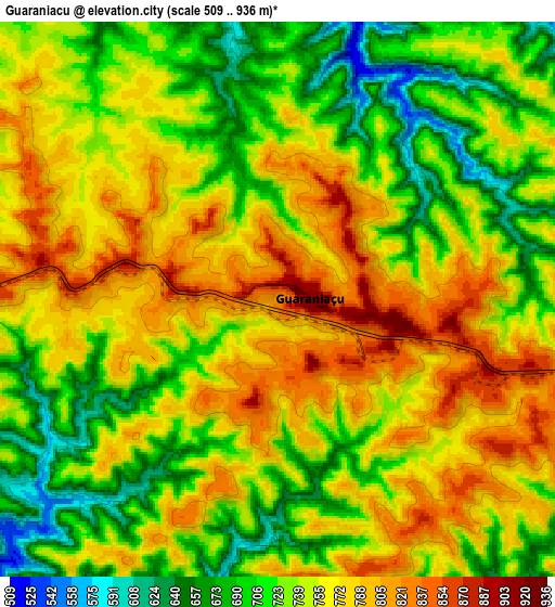
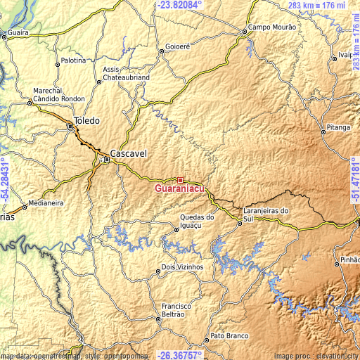
These maps also provides idea of topography and contour of this city, they are displayed at different zoom levels. More info about maps, scale and edge coordinates you can find below images.
| \ | Map #1 | Map #2 | Topo.Map |
| Scale [m] | 572..936 m | 509..936 m | × |
| Scale [ft] | 1877..3071 ft | 1670..3071 ft | × |
| Average | 795.3 m = 2609 ft | 747.5 m = 2452 ft | × |
| Width | 8.85 km = 5.5 mi | 17.7 km = 11 mi | 283.2 km = 176 mi |
| Height | 8.85 km = 5.5 mi | 17.7 km = 11 mi | 283.2 km = 176 mi |
| ↑Max Latitude | -25.061028° | -25.021214° | -23.82084° |
| Latitude at center | -25.10083° | -25.10083° | -25.10083° |
| ↓Min Latitude | -25.140619° | -25.180395° | -26.36757° |
| ← Min Longitude | -52.922005° | -52.965951° | -54.28431° |
| Longitude center | -52.87806° | -52.87806° | -52.87806° |
| →Max Longitude | -52.834115° | -52.790169° | -51.47181° |
Nearby cities:
Cities around Guaraniaçu sort by population:
• Cascavel elevation 786 m
60.3 km,  285°
285°
• Toledo 562 m
97.3 km,  296°
296°
• Francisco Beltrão 567 m
110.4 km,  189°
189°
• Dois Vizinhos 562 m
72.6 km, 194°
• Laranjeiras do Sul 846 m
57.6 km,  126°
126°
• Coronel Vivida 715 m
102.6 km,  162°
162°
• Ampére 509 m
108.4 km,  213°
213°
• Chopinzinho 716 m
91.2 km, 157°
• Corbélia 639 m
54.7 km,  307°
307°
• Matelândia 491 m
113.6 km,  262°
262°
• Realeza 462 m
99.2 km,  221°
221°
• Moreira Sales 463 m
116.2 km,  353°
353°
Multilingual:
 En español:
Guaraniaçu elevación 819 m.
 En France:
Guaraniaçu élévation 819 m.
 Auf Deutsch:
Guaraniaçu höhe über dem Meeresspiegel ist 819 m.

Sources and notes:
- [note 1] Map square and city borders are not equal. Map elevation data is calculated only from area inside that square.
- [src 1] Elevation data from geonames database provided with same terms of usage.
- [src 2] The elevation map of Guaraniaçu is generated using elevation data from NASA's 3 arcsec (90m) resolution SRTM data.
- [src 3] Base (background) map © OpenStreetMap contributors tiles are generated by Geofabrik and OpenTopoMap.
Copyright & License:
This Guaraniaçu Elevation Map is licensed under CC BY-SA. You may reuse any part from this page, if you give a proper credit by linking to this URL:
 More info on terms of use page.