Itiruçu elevation
Itiruçu (Bahia), Brazil elevation is 824 meters and Itiruçu elevation in feet is 2703 ft above sea level [src 1]. Itiruçu is a populated place (feature code) with elevation that is 442 meters (1450 ft) bigger than average city elevation in Brazil.
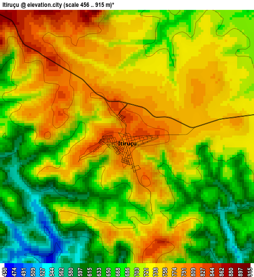
Below is the Elevation map of Itiruçu, which displays elevation range with different colors. Scale of the first map is from 456 to 915 m (1496 to 3002 ft) with average elevation of 711.5 meters (=2334 ft) [note 1]
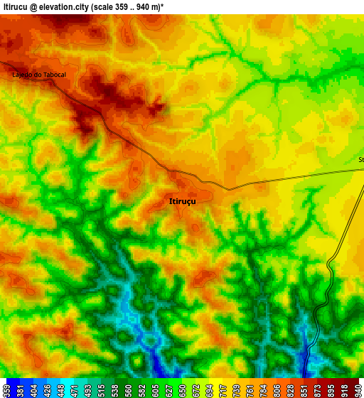
These maps also provides idea of topography and contour of this city, they are displayed at different zoom levels. More info about maps, scale and edge coordinates you can find below images.
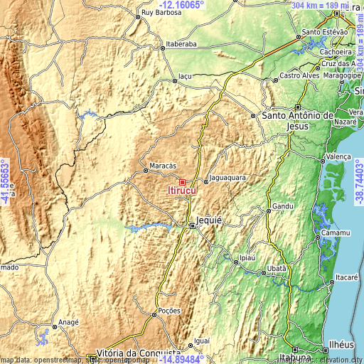
| \ | Map #1 | Map #2 | Topo.Map |
| Scale [m] | 456..915 m | 359..940 m | × |
| Scale [ft] | 1496..3002 ft | 1178..3084 ft | × |
| Average | 711.5 m = 2334 ft | 690.2 m = 2264 ft | × |
| Width | 9.5 km = 5.9 mi | 19 km = 11.8 mi | 304 km = 188.9 mi |
| Height | 9.5 km = 5.9 mi | 19 km = 11.8 mi | 304 km = 188.9 mi |
| ↑Max Latitude | -13.488941° | -13.446204° | -12.16065° |
| Latitude at center | -13.53167° | -13.53167° | -13.53167° |
| ↓Min Latitude | -13.574392° | -13.617105° | -14.89484° |
| ← Min Longitude | -40.194225° | -40.238171° | -41.55653° |
| Longitude center | -40.15028° | -40.15028° | -40.15028° |
| →Max Longitude | -40.106335° | -40.062389° | -38.74403° |
Nearby cities:
Cities around Itiruçu sort by population:
• Jequié elevation 223 m
37 km,  169°
169°
• Jaguaquara 675 m
19.4 km,  89°
89°
• Ipiaú 140 m
80.4 km,  146°
146°
• Amargosa 412 m
81.2 km,  46°
46°
• Maracás 963 m
32 km,  288°
288°
• Gandu 159 m
75.5 km,  108°
108°
• Ibirataia 151 m
81.1 km,  137°
137°
• Jitaúna 170 m
60 km, 153°
• Itagi 220 m
71.9 km, 167°
• Santa Inês 400 m
44.6 km, 53°
• Mutuípe 219 m
77.5 km,  64°
64°
• Ubaíra 339 m
60.3 km, 60°
Multilingual:
 En español:
Itiruçu elevación 824 m.
 En France:
Itiruçu élévation 824 m.


Sources and notes:
- [note 1] Map square and city borders are not equal. Map elevation data is calculated only from area inside that square.
- [src 1] Elevation data from geonames database provided with same terms of usage.
- [src 2] The elevation map of Itiruçu is generated using elevation data from NASA's 3 arcsec (90m) resolution SRTM data.
- [src 3] Base (background) map © OpenStreetMap contributors tiles are generated by Geofabrik and OpenTopoMap.
Copyright & License:
This Itiruçu Elevation Map is licensed under CC BY-SA. You may reuse any part from this page, if you give a proper credit by linking to this URL:
 More info on terms of use page.