Maruim elevation
Maruim (Sergipe), Brazil elevation is 12 meters and Maruim elevation in feet is 39 ft above sea level [src 1]. Maruim is a populated place (feature code) with elevation that is 370 meters (1214 ft) smaller than average city elevation in Brazil.
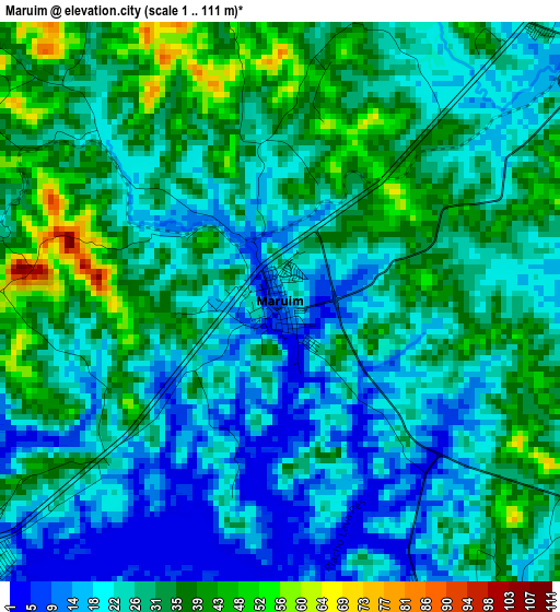
Below is the Elevation map of Maruim, which displays elevation range with different colors. Scale of the first map is from 1 to 111 m (3 to 364 ft) with average elevation of 27.6 meters (=91 ft) [note 1]
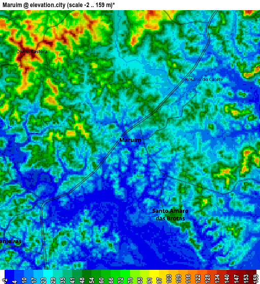
These maps also provides idea of topography and contour of this city, they are displayed at different zoom levels. More info about maps, scale and edge coordinates you can find below images.
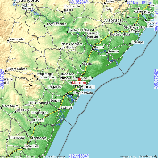
| \ | Map #1 | Map #2 | Topo.Map |
| Scale [m] | 1..111 m | -2..159 m | × |
| Scale [ft] | 3..364 ft | -7..522 ft | × |
| Average | 27.6 m = 91 ft | 33.4 m = 110 ft | × |
| Width | 9.6 km = 6 mi | 19.2 km = 11.9 mi | 307.2 km = 190.9 mi |
| Height | 9.6 km = 6 mi | 19.2 km = 11.9 mi | 307.2 km = 190.9 mi |
| ↑Max Latitude | -10.694321° | -10.651136° | -9.35284° |
| Latitude at center | -10.7375° | -10.7375° | -10.7375° |
| ↓Min Latitude | -10.780673° | -10.823839° | -12.11584° |
| ← Min Longitude | -37.125615° | -37.169561° | -38.48792° |
| Longitude center | -37.08167° | -37.08167° | -37.08167° |
| →Max Longitude | -37.037725° | -36.993779° | -35.67542° |
Nearby cities:
Cities around Maruim sort by population:
• Aracaju elevation 11 m
19.3 km,  176°
176°
• Nossa Senhora do Socorro 39 m
13.9 km,  200°
200°
• São Cristóvão 38 m
33.7 km, 203°
• Barra dos Coqueiros 7 m
19.6 km,  166°
166°
• Laranjeiras 49 m
12.3 km,  231°
231°
• Capela 165 m
26.2 km,  6°
6°
• Nossa Senhora das Dores 201 m
29.9 km,  335°
335°
• Santo Amaro das Brotas 56 m
6.4 km,  152°
152°
• Japaratuba 89 m
22.3 km,  43°
43°
• Areia Branca 163 m
25.6 km,  264°
264°
• Malhador 263 m
25.9 km,  289°
289°
• Moita Bonita 228 m
33.6 km,  301°
301°
Multilingual:
 En español:
Maruim elevación 12 m.
 En France:
Maruim élévation 12 m.


Sources and notes:
- [note 1] Map square and city borders are not equal. Map elevation data is calculated only from area inside that square.
- [src 1] Elevation data from geonames database provided with same terms of usage.
- [src 2] The elevation map of Maruim is generated using elevation data from NASA's 3 arcsec (90m) resolution SRTM data.
- [src 3] Base (background) map © OpenStreetMap contributors tiles are generated by Geofabrik and OpenTopoMap.
Copyright & License:
This Maruim Elevation Map is licensed under CC BY-SA. You may reuse any part from this page, if you give a proper credit by linking to this URL:
 More info on terms of use page.