Mucurici elevation
Mucurici (Espírito Santo), Brazil elevation is 223 meters and Mucurici elevation in feet is 732 ft above sea level [src 1]. Mucurici is a populated place (feature code) with elevation that is 159 meters (522 ft) smaller than average city elevation in Brazil.
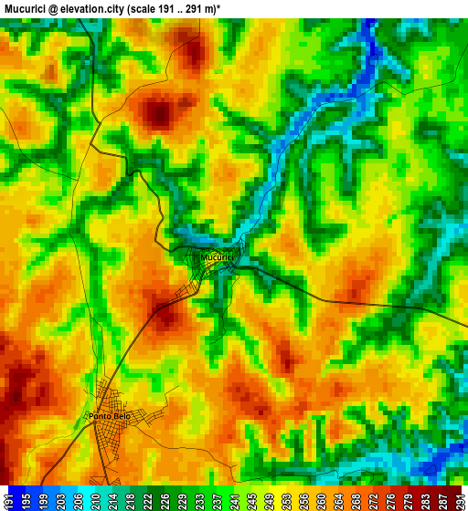
Below is the Elevation map of Mucurici, which displays elevation range with different colors. Scale of the first map is from 191 to 291 m (627 to 955 ft) with average elevation of 245 meters (=804 ft) [note 1]
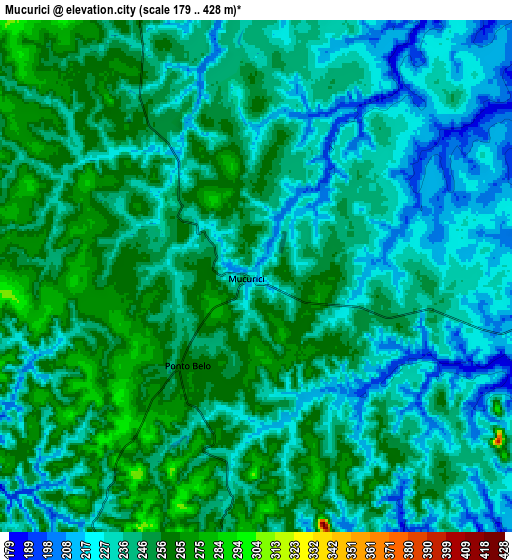
These maps also provides idea of topography and contour of this city, they are displayed at different zoom levels. More info about maps, scale and edge coordinates you can find below images.
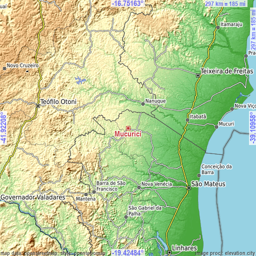
| \ | Map #1 | Map #2 | Topo.Map |
| Scale [m] | 191..291 m | 179..428 m | × |
| Scale [ft] | 627..955 ft | 587..1404 ft | × |
| Average | 245 m = 804 ft | 241 m = 791 ft | × |
| Width | 9.29 km = 5.8 mi | 18.58 km = 11.5 mi | 297.2 km = 184.7 mi |
| Height | 9.29 km = 5.8 mi | 18.58 km = 11.5 mi | 297.3 km = 184.7 mi |
| ↑Max Latitude | -18.051553° | -18.009766° | -16.75163° |
| Latitude at center | -18.09333° | -18.09333° | -18.09333° |
| ↓Min Latitude | -18.135097° | -18.176855° | -19.42484° |
| ← Min Longitude | -40.559775° | -40.603721° | -41.92208° |
| Longitude center | -40.51583° | -40.51583° | -40.51583° |
| →Max Longitude | -40.471885° | -40.427939° | -39.10958° |
Nearby cities:
Cities around Mucurici sort by population:
• São Mateus elevation 38 m
98.3 km,  135°
135°
• Nanuque 108 m
33 km,  31°
31°
• Nova Venécia 80 m
69.7 km,  169°
169°
• Posto da Mata 93 m
73.4 km,  71°
71°
• Barra de São Francisco 197 m
83.5 km,  208°
208°
• Conceição da Barra 8 m
99.7 km,  123°
123°
• Medeiros Neto 150 m
85.9 km,  21°
21°
• Ecoporanga 230 m
45.5 km,  226°
226°
• Carlos Chagas 206 m
50.9 km,  328°
328°
• Montanha 191 m
16.5 km,  103°
103°
• Boa Esperança 132 m
54.8 km,  154°
154°
• Águia Branca 143 m
101.7 km,  193°
193°
Multilingual:
 En español:
Mucurici elevación 223 m.
 En France:
Mucurici élévation 223 m.
 Auf Deutsch:
Mucurici höhe über dem Meeresspiegel ist 223 m.

Sources and notes:
- [note 1] Map square and city borders are not equal. Map elevation data is calculated only from area inside that square.
- [src 1] Elevation data from geonames database provided with same terms of usage.
- [src 2] The elevation map of Mucurici is generated using elevation data from NASA's 3 arcsec (90m) resolution SRTM data.
- [src 3] Base (background) map © OpenStreetMap contributors tiles are generated by Geofabrik and OpenTopoMap.
Copyright & License:
This Mucurici Elevation Map is licensed under CC BY-SA. You may reuse any part from this page, if you give a proper credit by linking to this URL:
 More info on terms of use page.