Padre Paraíso elevation
Padre Paraíso (Minas Gerais), Brazil elevation is 681 meters and Padre Paraíso elevation in feet is 2234 ft above sea level [src 1]. Padre Paraíso is a populated place (feature code) with elevation that is 299 meters (981 ft) bigger than average city elevation in Brazil.
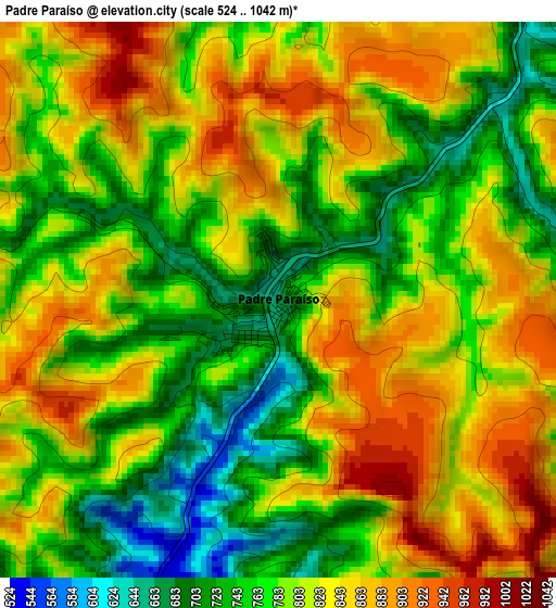
Below is the Elevation map of Padre Paraíso, which displays elevation range with different colors. Scale of the first map is from 524 to 1042 m (1719 to 3419 ft) with average elevation of 799.3 meters (=2622 ft) [note 1]
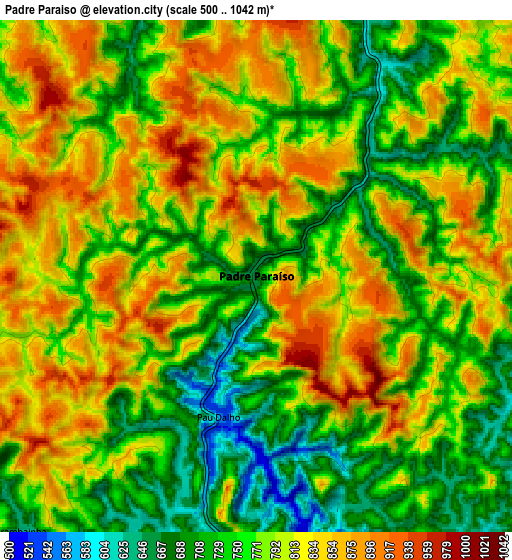
These maps also provides idea of topography and contour of this city, they are displayed at different zoom levels. More info about maps, scale and edge coordinates you can find below images.
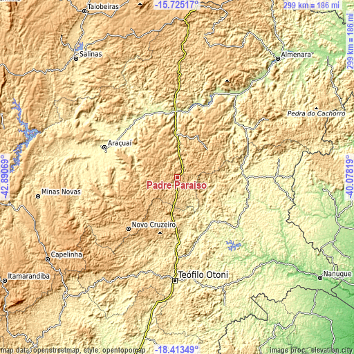
| \ | Map #1 | Map #2 | Topo.Map |
| Scale [m] | 524..1042 m | 500..1042 m | × |
| Scale [ft] | 1719..3419 ft | 1640..3419 ft | × |
| Average | 799.3 m = 2622 ft | 782.1 m = 2566 ft | × |
| Width | 9.34 km = 5.8 mi | 18.68 km = 11.6 mi | 298.9 km = 185.7 mi |
| Height | 9.34 km = 5.8 mi | 18.68 km = 11.6 mi | 298.9 km = 185.7 mi |
| ↑Max Latitude | -17.032157° | -16.990134° | -15.72517° |
| Latitude at center | -17.07417° | -17.07417° | -17.07417° |
| ↓Min Latitude | -17.116174° | -17.158168° | -18.41349° |
| ← Min Longitude | -41.528385° | -41.572331° | -42.89069° |
| Longitude center | -41.48444° | -41.48444° | -41.48444° |
| →Max Longitude | -41.440495° | -41.396549° | -40.07819° |
Nearby cities:
Cities around Padre Paraíso sort by population:
• Teófilo Otoni elevation 343 m
87.1 km,  181°
181°
• Araçuaí 316 m
67.1 km,  291°
291°
• Jequitinhonha 239 m
87.7 km,  35°
35°
• Medina 572 m
94.7 km,  0°
0°
• Itambacuri 349 m
108.5 km,  191°
191°
• Carlos Chagas 206 m
103.4 km,  132°
132°
• Águas Formosas 260 m
58.3 km,  90°
90°
• Novo Cruzeiro 770 m
60.3 km,  223°
223°
• Joaíma 270 m
67.2 km,  45°
45°
• Malacacheta 683 m
106 km, 216°
• Caraí 804 m
25.7 km,  240°
240°
• Itinga 268 m
59.3 km,  329°
329°
Multilingual:
 En español:
Padre Paraíso elevación 681 m.
 En France:
Padre Paraíso élévation 681 m.
 Auf Deutsch:
Padre Paraíso höhe über dem Meeresspiegel ist 681 m.

Sources and notes:
- [note 1] Map square and city borders are not equal. Map elevation data is calculated only from area inside that square.
- [src 1] Elevation data from geonames database provided with same terms of usage.
- [src 2] The elevation map of Padre Paraíso is generated using elevation data from NASA's 3 arcsec (90m) resolution SRTM data.
- [src 3] Base (background) map © OpenStreetMap contributors tiles are generated by Geofabrik and OpenTopoMap.
Copyright & License:
This Padre Paraíso Elevation Map is licensed under CC BY-SA. You may reuse any part from this page, if you give a proper credit by linking to this URL:
 More info on terms of use page.