Poá elevation
Poá (São Paulo), Brazil elevation is 764 meters and Poá elevation in feet is 2507 ft above sea level [src 1]. Poá is a populated place (feature code) with elevation that is 382 meters (1253 ft) bigger than average city elevation in Brazil.
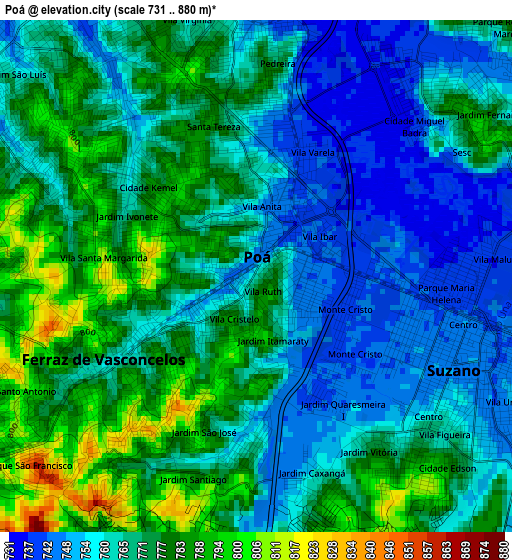
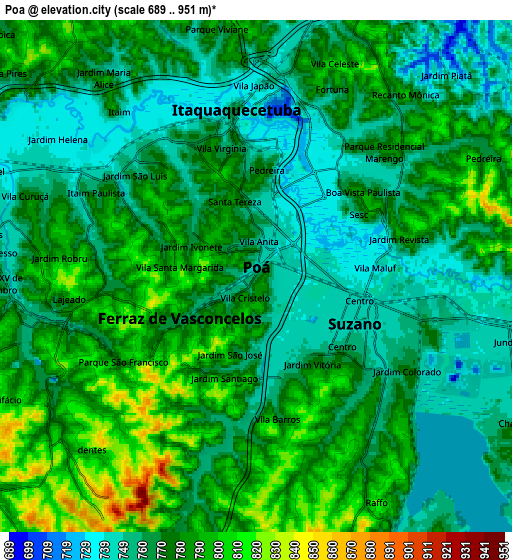
Below is the Elevation map of Poá, which displays elevation range with different colors. Scale of the first map is from 731 to 880 m (2398 to 2887 ft) with average elevation of 768.1 meters (=2520 ft) [note 1]
These maps also provides idea of topography and contour of this city, they are displayed at different zoom levels. More info about maps, scale and edge coordinates you can find below images.
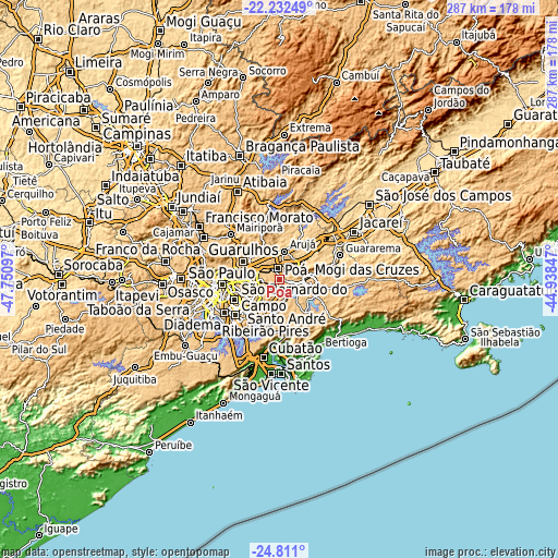
| \ | Map #1 | Map #2 | Topo.Map |
| Scale [m] | 731..880 m | 689..951 m | × |
| Scale [ft] | 2398..2887 ft | 2260..3120 ft | × |
| Average | 768.1 m = 2520 ft | 772.8 m = 2535 ft | × |
| Width | 8.96 km = 5.6 mi | 17.92 km = 11.1 mi | 286.7 km = 178.1 mi |
| Height | 8.96 km = 5.6 mi | 17.92 km = 11.1 mi | 286.7 km = 178.1 mi |
| ↑Max Latitude | -23.487762° | -23.447452° | -22.23249° |
| Latitude at center | -23.52806° | -23.52806° | -23.52806° |
| ↓Min Latitude | -23.568346° | -23.608619° | -24.811° |
| ← Min Longitude | -46.388665° | -46.432611° | -47.75097° |
| Longitude center | -46.34472° | -46.34472° | -46.34472° |
| →Max Longitude | -46.300775° | -46.256829° | -44.93847° |
Nearby cities:
Cities around Poá sort by population:
• Guarulhos elevation 774 m
20.6 km,  290°
290°
• Santo André 801 m
24.8 km,  232°
232°
• Mauá 773 m
19.6 km,  217°
217°
• Itaquaquecetuba 748 m
4.7 km,  355°
355°
• Mogi das Cruzes 759 m
16 km,  87°
87°
• Suzano 747 m
3.8 km,  114°
114°
• Ferraz de Vasconcelos 759 m
2.8 km,  239°
239°
• São Caetano do Sul 770 m
23.5 km, 243°
• Ribeirão Pires 760 m
21.5 km,  199°
199°
• Arujá 788 m
14.9 km,  9°
9°
• Rio Grande da Serra 777 m
24.6 km,  192°
192°
• Santa Isabel 658 m
26.8 km,  28°
28°
Multilingual:
 En español:
Poá elevación 764 m.
 En France:
Poá élévation 764 m.


Sources and notes:
- [note 1] Map square and city borders are not equal. Map elevation data is calculated only from area inside that square.
- [src 1] Elevation data from geonames database provided with same terms of usage.
- [src 2] The elevation map of Poá is generated using elevation data from NASA's 3 arcsec (90m) resolution SRTM data.
- [src 3] Base (background) map © OpenStreetMap contributors tiles are generated by Geofabrik and OpenTopoMap.
Copyright & License:
This Poá Elevation Map is licensed under CC BY-SA. You may reuse any part from this page, if you give a proper credit by linking to this URL:
 More info on terms of use page.