Rio Casca elevation
Rio Casca (Minas Gerais), Brazil elevation is 336 meters and Rio Casca elevation in feet is 1102 ft above sea level [src 1]. Rio Casca is a populated place (feature code) with elevation that is 46 meters (151 ft) smaller than average city elevation in Brazil.
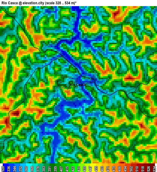
Below is the Elevation map of Rio Casca, which displays elevation range with different colors. Scale of the first map is from 328 to 534 m (1076 to 1752 ft) with average elevation of 405.2 meters (=1329 ft) [note 1]
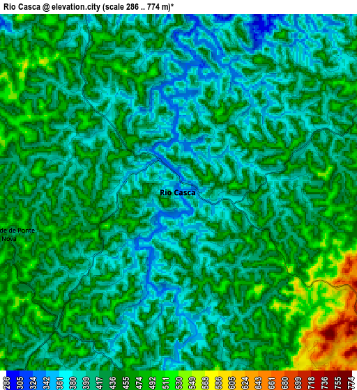
These maps also provides idea of topography and contour of this city, they are displayed at different zoom levels. More info about maps, scale and edge coordinates you can find below images.
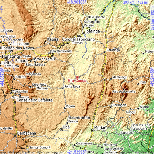
| \ | Map #1 | Map #2 | Topo.Map |
| Scale [m] | 328..534 m | 286..774 m | × |
| Scale [ft] | 1076..1752 ft | 938..2539 ft | × |
| Average | 405.2 m = 1329 ft | 430.8 m = 1413 ft | × |
| Width | 9.17 km = 5.7 mi | 18.34 km = 11.4 mi | 293.4 km = 182.3 mi |
| Height | 9.17 km = 5.7 mi | 18.34 km = 11.4 mi | 293.4 km = 182.3 mi |
| ↑Max Latitude | -20.184869° | -20.143617° | -18.90108° |
| Latitude at center | -20.22611° | -20.22611° | -20.22611° |
| ↓Min Latitude | -20.26734° | -20.308559° | -21.53995° |
| ← Min Longitude | -42.694775° | -42.738721° | -44.05708° |
| Longitude center | -42.65083° | -42.65083° | -42.65083° |
| →Max Longitude | -42.606885° | -42.562939° | -41.24458° |
Nearby cities:
Cities around Rio Casca sort by population:
• Timóteo elevation 356 m
71.7 km,  0°
0°
• João Monlevade 742 m
71.6 km,  310°
310°
• Viçosa 656 m
63.4 km,  202°
202°
• Caratinga 586 m
72.2 km,  47°
47°
• Manhuaçu 641 m
64.5 km,  93°
93°
• Ponte Nova 438 m
34.2 km,  231°
231°
• Nova Era 632 m
66.6 km,  322°
322°
• Matipó 621 m
32.9 km,  101°
101°
• Bom Jesus do Galho 508 m
56.3 km,  38°
38°
• Alvinópolis 602 m
43.6 km,  287°
287°
• Rio Piracicaba 634 m
63.9 km,  301°
301°
• São Domingos do Prata 589 m
52.1 km, 320°
Multilingual:
 En español:
Rio Casca elevación 336 m.
 En France:
Rio Casca élévation 336 m.
 Auf Deutsch:
Rio Casca höhe über dem Meeresspiegel ist 336 m.

Sources and notes:
- [note 1] Map square and city borders are not equal. Map elevation data is calculated only from area inside that square.
- [src 1] Elevation data from geonames database provided with same terms of usage.
- [src 2] The elevation map of Rio Casca is generated using elevation data from NASA's 3 arcsec (90m) resolution SRTM data.
- [src 3] Base (background) map © OpenStreetMap contributors tiles are generated by Geofabrik and OpenTopoMap.
Copyright & License:
This Rio Casca Elevation Map is licensed under CC BY-SA. You may reuse any part from this page, if you give a proper credit by linking to this URL:
 More info on terms of use page.