Santo Anastácio elevation
Santo Anastácio (São Paulo, Ribeirão dos Índios), Brazil elevation is 395 meters and Santo Anastácio elevation in feet is 1296 ft above sea level [src 1]. Santo Anastácio is a populated place (feature code) with elevation that is 13 meters (43 ft) bigger than average city elevation in Brazil.
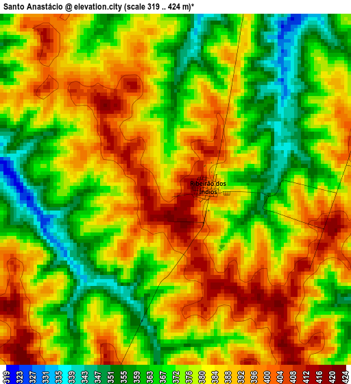
Below is the Elevation map of Santo Anastácio, which displays elevation range with different colors. Scale of the first map is from 319 to 424 m (1047 to 1391 ft) with average elevation of 379.1 meters (=1244 ft) [note 1]
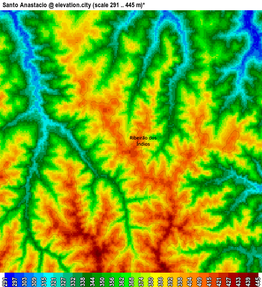
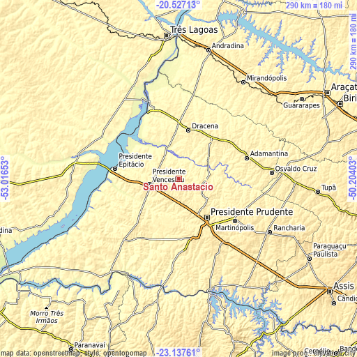
These maps also provides idea of topography and contour of this city, they are displayed at different zoom levels. More info about maps, scale and edge coordinates you can find below images.
| \ | Map #1 | Map #2 | Topo.Map |
| Scale [m] | 319..424 m | 291..445 m | × |
| Scale [ft] | 1047..1391 ft | 955..1460 ft | × |
| Average | 379.1 m = 1244 ft | 368.5 m = 1209 ft | × |
| Width | 9.07 km = 5.6 mi | 18.14 km = 11.3 mi | 290.3 km = 180.4 mi |
| Height | 9.07 km = 5.6 mi | 18.14 km = 11.3 mi | 290.3 km = 180.4 mi |
| ↑Max Latitude | -21.797533° | -21.756723° | -20.52713° |
| Latitude at center | -21.83833° | -21.83833° | -21.83833° |
| ↓Min Latitude | -21.879116° | -21.91989° | -23.13761° |
| ← Min Longitude | -51.654225° | -51.698171° | -53.01653° |
| Longitude center | -51.61028° | -51.61028° | -51.61028° |
| →Max Longitude | -51.566335° | -51.522389° | -50.20403° |
Nearby cities:
Cities around Santo Anastácio sort by population:
• Presidente Prudente elevation 462 m
39.3 km,  144°
144°
• Presidente Epitácio 305 m
52.8 km,  279°
279°
• Presidente Venceslau 428 m
24.5 km,  260°
260°
• Pirapozinho 491 m
49.9 km,  166°
166°
• Álvares Machado 484 m
30.4 km,  151°
151°
• Martinópolis 501 m
56.8 km,  127°
127°
• Regente Feijó 511 m
53.1 km, 143°
• Junqueirópolis 421 m
40.3 km,  26°
26°
• Presidente Bernardes 417 m
19.6 km,  162°
162°
• Tupi Paulista 383 m
51 km,  4°
4°
• Pacaembu 417 m
47.4 km,  49°
49°
• Paulista Flórida 375 m
50 km,  57°
57°
Multilingual:
 En español:
Santo Anastácio elevación 395 m.
 En France:
Santo Anastácio élévation 395 m.
 Auf Deutsch:
Santo Anastácio höhe über dem Meeresspiegel ist 395 m.

Sources and notes:
- [note 1] Map square and city borders are not equal. Map elevation data is calculated only from area inside that square.
- [src 1] Elevation data from geonames database provided with same terms of usage.
- [src 2] The elevation map of Santo Anastácio is generated using elevation data from NASA's 3 arcsec (90m) resolution SRTM data.
- [src 3] Base (background) map © OpenStreetMap contributors tiles are generated by Geofabrik and OpenTopoMap.
Copyright & License:
This Santo Anastácio Elevation Map is licensed under CC BY-SA. You may reuse any part from this page, if you give a proper credit by linking to this URL:
 More info on terms of use page.