Sapiranga elevation
Sapiranga (Rio Grande do Sul), Brazil elevation is 36 meters and Sapiranga elevation in feet is 118 ft above sea level [src 1]. Sapiranga is a populated place (feature code) with elevation that is 346 meters (1135 ft) smaller than average city elevation in Brazil.
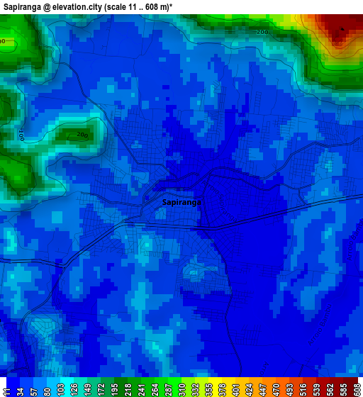
Below is the Elevation map of Sapiranga, which displays elevation range with different colors. Scale of the first map is from 11 to 608 m (36 to 1995 ft) with average elevation of 73.9 meters (=242 ft) [note 1]
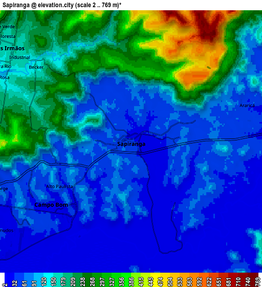
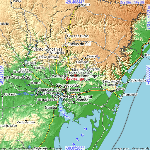
These maps also provides idea of topography and contour of this city, they are displayed at different zoom levels. More info about maps, scale and edge coordinates you can find below images.
| \ | Map #1 | Map #2 | Topo.Map |
| Scale [m] | 11..608 m | 2..769 m | × |
| Scale [ft] | 36..1995 ft | 7..2523 ft | × |
| Average | 73.9 m = 242 ft | 131.7 m = 432 ft | × |
| Width | 8.49 km = 5.3 mi | 16.99 km = 10.6 mi | 271.8 km = 168.9 mi |
| Height | 8.49 km = 5.3 mi | 16.99 km = 10.6 mi | 271.8 km = 168.9 mi |
| ↑Max Latitude | -29.599857° | -29.561639° | -28.40844° |
| Latitude at center | -29.63806° | -29.63806° | -29.63806° |
| ↓Min Latitude | -29.676249° | -29.714423° | -30.85285° |
| ← Min Longitude | -51.050885° | -51.094831° | -52.41319° |
| Longitude center | -51.00694° | -51.00694° | -51.00694° |
| →Max Longitude | -50.962995° | -50.919049° | -49.60069° |
Nearby cities:
Cities around Sapiranga sort by population:
• Novo Hamburgo elevation 56 m
12.8 km,  249°
249°
• São Leopoldo 10 m
19.2 km,  224°
224°
• Sapucaia 37 m
25.7 km,  212°
212°
• Esteio 12 m
29.9 km, 213°
• Parobé 55 m
16.7 km,  86°
86°
• Taquara 33 m
21.9 km, 93°
• Estância Velha 43 m
16.2 km,  265°
265°
• Igrejinha 36 m
22.1 km,  71°
71°
• Três Coroas 53 m
25.9 km,  58°
58°
• Portão 49 m
23.8 km, 252°
• Ivoti 125 m
15.7 km,  289°
289°
• Nova Petrópolis 589 m
30.9 km,  340°
340°
Multilingual:
 En español:
Sapiranga elevación 36 m.
 En France:
Sapiranga élévation 36 m.
 Auf Deutsch:
Sapiranga höhe über dem Meeresspiegel ist 36 m.

Sources and notes:
- [note 1] Map square and city borders are not equal. Map elevation data is calculated only from area inside that square.
- [src 1] Elevation data from geonames database provided with same terms of usage.
- [src 2] The elevation map of Sapiranga is generated using elevation data from NASA's 3 arcsec (90m) resolution SRTM data.
- [src 3] Base (background) map © OpenStreetMap contributors tiles are generated by Geofabrik and OpenTopoMap.
Copyright & License:
This Sapiranga Elevation Map is licensed under CC BY-SA. You may reuse any part from this page, if you give a proper credit by linking to this URL:
 More info on terms of use page.