Altamira elevation
Altamira (Pará), Brazil elevation is 101 meters and Altamira elevation in feet is 331 ft above sea level [src 1]. Altamira is a populated place (feature code) with elevation that is 281 meters (922 ft) smaller than average city elevation in Brazil.
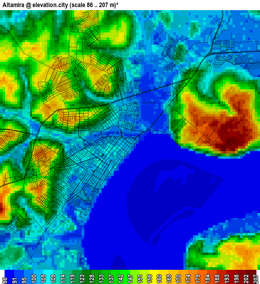
Below is the Elevation map of Altamira, which displays elevation range with different colors. Scale of the first map is from 86 to 207 m (282 to 679 ft) with average elevation of 116.7 meters (=383 ft) [note 1]
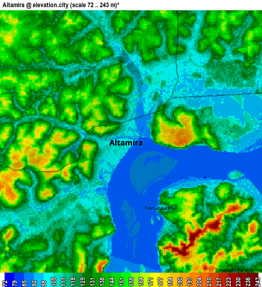
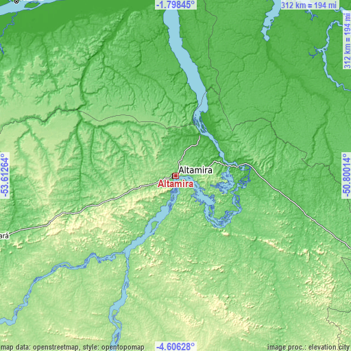
These maps also provides idea of topography and contour of this city, they are displayed at different zoom levels. More info about maps, scale and edge coordinates you can find below images.
| \ | Map #1 | Map #2 | Topo.Map |
| Scale [m] | 86..207 m | 72..243 m | × |
| Scale [ft] | 282..679 ft | 236..797 ft | × |
| Average | 116.7 m = 383 ft | 125.5 m = 412 ft | × |
| Width | 9.76 km = 6.1 mi | 19.51 km = 12.1 mi | 312.2 km = 194 mi |
| Height | 9.76 km = 6.1 mi | 19.51 km = 12.1 mi | 312.2 km = 194 mi |
| ↑Max Latitude | -3.159452° | -3.115573° | -1.79845° |
| Latitude at center | -3.20333° | -3.20333° | -3.20333° |
| ↓Min Latitude | -3.247206° | -3.29108° | -4.60628° |
| ← Min Longitude | -52.250335° | -52.294281° | -53.61264° |
| Longitude center | -52.20639° | -52.20639° | -52.20639° |
| →Max Longitude | -52.162445° | -52.118499° | -50.80014° |
Nearby cities:
Cities around Altamira sort by population:
• Santarém elevation 51 m
290.4 km,  286°
286°
• Tucuruí 60 m
287.4 km,  102°
102°
• Breves 7 m
255.7 km,  48°
48°
• Monte Alegre 57 m
247.5 km,  302°
302°
• Portel 12 m
208.7 km, 47°
• Almeirim 6 m
191.4 km,  347°
347°
• Baião 31 m
285.2 km,  80°
80°
• Oeiras do Pará 6 m
293.4 km,  62°
62°
• Porto de Moz 20 m
161.8 km,  358°
358°
• Prainha 35 m
210.6 km,  317°
317°
• Gurupá 4 m
209.6 km,  17°
17°
• Senador José Porfírio 7 m
73.6 km, 22°
Multilingual:
 En español:
Altamira elevación 101 m.
 En France:
Altamira élévation 101 m.
 Auf Deutsch:
Altamira höhe über dem Meeresspiegel ist 101 m.
 На русском:
Альтамира, Алтамира высота над уровнем моря 101 м
Sources and notes:
- [note 1] Map square and city borders are not equal. Map elevation data is calculated only from area inside that square.
- [src 1] Elevation data from geonames database provided with same terms of usage.
- [src 2] The elevation map of Altamira is generated using elevation data from NASA's 3 arcsec (90m) resolution SRTM data.
- [src 3] Base (background) map © OpenStreetMap contributors tiles are generated by Geofabrik and OpenTopoMap.
Copyright & License:
This Altamira Elevation Map is licensed under CC BY-SA. You may reuse any part from this page, if you give a proper credit by linking to this URL:
 More info on terms of use page.